Note: GJEL Accident Attorneys regularly sponsors coverage on Streetsblog San Francisco and Streetsblog California. Unless noted in the story, GJEL Accident Attorneys is not consulted for the content or editorial direction of the sponsored content.
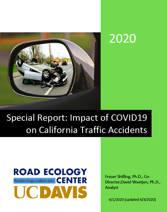
Researchers at UC Davis' Road Ecology Center are using real-time collision report data from the California Highway Patrol to measure and compare crash rates during the stay-at-home orders. The preliminary report [PDF] finds that collisions have reduced by half since the order went into effect on March 20, from about 1,000 collisions per day a year ago to about 500 per day, and from about 400 injury or fatal crashes per day to about 200. The data is from state highways, which in some cases are freeways and rural roads but can also be main streets.
The reduction follows greatly reduced traffic volumes of up to sixty percent in some places over the same time period. This was not uniform--on some interstate highways traffic reductions got up to about thirty percent. But it is, write the report's authors, "unparalleled."
"There is no equivalent in our recent transportation history to such large changes in vehicle movement on our state and local roads," they write.
"The reduction works out to about 15,000 fewer collisions per month and 6,000 fewer injury/fatal accidents per month that can be directly or indirectly attributed to the shelter-in-place order. . . The Governor’s shelter-in-place order may have provided unexpected reductions in injuries and harm from traffic accidents."
An update on the report is expected to be released on Monday, and that may reveal further evidence about whether these numbers are as low as they will go. Based on the data collected so far, said Fraser Shilling, one of the authors, "we couldn't tell if it was bottoming out. But the downward slope is not continuing--over the last five or six days, it seems to have a hit a minimum."
The researchers are also refining their findings on speed and hope to update that. The preliminary report found small increases in speed on some highways, but that data is based on road sensors, which may not be as reliable as a cop holding a speed detector. That data shows increases in the fastest and in average speeds, primarily on urban highways. But, said Fraser, "anecdotally, police are seeing a lot more excessive speeders (over 100 mph), including on city streets."
The data used by the researchers is based on up-to-the minute incident reports from the CHP as well as from the Caltrans-run Performance Measurement System, or PeMs. This last collects real-time data from over 39,000 detectors placed in the road to count vehicles and estimate speed and congestion.
The report's authors, Fraser Shilling and David Waetjen, created custom software that draws data from real-time narrative reports written by CHP officers and puts them into a database in real time. They capture about two million duplicated records every year, said Shilling, and the software filters out duplicates for about 800,000 unique records.
They have been working on this as a "side project," he said, for about five years. Their focus has been on animal-vehicle crashes, and they have also been working with the California Department of Public Health and the UC Davis Medical Center to "better understand true crash rates, and to help create a better system for reporting on all kinds of traffic events--especially for biking and pedestrian crashes, which tend not to get reported," said Fraser.
But then everyone got distracted by the pandemic, and their real-time system has suddenly become useful in new ways.
Their goal remains helping figure out a better overall reporting and data tracking system. "We rely on the CHP doing an excellent job of describing incidents," said Fraser, and they do it--without proper resources. The level of detail in the incident reports is remarkable, said Fraser, but "they are not provided with up-to-date equipment. There are a lot of reporting issues; they're using old laptops and old servers. The only way we're able to do any of this research is due to individual officer effort."
The researchers compare their incident information with PeMS and with SWITRS, the Statewide Integrated Traffic Records System. That system is relied on by local and statewide agencies and planners as the main data source for crashes. But its data, which is usually at least two years old, leaves out most of the detail. "Ours are more accurate," he said.
As to what's happening with the number of animals being hit on the roads: they haven't found that the drop in traffic is making much of a difference. This may be because the shelter-in-place order is still too recent, and there aren't enough data points to draw a conclusion; or it could be that speed plays a big role in animal-vehicle crashes.
"With this big reduction in traffic, are we actually changing interaction with wildlife and traffic?" is the question Fraser asks. "If you have less traffic, are animals more willing to make a break and run for it? High levels of traffic have an aversion effect, keeping animals from being willing to cross a road. But moderate levels of traffic still could kill them, especially if they are lulled into believing it's quiet."
Recent scenes of animals taking over city streets seems to bear this out.
Note: Streetsblog had a conversation with the author about the use of the word "accidents," which tends to erase agency and can also lead to false suppositions about fault. The issue for his research is that "incidents," "crashes," and "collisions" all have specific meanings under the CHP nomenclature. "Incidents," for example, are any events that the CHP must respond to, but they could include planned road closures or repairs that need an officer standing by. Some dangerous events are not technically either crashes or collisions--for example, if a car spins out or drives off the highway without actually hitting anything. The solution to this naming problem, it turns out, is not at all simple.


