Streetsbloggers and Yolobus Step Up to Provide Clear Ways to Take Transit to See the A’s
Back in March, right at the start of baseball season, Streetsblog reviewed each of California’s baseball teams based on their public-facing plans to get fans to and from the stadium.
At the time of the article, the Athletics hadn’t yet played a game at their temporary home of Sutter Health Park in West Sacramento. We promised to check in if things changed throughout the season after they ranked last for transit accessibility in Streetblog’s estimation.
Well, things haven’t changed on the A’s official website, although Yolobus, the regional bus service, published a page on their website to encourage people to take their buses to the game sometime between when Streetsblog published and opening day.
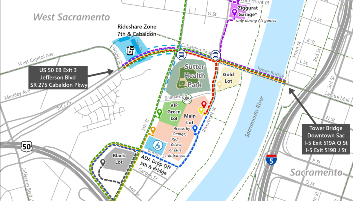
The map on the A’s website that shows walking routes to the stadium and where the two closest Yolobus stops are still doesn’t show where the nearest transit stations are or provide any route information. The “public transit” portion of their transportation page is just three bullet points with links to the front pages for Yolobus (not the page Yolobus created with directions for taking the bus to the game) and Capitol Corridor, and a link to a press release for SacRT.
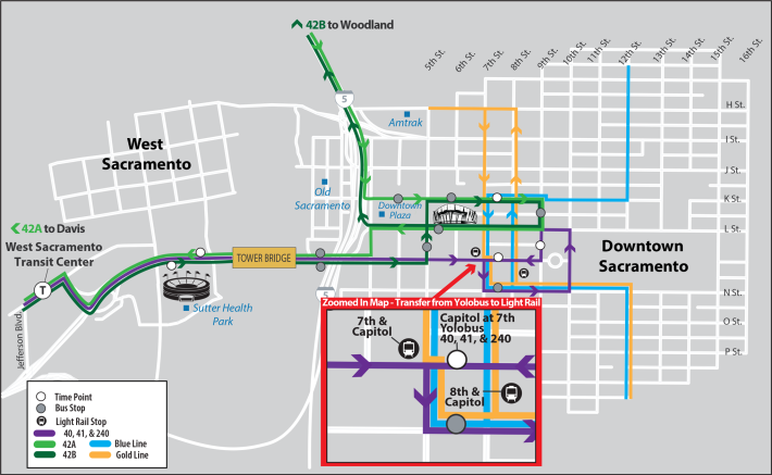
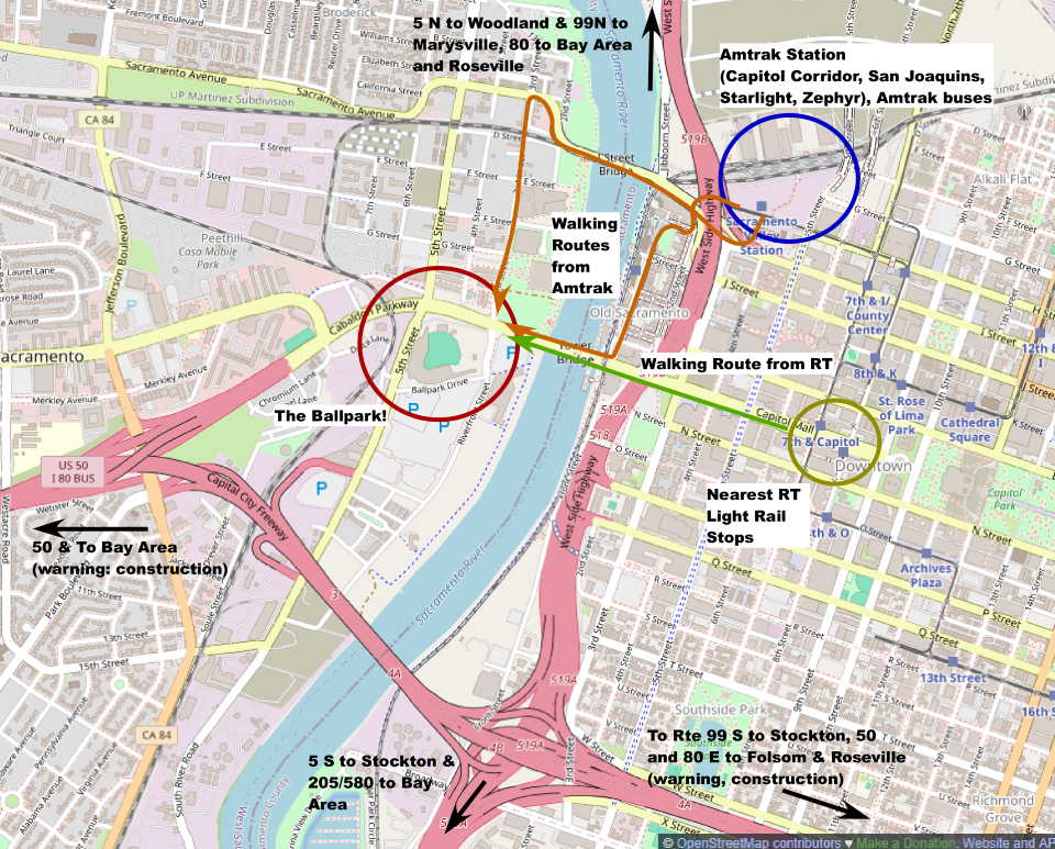
But, as is often the case, when official sources fail, Streetsbloggers can step up. Sacramento-area resident Mike Brady used Open Street Map to create the above map that not only shows where the closest rail stops are, but also suggests some walking routes. Brady’s map notes that the Capitol Corridor isn’t the only AMTRAK route that utilizes the station in Sacramento, but it is also a hub for AMTRAK buses, the San Joaquins, Coast Starlight, and Zephyr routes.
Brady adds, “I have done light rail (and the walk) to the stadium a few times. Works for me because the last train home isn’t until about 11 p.m. It can be pretty warm on the walk to the stadium, but it’s usually cooled off a bit by the time we’re going home.”
Brady put together his own link stack for people looking to take transit to the stadium. If anyone is reading this article looking for the best way to visit Sutter Health Park themselves, Streetsblog has combined the A’s and Brady’s lists right here:
Amtrak Capitol Corridor : Train Schedule, Real Time Amtrak Train Location Map, Amtrak Regional Bus Schedule, Amtrak Trip Planner
Sacramento RT : A’s specific webpage, Sacramento Regional Transit District Homepage
Yolobus (the only transit that stops at the stadium): Baseball specific webpage, Yolobus homepage
Caltrans Quickmap: QuickMap

Streetsblog has migrated to a new comment system. New commenters can register directly in the comments section of any article. Returning commenters: your previous comments and display name have been preserved, but you'll need to reclaim your account by clicking "Forgot your password?" on the sign-in form, entering your email, and following the verification link to set a new password — this is required because passwords could not be carried over during the migration. For questions, contact tips@streetsblog.org.