New Two-Way Protected Bikeway in Medford, Oregon
The week of Thanksgiving, I visited relatives in Medford, Oregon. Many readers might expect that all of blue-state Oregon would be as bike-friendly as its big cities, Portland and Eugene, but this is not the case. Oregon’s eighth largest city (population 86,000) is relatively car-centric. Medford has a pleasant but struggling historic downtown, which is surrounded by lots of suburban development. People certainly bike and walk, but the city is mostly conducive to getting around by car.
I don’t claim to be an expert on Medford, though I have visited a couple of times. This year, I checked out some green transportation features and figured I would share them with SBCA readers.
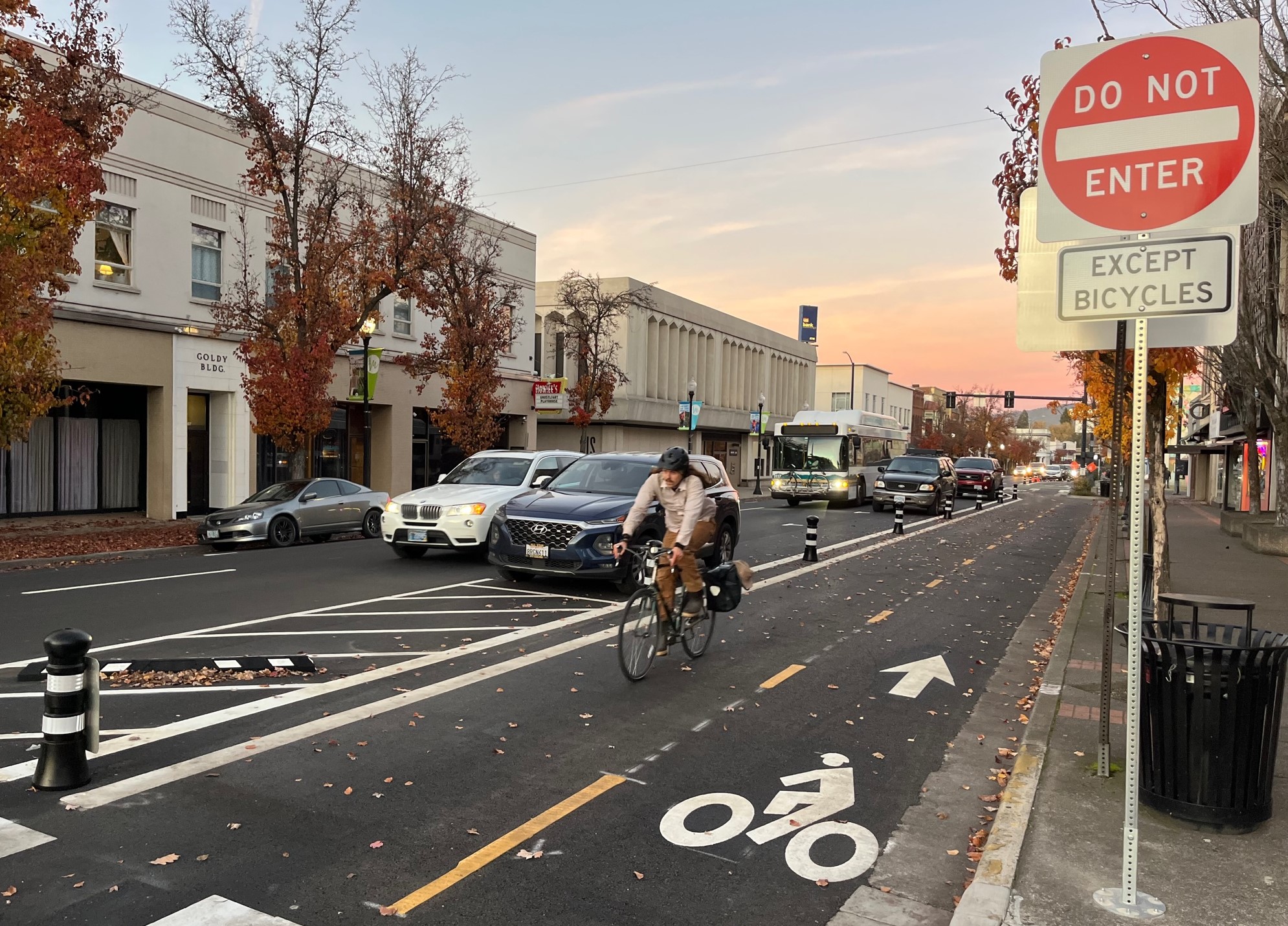
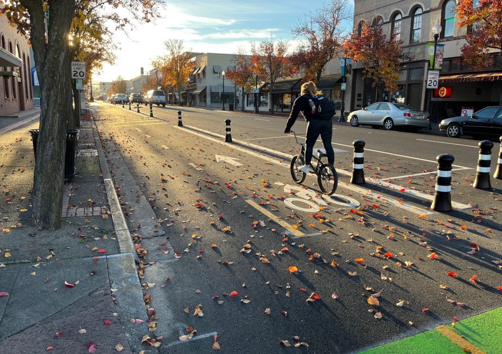
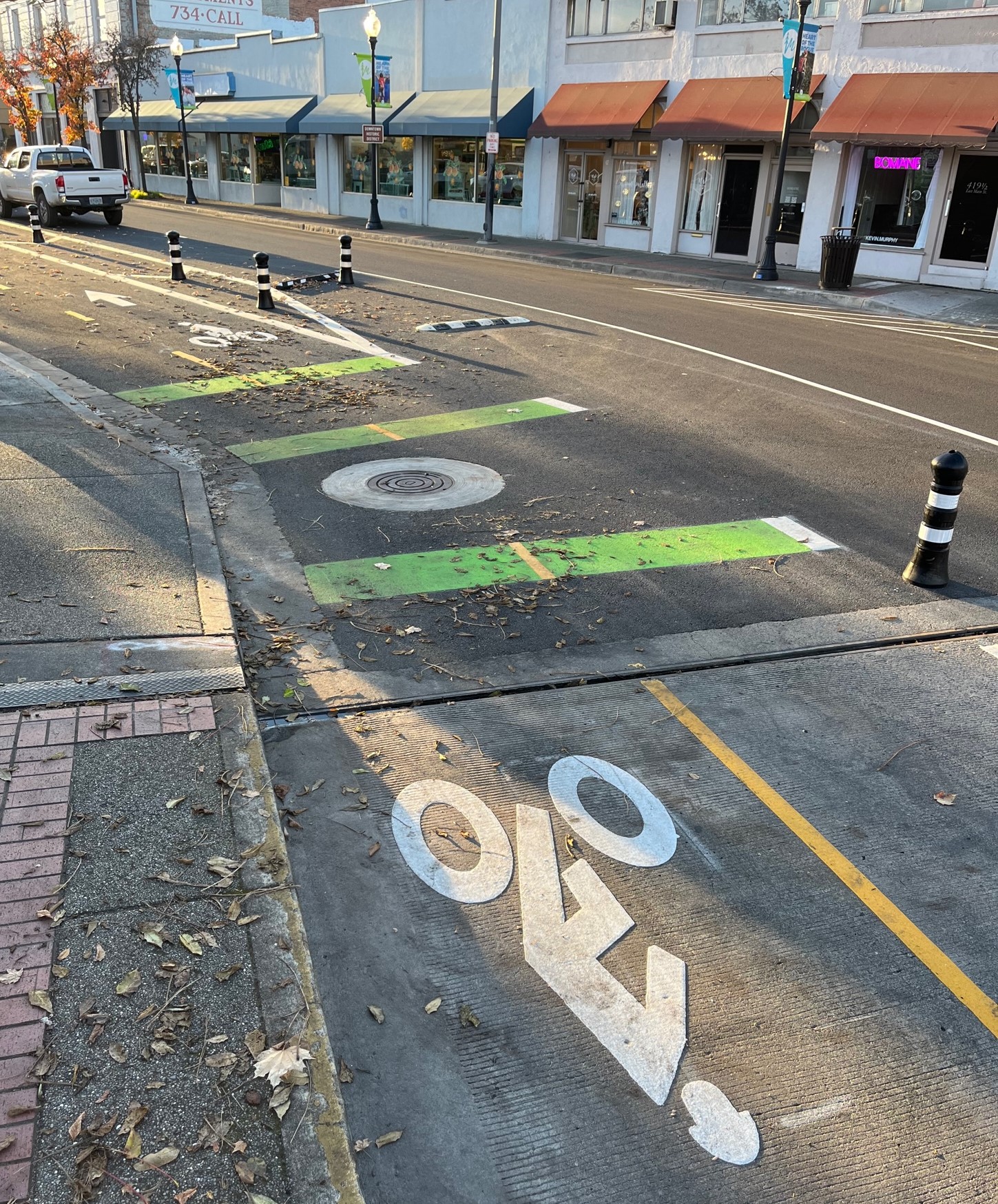
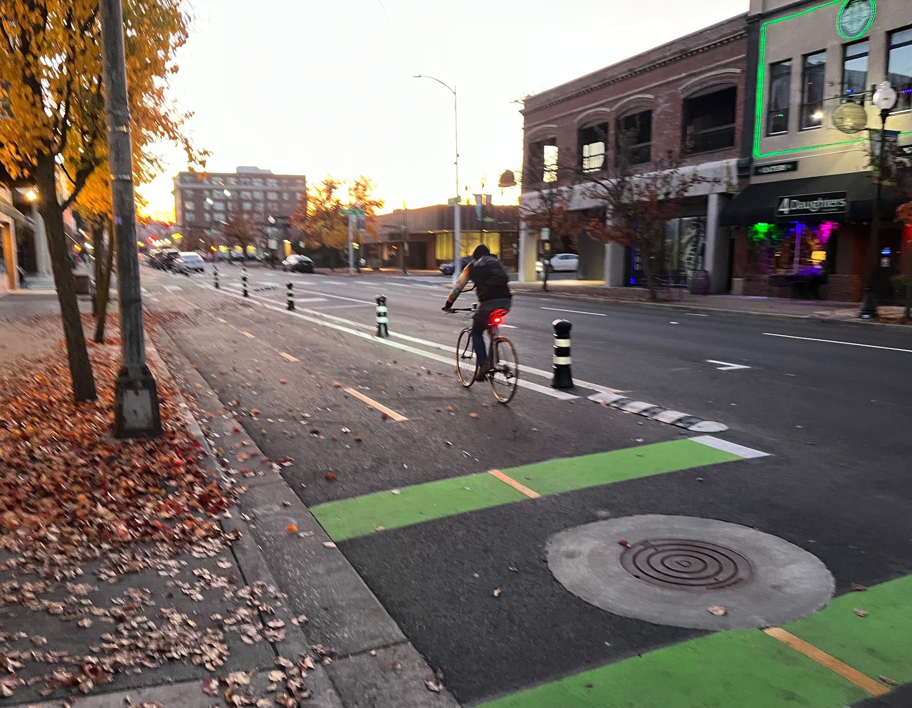
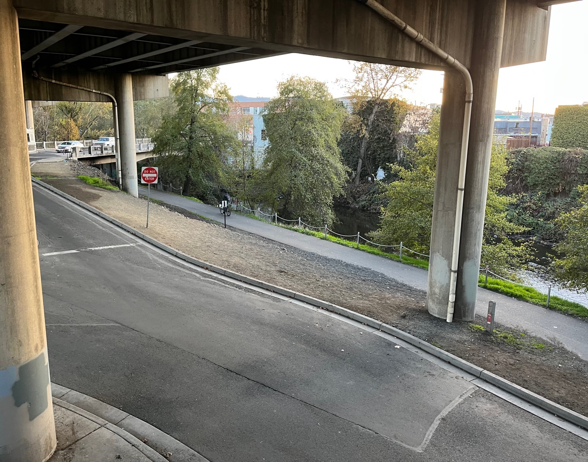
This year, Medford added what I think are the city’s first protected bike lanes. Through downtown, the city removed one car lane (which generated some criticism) to make space for adding a two-way parking-protected bikeway. The facility runs about 0.6 miles on Main Street between Oakdale Avenue and 8th Street, where cyclists can connect with a bike path along Bear Creek.
The bikeway is the main part of a project the city termed Main Street Multimodal Improvements. I found it to be a fairly high-quality low-cost ($450,000 budget per The Rogue Valley Times) bike facility that could be a good example for other locations, especially for cities looking to improve bike and walk safety on central one-way streets.
Often, two-way protected bikeway projects feature costly bike traffic signals. Medford was largely able to omit these, instead installing signs for contraflow cyclists to simply “use ped signal.” (As far as I could tell, there is just one bike signal at Oakdale, the west end of the project.)
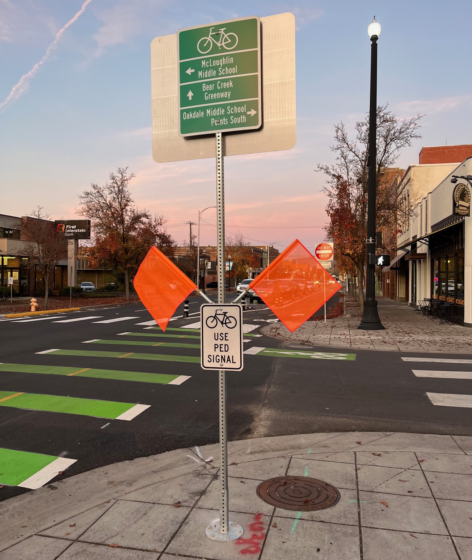
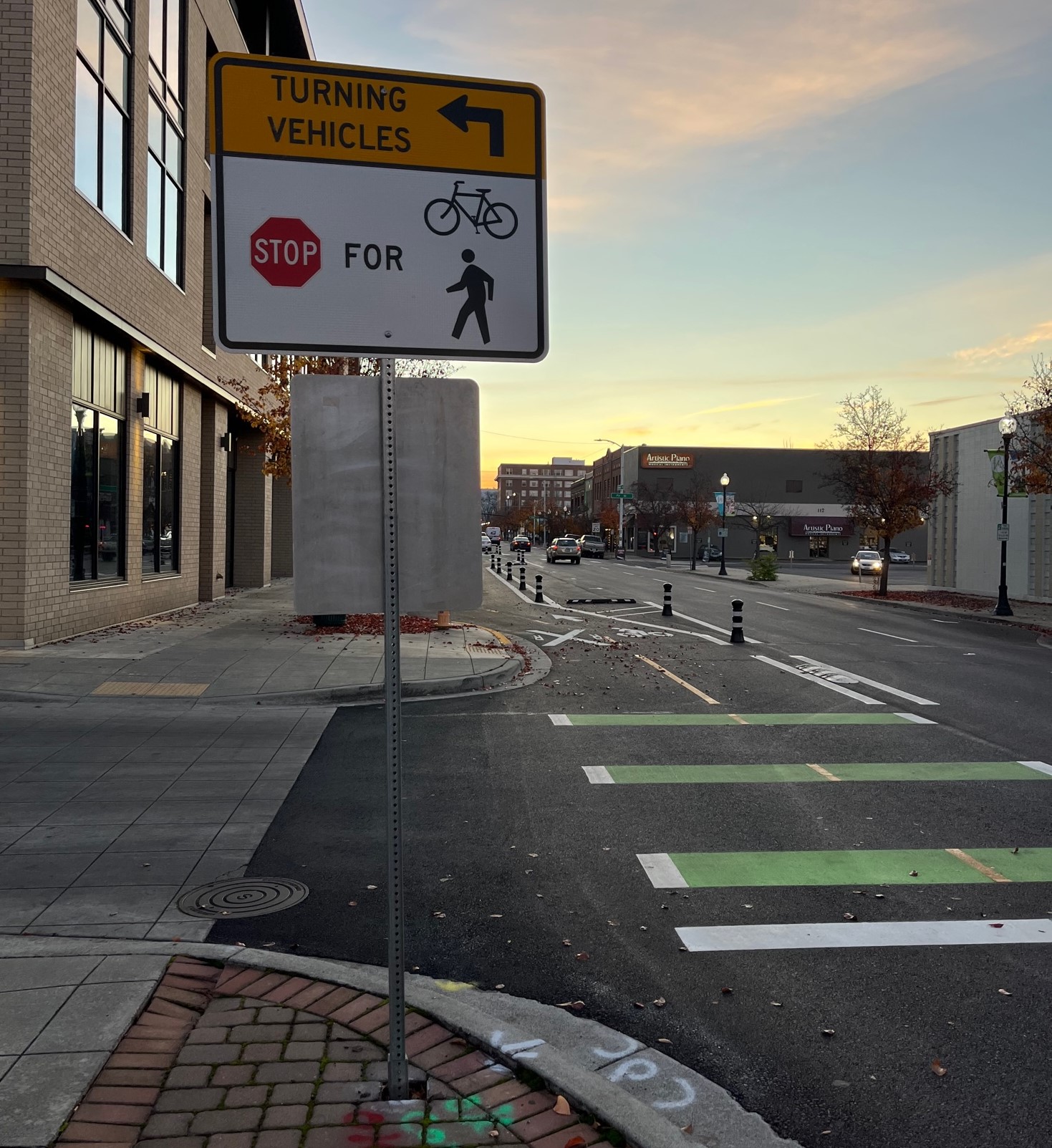
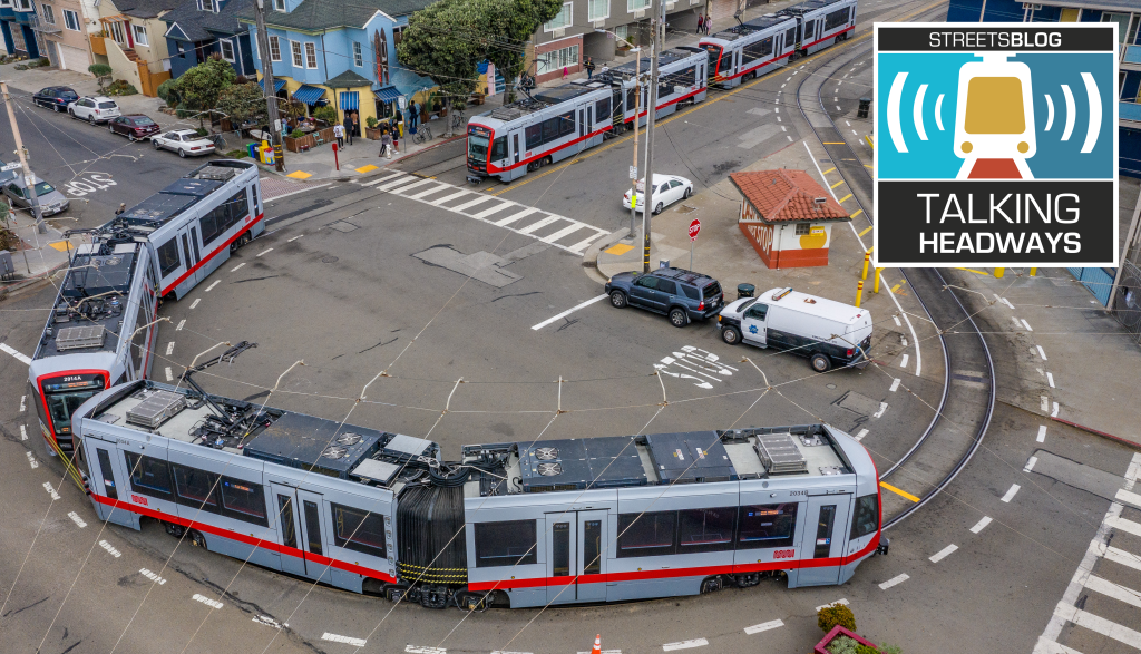
At the east end of the bikeway, the city installed a small bike traffic circle. It’s located at the Y-intersection where two-way Main Street splits into two one-way streets (Main and 8th) through downtown. At that location, westbound cyclists need to transition from a basic right-side bike lane onto the new protected bikeway on the left side of the street.
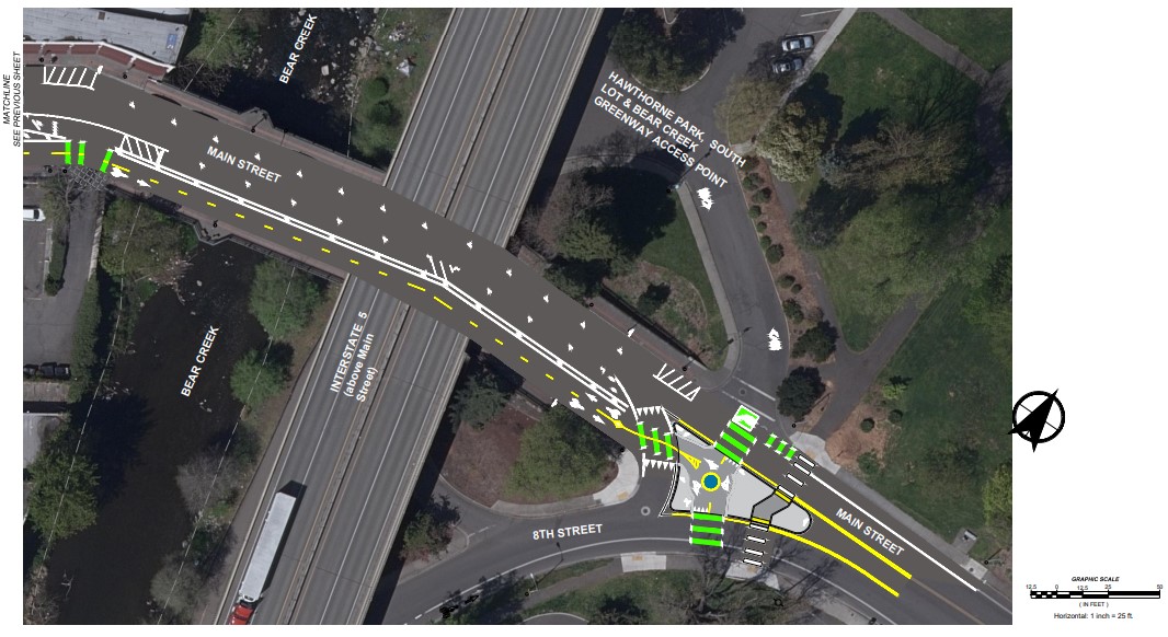
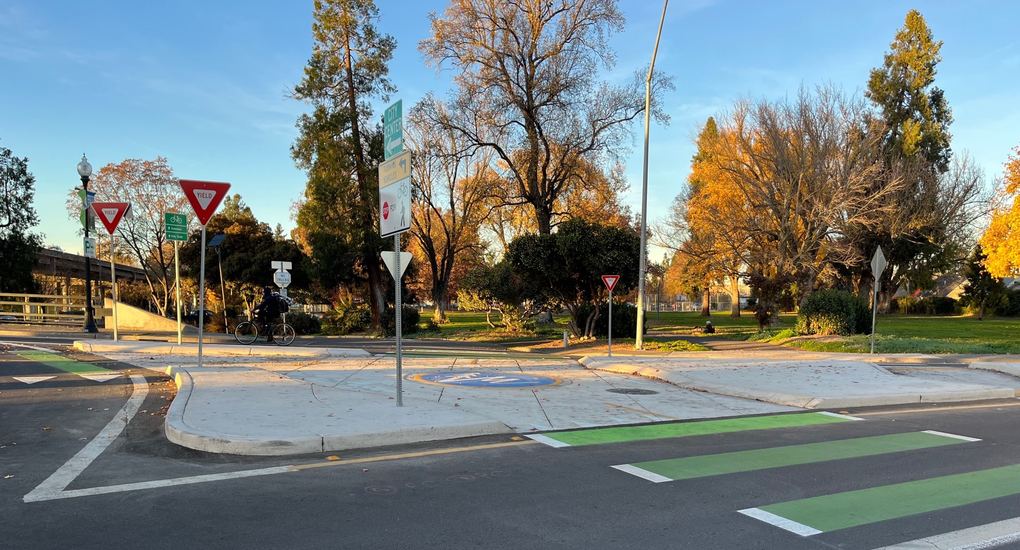
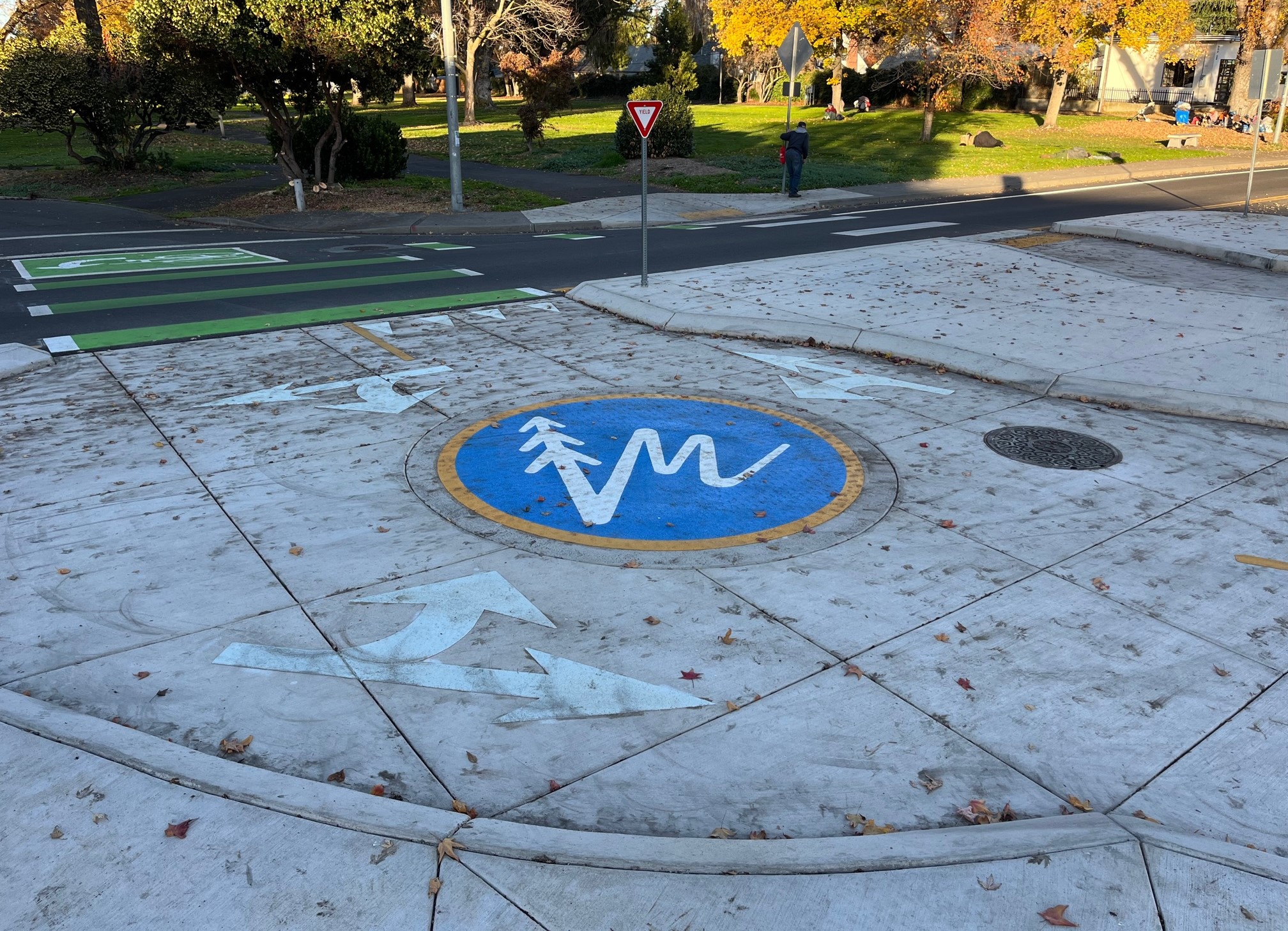
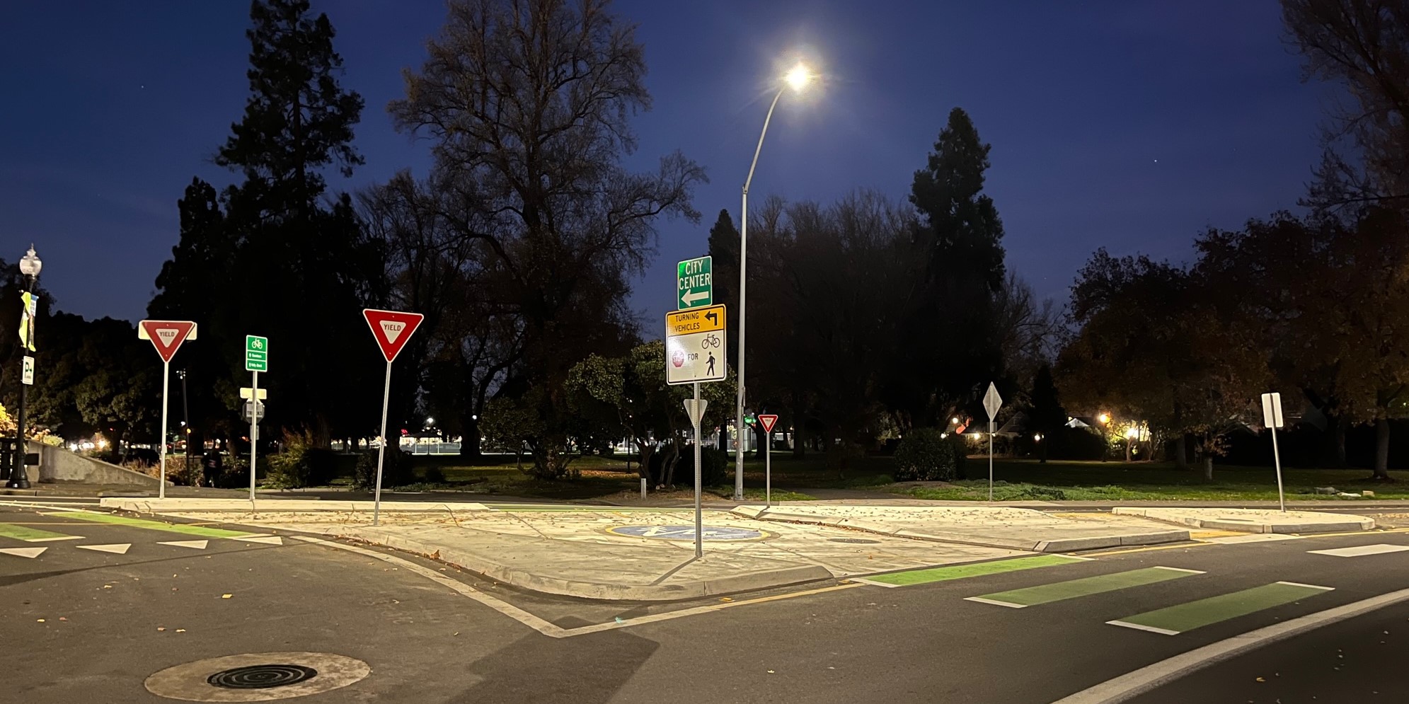
The circle works as sort of transition point, where cyclists get on or off the protected bikeway, continuing onto streets or the creek path. It’s a point where there could be bike-car conflict. For safety, it’s very well-lit and has curbs and pavement markings that specify where drivers, cyclists, and pedestrians go.
It isn’t perfect. During my visit, I observed 4-5 cyclists choosing to avoid the circle, biking around it instead of through it. At the time, car traffic there wasn’t heavy, so cyclists were taking a more direct, less curvy route than using the circle. This maneuver is perhaps a bit more dangerous, but makes sense (it’s faster, and conserves momentum/energy) when there aren’t a lot of cars to navigate around. The circle probably makes more sense at times when car (or bike) volumes are higher.
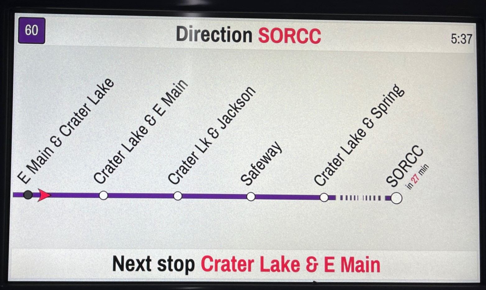
I also rode a Rogue Valley Transportation District bus for the first time. RVTD buses have an on-board monitor displaying quite a bit of real-time information: upcoming stops, the overall route, the local area, and also announcing stops – cycling through this in Spanish and English. It’s perhaps not essential (many riders can and do get this on their smart phones), but I found it informative and helpful, especially as someone not all that familiar with the area.
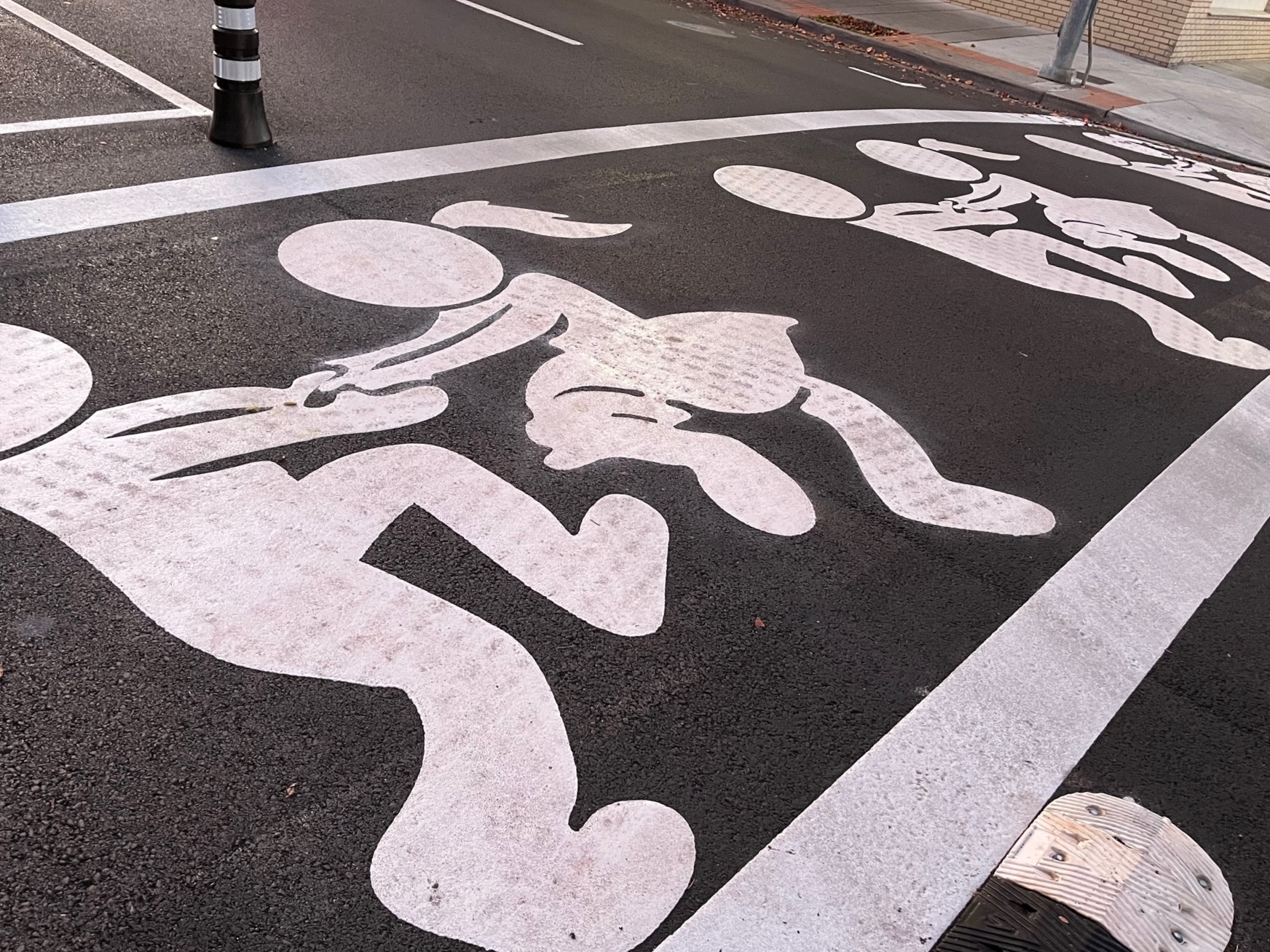
Lastly, here’s one pedestrian facility: an emotionally intelligent crosswalk installation leading to a park, downtown library, and children’s museum.

Streetsblog has migrated to a new comment system. New commenters can register directly in the comments section of any article. Returning commenters: your previous comments and display name have been preserved, but you'll need to reclaim your account by clicking "Forgot your password?" on the sign-in form, entering your email, and following the verification link to set a new password — this is required because passwords could not be carried over during the migration. For questions, contact tips@streetsblog.org.