Skip to Content
Streetsblog California home
Log In
Safety

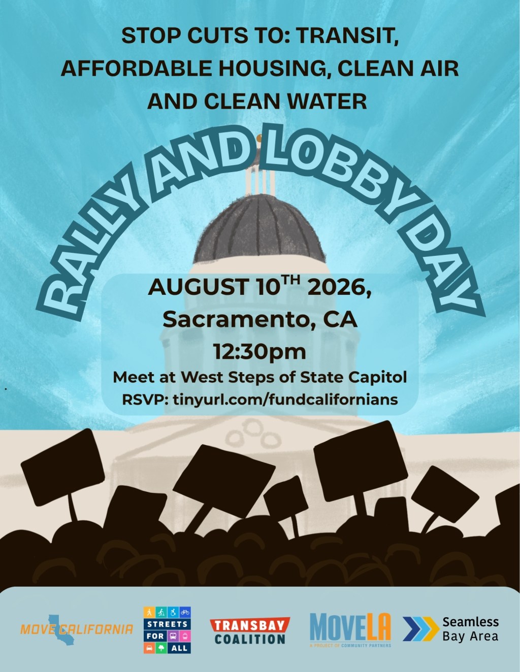
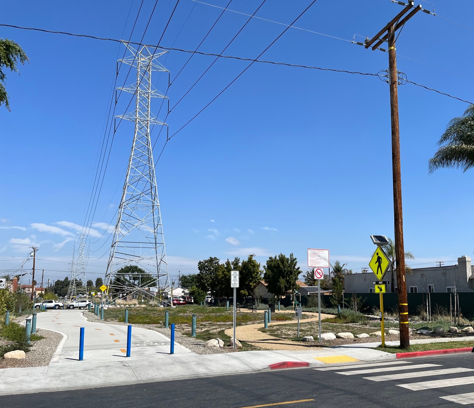
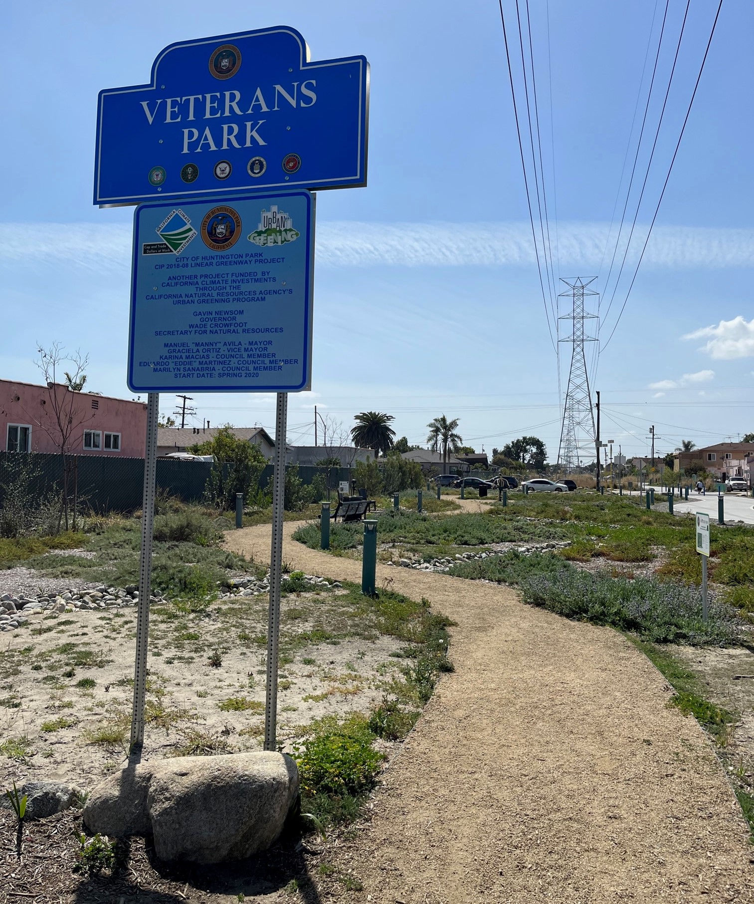
Eyes on the Street: Huntington Park’s Veterans Park Corridor Walk/Bike Trails

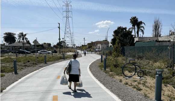
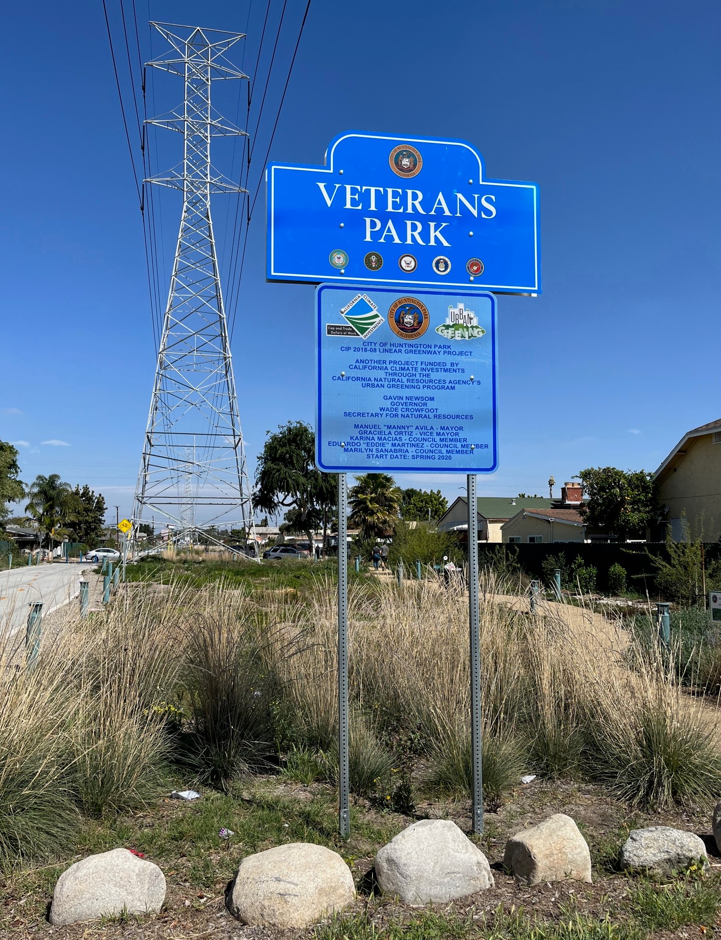
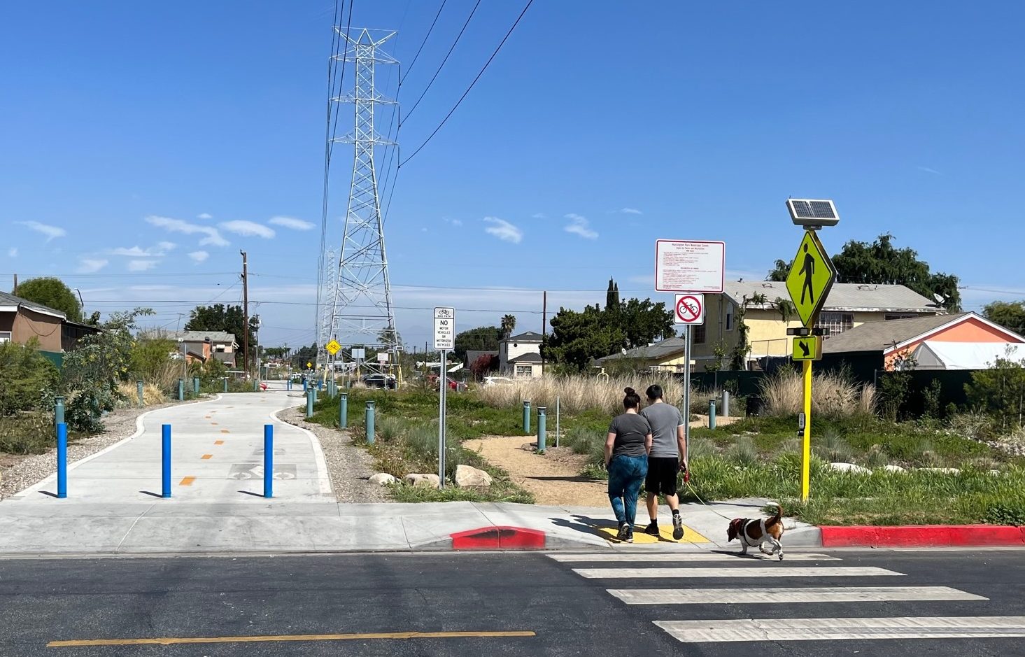
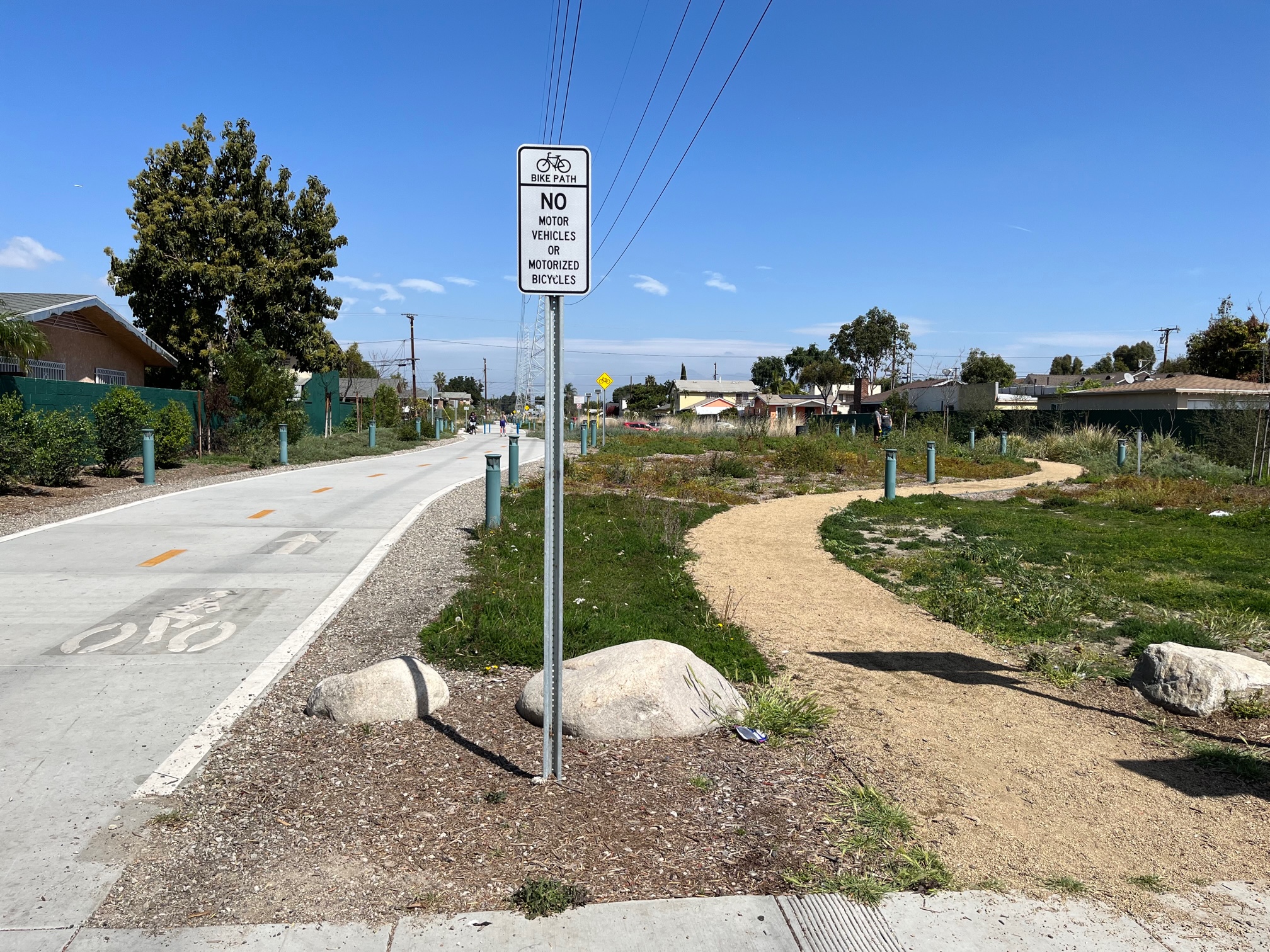
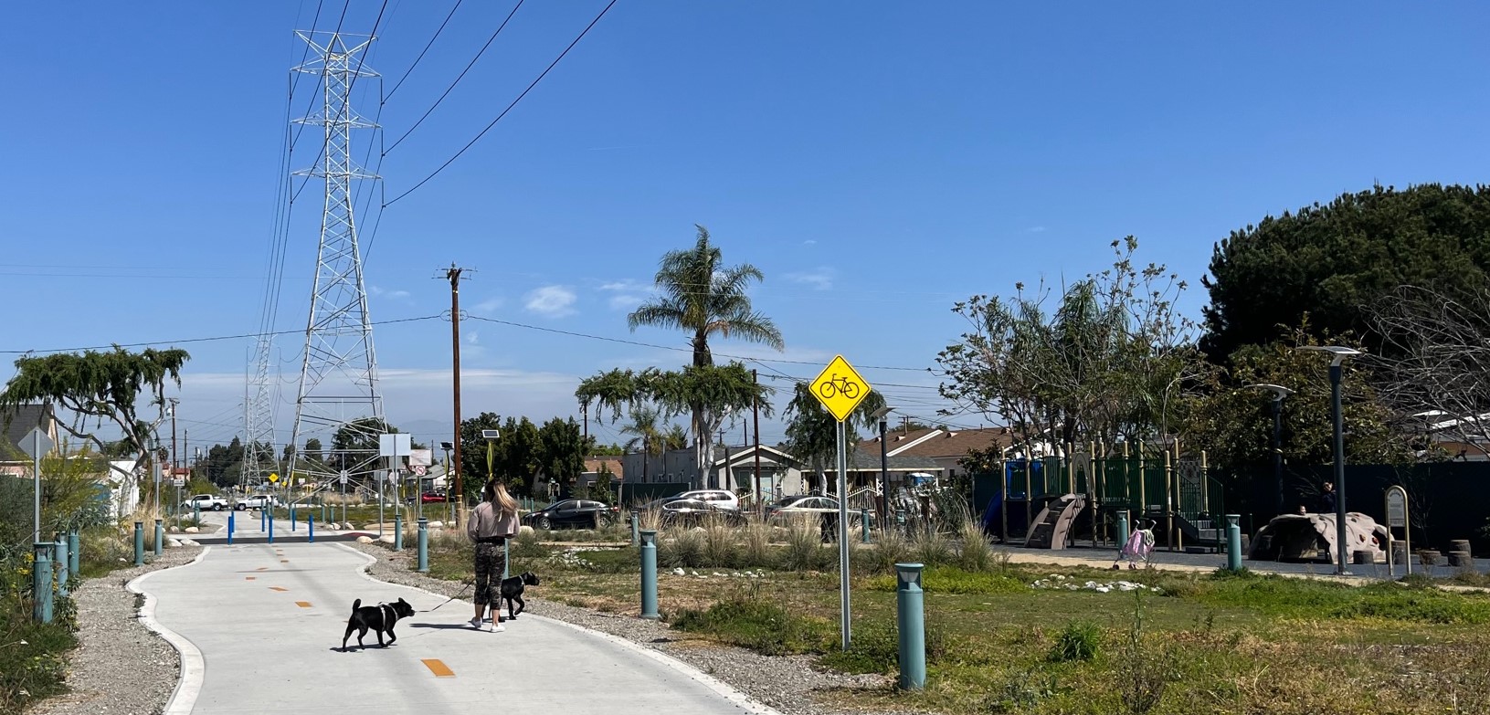
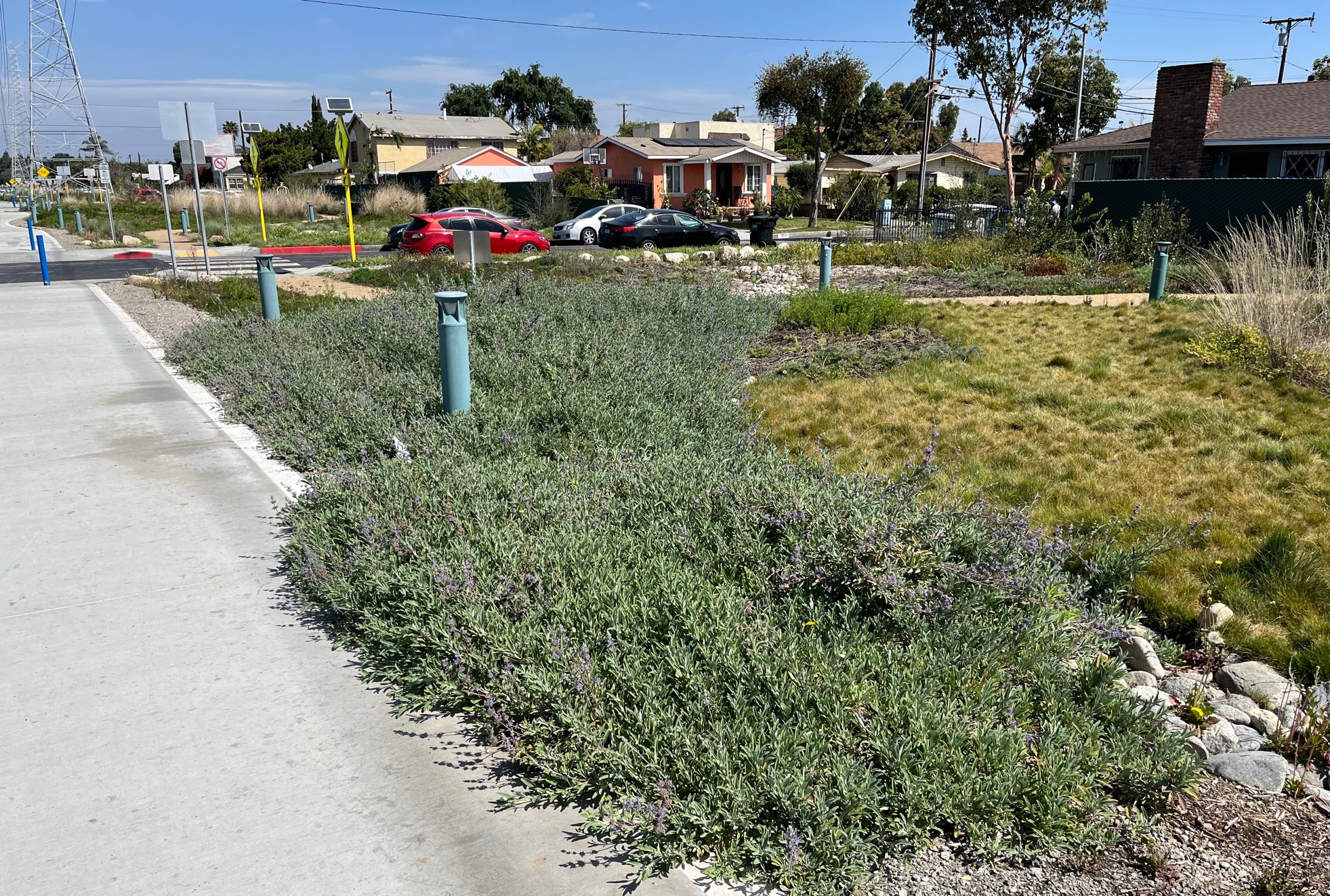
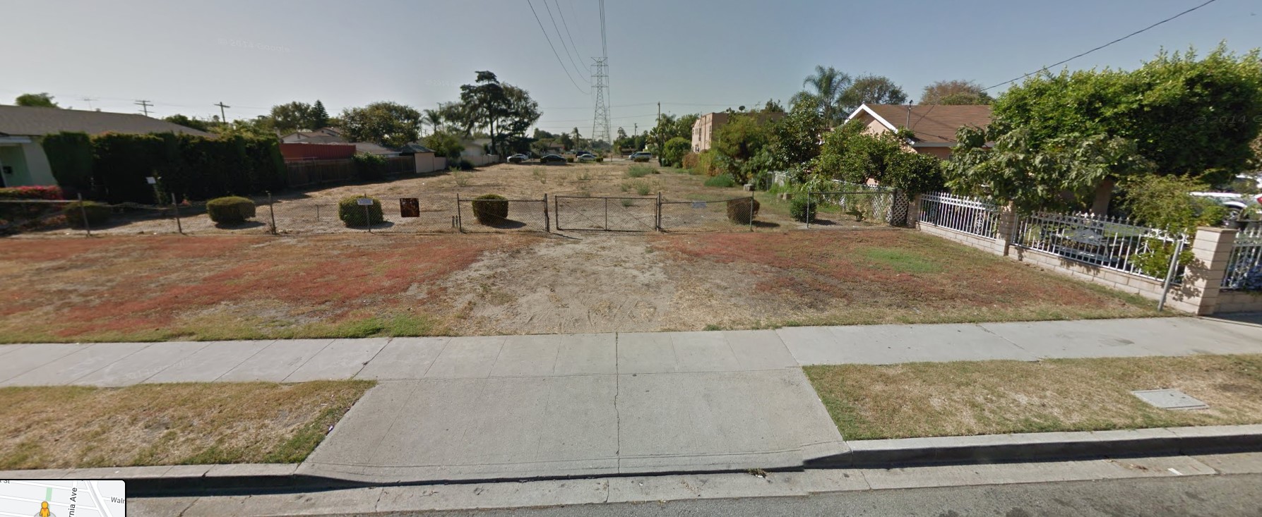
Last year, the southeast L.A. County city of Huntington Park opened Veterans Park, a new linear park featuring walk and bike paths. The half-mile long park is located below high-voltage powerlines and presents a very good example of how to convert underutilized utility corridors into multi-purpose community spaces.

Veterans Park
Veterans Park is located in a power line utility corridor extending from Walnut Street to Santa Ana Street in the city of Huntington Park. (Metro's West Santa Ana Branch rail is planned to run on the right of way along Salt Lake Avenue on the right.) Aerial via Google
false

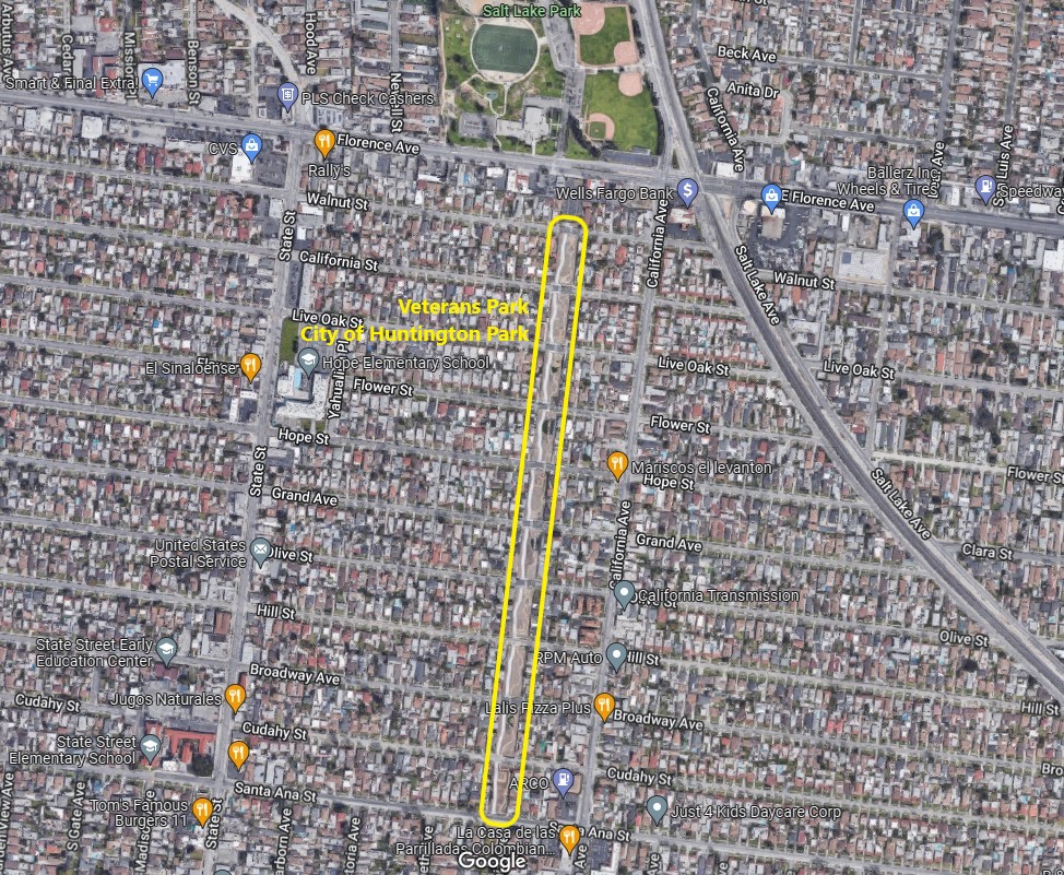
Veterans Park extends ten blocks from Walnut Street to Santa Ana Street. It is about 0.56 mile long - and about 50 feet wide. The northern end of the park is located just two blocks from Metro's planned West Santa Ana Branch rail line.
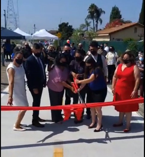
Apologies that Streetsblog doesn't have a more thorough history of this project. It opened last August; catch the grand opening ceremonies posted on the city's Facebook page.

Veterans Park ribbon-cutting - via Facebook video
false

Streetsblog visited the site last weekend.

xxxx
Huntington Park's Veterans Park is a half-mile long linear park, located in a L.A. Department of Water and Power utility right-of-way (L.A. City DWP)
false
Though the park includes a bike path, Streetsblog did not observe any cyclists using the bikeway during a short visit last weekend. Plenty of pedestrians were using the park.
false
The park features two parallel paths: a concrete-paved bike path (left) and a decomposed-granite walk path (right)
false
xxx
There are various park features interspersed through Veterans Park - kids play structures (in photo on right), as well as veteran memorials, fitness stations, seating areas, and more
false
xxx
Veterans Park features extensive native landscaping, including plantings in bioswales to soak rainwater into the earth. The landscaping allowed under power lines does not include taller trees, which might grow to interfere with the wires high overhead.
false
xxx
The park right-of-way is intersected by many 2-lane residential streets. Cyclists and pedestrians cross these fairly-low-traffic streets at grade. Many of the crosswalks include high-visibility flashing light signs.
false
For comparison, this is the unimproved utility right-of-way in 2014 - via Google Street View
For comparison, this is the unimproved fenced-off utility right-of-way in 2014 - via Google Street View
false
Veterans Park
Veterans Park signs are on both ends of the park.
false

Stay in touch

Sign up for our free newsletter

More from Streetsblog California

Friday’s Headlines

Another freeway falling into the ocean?

July 25, 2025

Hit and Run Driver Kills Pedestrian in the Excelsior, More Evidence that Paint and Plastic Aren’t Enough

Killed by a hit & run driver, long outreach, and lack of real protection on another notorious street.

July 24, 2025

Metro A Line Extension to Pomona Will Open September 19

Nine new miles of light rail, four new stations - Glendora, San Dimas, La Verne, and Pomona - extending the world's longest light rail line.

July 24, 2025

Thursday’s Headlines

Hey that Stoner Park DIY crosswalk is right by my house!

July 24, 2025

What Will It Take to Automatically Brick Drivers’ Cell Phones Behind the Wheel?

The technology to stop cell phone use behind the wheel has existed for years. Why are so few drivers using it – and why aren't lawmakers making them?

July 23, 2025

CalBike Insider: Updating Bike Parking in Green Building Codes

"CalBike and 17 of our local partners submitted a letter to the California Building Standards Commission, which is updating California’s Green Building Standards Code."

July 23, 2025
See all posts