California, Cars, and the Vision of a More Diverse Transportation Future
Note: GJEL Accident Attorneys regularly sponsors coverage on Streetsblog San Francisco and Streetsblog California. Unless noted in the story, GJEL Accident Attorneys is not consulted for the content or editorial direction of the sponsored content.
During my break, I decided to burn up some Amtrak points and trundle around the state by train. Riding a train around California is relaxing and scenic, but it also gives one a great opportunity to see, first hand, just how much this state has over-invested in the automobile at the expense of all other forms of transportation.
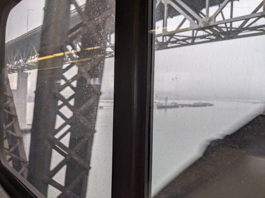
That was no more clear perhaps than when I took Amtrak from Oakland to Davis. First, the train meanders slowly along the coast, on tracks that hug the shore because they were built before machinery existed to create a more direct route inland, as was done with the Bay Area’s interstate highways. But it’s when trains cross over the Carquinez Strait that the inequity between cars and other forms of transportation is most apparent. Trains are regularly and significantly delayed here at a 90-year-old, two-track draw bridge.
As absurd as it sounds, whenever a large ship goes through the strait, all trains have to stop. Motorists, on the other hand, have been provided with not one but two super-wide, super-high road bridges, one on either side of the rail bridge. The lead photo shows one of them, high and above my train. There are also two more car bridges a few miles to the west of this point, for a total of 20 lanes for cars over the strait on bridges that are all high enough for ships to pass underneath.
Trains, on the other hand, get two “lanes,” and are beholden to ships. And those two tracks are shared with long, slow freight trains.
And free-market think tankers have the f*ing audacity to say Amtrak is subsidized?
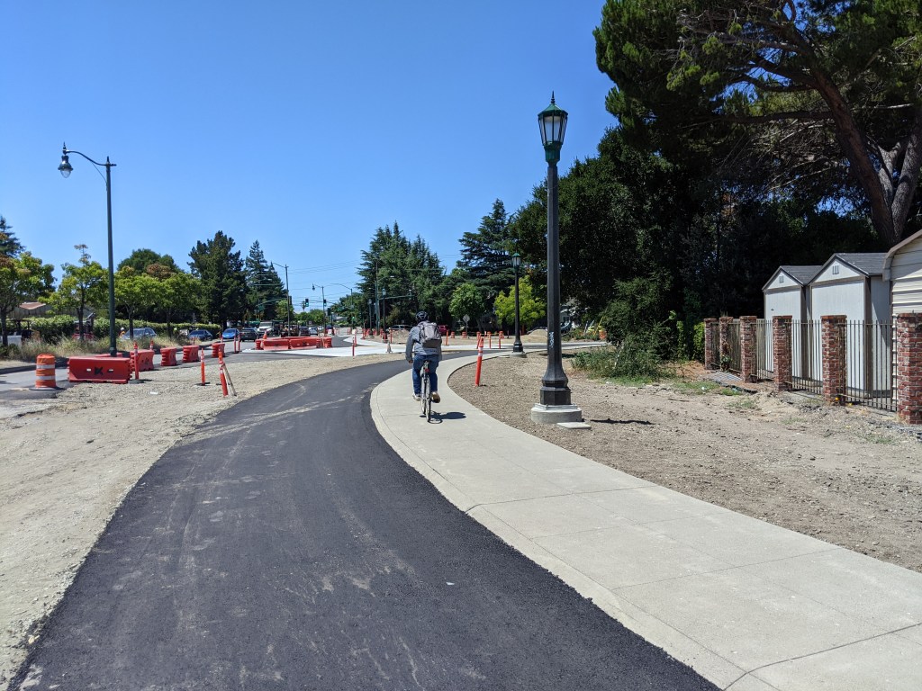
Meanwhile, in Davis, it’s possible to get a taste of what can be accomplished when city planners take safety and the freedom to chose a travel mode seriously. There are roads, obviously, and if you want to drive, it’s not a bad place to use a car. But Davis also has its famous system of off-street greenways, where cyclists can ride free of the fear of getting slaughtered by some inattentive motorist.
Nearly every intersection in downtown Davis has large bulbouts to make it easier to cross and to prevent motorists from whipping dangerously around corners. It’s not a coincidence that motorists seem to yield at crosswalks almost universally. And when Davis decided to build more parklets and pedestrian zones in response to the COVID emergency, they didn’t install dinky little signs and plastic posts. They installed stuff that can actually stop an errant or scofflaw motorist, as seen in the pic below:
Basically, Davis can be seen as a California experiment: and it proves if you build it, they will come on two wheels, not just four. Yes, it’s a college town, and yes, it’s small, but infrastructure is the main reason Davis has such a high percentage of people getting around by bike.
After returning to Oakland from Davis, I decided to take Amtrak’s Coast Starlight to Los Angeles to visit some old friends. The train is kind of ridiculous–it takes all day to get to L.A. But it’s comfortable and the food service has improved and is actually pretty yummy. (I still wish Amtrak would run an overnight sleeper train between L.A. and San Francisco, so it might be useful to people who don’t have lots of time to kill).
I also got a fresh look at some of the electrification work going on along the Caltrain corridor (the Starlight runs alongside Caltrain for a few miles). Note in the photo below the double-decker passenger train running under that wire, to the right (this is something the L.A. Times regularly reports can’t happen because of clearance issues, which ostensibly means high-speed rail can’t share tracks… or something).
It’s exciting to see serious investment finally coming to rail transportation.
But my travels around the state were also a refresher course in how most California cities, even when they’re building transit, still manage to prioritize driving and give cyclists and pedestrians short shrift.
Take the Regional Connector project, a two-mile light-rail connection that cuts through my old neighborhood in downtown Los Angeles. The majority of the expenses on the $1.5 billion project have to do with preserving car lanes, not improving transit. The city removed the Little Tokyo light-rail station–built on the surface just a few years ago–and is in the process of rebuilding it underground as part of the project. This was all to avoid a few additional grade crossings and taking out some street parking in Little Tokyo had the project continued on the surface, as was originally envisioned. A simple rail extension ballooned into a massive project, all because the loss of a few parking spaces and some traffic delay caused by grade crossings was deemed unacceptable.
During the construction Los Angeles has closed sidewalks pretty much everywhere (never closing traffic lanes, just sidewalks). The sidewalk on the right side of the road, below, was closed and people are supposed to walk down this narrow sidewalk on the left to reach Union Station – arguable the single most important destination in the area. Imagine trying to navigate this in a wheelchair.
It’s no surprise you don’t see anybody walking on this important corridor, the most direct route across the 101 freeway.
From Los Angeles, I took Amtrak’s Pacific Surfliner to San Diego, to visit my mother for Thanksgiving. That train has greatly improved over the years, with the addition of double-tracking, which eliminated most choke-points and bottlenecks. The ride was smooth and punctual. There were even a few places where we were (mostly) beating cars on I-5, which it largely parallels.
San Diego, as with Los Angeles, seems to view transit only as a way to alleviate traffic jams – a last resort for people who are too poor to buy a car or, maybe, for motorist commuters who want an alternative during the height of rush hour. Stations on San Diego’s trolley lines are downright hostile to pedestrians, as seen in this shot of the area around the Hazard Center trolley stop near my mother’s house. Everything is designed solely to make sure transit users don’t slow car traffic.
Riders on the trolley even have to hit a beg button just to cross a hotel driveway to get to the shopping center and cineplex, the only things within easy walking distance.
After Thanksgiving, I took Amtrak back to Los Angeles, and then after staying overnight, Amtrak’s San Joaquin back to Oakland via the Central Valley.
It’s a bummer that the connection from L.A. to Bakersfield requires a bus–I was stuck in L.A. traffic for the first part of the trip. The train it connects to is, nevertheless, the fastest way back home (despite the erroneous claims of many reporters, it does actually go to Oakland). It’s comfortable and relatively smooth and it also affords good views of the enormous progress being made on the state’s rail modernization project, also known as high-speed rail:
Seeing miles and miles of high-speed rail structures is encouraging. The state is, at long last, digging itself out of the hole of its deadly, auto-uber-alles transportation system. Why should it surprise anyone that the project is expensive and complex, considering the state has invested table scraps in rail since the late 1800s, while pouring trillions into freeways and roads?
It’s going to be a long journey, but we’re getting there, and the evidence of that progress is becoming more visible. Soon enough it won’t be necessary to fly to Europe or Asia to see what the future of the state’s transportation system will look like. Maybe when trains start zipping around the state at 220 mph, even planners in L.A. and San Diego will start to see rail transit, cycling, and walking as just as important as automobile throughput. One can hope, finally, they will change how they view streets and the importance of providing options to people, and they’ll try to make their streets a little safer, more diverse, and inviting—and just a little bit more like Davis.

Streetsblog has migrated to a new comment system. New commenters can register directly in the comments section of any article. Returning commenters: your previous comments and display name have been preserved, but you'll need to reclaim your account by clicking "Forgot your password?" on the sign-in form, entering your email, and following the verification link to set a new password — this is required because passwords could not be carried over during the migration. For questions, contact tips@streetsblog.org.