Support journalism that covers the issues you want to know about. Streetsblog California reports on issues few media outlets cover, and we can't do it without you. Click here to donate today.
OCTA has been working this year on its very first active transportation plan. The OC Active plan will identify areas throughout the county that have a high need for bicycle and pedestrian improvements. It will also provide an overview of work done by local municipalities in these areas.
The final plan is expected to be released this coming summer.
Streetsblog sat down in early November with Paul Martin, OCTA’s active transportation coordinator, to talk about OC Active, the outreach effort to develop the plan, and the next steps towards completing the plan.
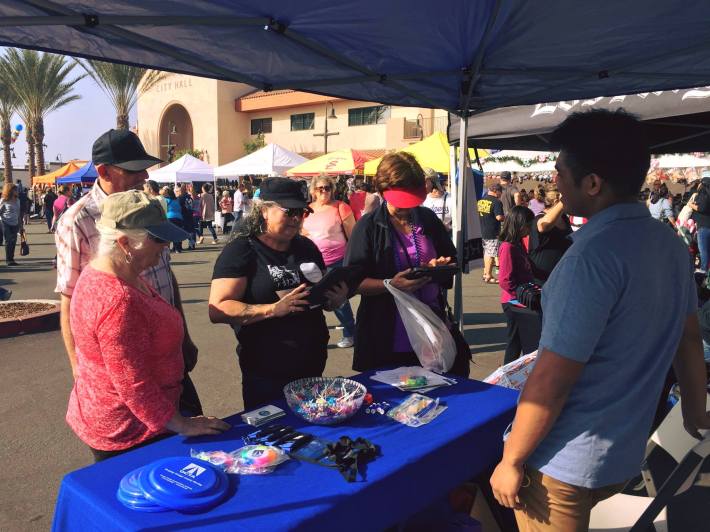
The OC Active outreach team has attended more than forty community events to tell people about it and gather feedback, and more than 1,040 surveys had been collected as of early November. The survey is expected to close at the end of the month. Fill it out here.
Streetsblog: What’s the purpose of the OC Active plan?
Paul Martin: Our explicit purpose is that we coordinate improvements into one master plan in accordance with CTC [California Transportation Commission] requirements. The CTC has a formal checklist of items that [you need] if you're going to prepare an active transportation plan.
That's our plain stated purpose for the project, but when we talk about outcomes, when we break it down, we think of it in two major buckets: bicycle and pedestrian topics.
There has been a lot of bikeway planning. Some of the local jurisdictions have done a bicycle master plan. We're not recreating the wheel, we're not trying to draw lines on the map for where bikeways should go within the county. Rather, we want to roll all that work under one master document, the OC Active document, because local jurisdictions have already gone through and [done the work], and they have a prioritized list. We just want to [highlight] what those cities have already done. If the city doesn't have a whole lot, then we can give them a prioritized ranking of the things they are planning as shown in their general plan.
So that's the bikeway part, and it's pretty precise. It lists a corridor or street where bikeways are planned, includes a rough cost, and prioritizes by jurisdiction.
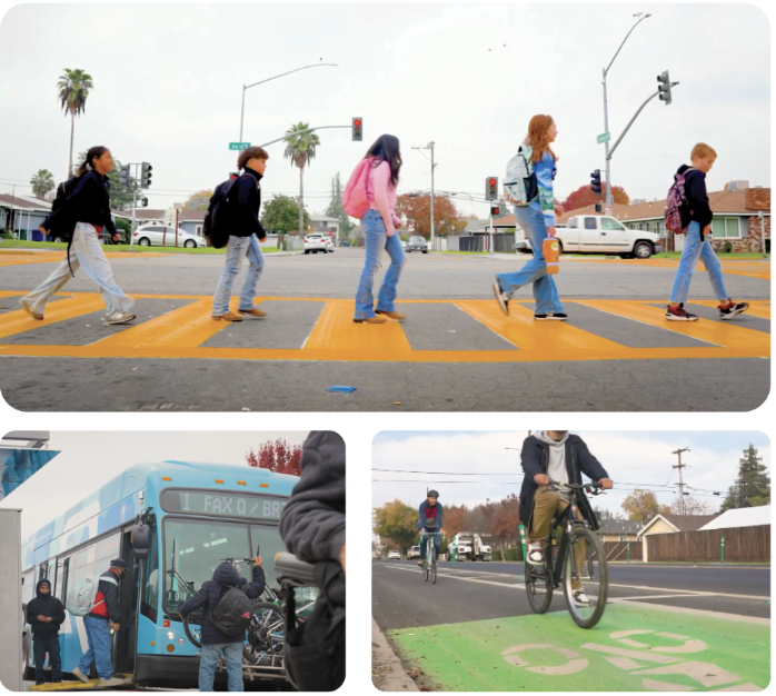
Now on the pedestrian scale, it's a little different. Here, we’re trying to identify hot spot areas, or what we call high-need areas for improvement. Most local jurisdictions haven't done a lot of pedestrian analysis. They haven't gone through comprehensively to find high crash locations, highest need locations, where improvements are needed, and where we want to focus investment to improve pedestrian [activities] in the public realm. We want to help cities along. So our project analysis accounts for multiple things: destinations — it could be schools or parks or major shopping areas or office parks — that account for demand; crash history; a look at socio-economics and income level. We will try to roll all that into a heat map to spotlight the high-need locations.
Right now we're envisioning not going to the level of saying you need to do a curb extension to a specific crosswalk, for example. Rather, [the plan highlights] areas that would benefit from investment, the high need locations.
How will this plan help Orange County Cities get more funding for bicycle and pedestrian improvements?
In 2009, OCTA had a document called the Commuter Bikeway Strategic Plan. That document satisfied this kind of umbrella planning document [required by the state] to get funding from Caltrans to build out bicycle infrastructure. Today, [the requirements] have been broadened to include an active transportation plan [that allows] jurisdictions to go after funding from the state, but also regional or local funding as well.
A local city could do their own document. Garden Grove has a recent one, Santa Ana has been doing a mixture of things, San Clemente and Huntington Beach, Newport, Anaheim, and La Habra all have updated their bicycle master plans recently. But this county document--the OC Active Plan--will cover pedestrian topics as well.
The last couple cycles of ATP funding have not required an active transportation plan, but it's been talked about at points. So, anticipating that, we wanted to do advanced planning work to provide that master umbrella document for the local jurisdictions. This could [support OCTA's request] for capital funds, or a local jurisdiction's request as well. And if they want to do their own local active transportation plan, they could as well.
What started the process of creating this active transportation plan?
There was the recognition that it was time to update the Commuter Bikeways Strategic Plan. I think it was already on the list, and it aligned with interest from the [OCTA] board to enhance and support active transportation. So it was a natural next step for us after all the regional bikeways studies were done. In ATP Cycle 1, our [map] guys got money to do a sidewalk inventory of major roadways throughout the county. That planning [and] technical work is complete — and in Cycle 2 we asked for funding for the planning work.
When did the planning process begin and where is it now?
In September we had a stakeholder working group meeting. This summer we had been working on our project goals and on the background and [identifying] existing conditions. Outreach is underway now. Recommendations are expected [to be worked on] through spring 2018 for both bicycle and pedestrian topics, and then [we plan to] finish the report next summer or fall. Currently, we're early in the project. Part of our goal with outreach is to get the word out that the study is being prepared and get people to complete the survey.
The plan does not get into the specifics of design but identifies locations that need improvement. How are the high-need locations being determined?
At our stakeholder working meeting in September, our project team listed out all the criteria that are going into the [mapping] analysis. We could look at income levels or access to a vehicle, proximity to a transit route or a bus stop, crash history, destinations like parks or schools. Through our [mapping] analysis, the team has come up with suggested weightings. And then we asked the working group participants to let us know if something should be weighted higher or lower.
There were good discussions. Some thought that maybe retail and commercial uses should be weighted higher than other land use destinations, and others felt that access to schools was important. So there was some back and forth on that.
Right now, what we've said is we're trying to roll in as much criteria as we can get our hands on, [including even] health data from Orange County Health Care Agency. So [the entire] laundry list of criteria is being considered. We have a draft pedestrian analysis, but none of it is quite done, and refinements are underway so we can bring them back to the stakeholder working group.
There’s a survey for OC Active, which closes at the end of the month. How will it be incorporated into the plan?
We're asking the public to fill out a short survey-- it's four questions, and two of them are multiple choice. We tried to prepare a concise survey that really gets at the heart of the issues. One question is: where is a specific location within Orange County where you would like walking to be easier and more attractive? Our team can map out these data points, and that serves as another layer in our analysis. If we get a lot of input about a specific location or a certain area, roadway, or corridor, then that information could be included.
That's helpful as long as we get the survey out to a broad audience throughout the county. A lot of our work has been focused on getting the word out about the survey. There’s a hard copy; we have a digitized version; we developed a business card that we could give out. When go to outreach events we just bring iPads and have people fill it out on the spot. Our goal is to [keep] the survey [open] through December and then we'll evaluate [whether] to go longer or to close the survey. We don't want it to be this constant moving target because we would like to move forward with the analysis, but that's our current goal.
If the city wanted to use the plan, how would it do so? Would they need to adopt it into the General Plan?
I don't know that the cities necessarily are going to need to incorporate into their general plan. It's more of a resource for them. I think for us to satisfy the CTC requirement, our board needs to formally take action, so there may be a resolution for that. But the local jurisdictions don't have to.
Our document will include all the best practices, things you typically see like engineering treatments. We've done that in all the past studies as well, but the intent here is to provide a spotlight on the areas that could use improvements as well as on solutions that the cities might employ.
OCTA is doing a chalk contest. What's that about?
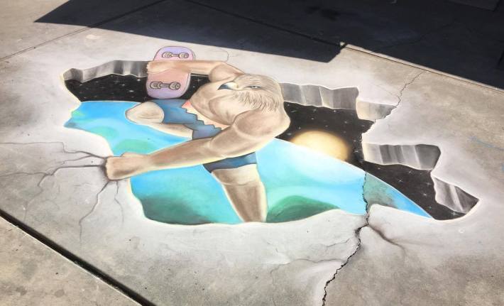
It's a nice, fun, social way for people to participate, and through the voting, we encourage people to go ahead and fill out the surveys again. The chalk contest just finished up. We got seven entries, four high school entries and three from middle schools. [Three high schools were in Santa Ana, and one of the middle schools is in Garden Grove]. And then we have voting directly through Facebook. So the idea is to get the word out, let the voting decide if there is a winning category within middle and high school level. We were able to get vendors to donate prizes, [including] skateboard racks or towers, and a pair of bicycle racks that look like oranges.
This was the first time that I know of that we've done something like this. Maybe that can build and grow.
What kind of events have you done outreach at?
Health events, Halloween events, 5Ks, 10Ks. We went to the Vans Skatepark in Lake Forest and engaged the skateboarders that were there, including parents that were at the event.
How will OC Active work with other OCTA planning documents, like the Master Plan of Arterial Highways, which promotes increasing roadway capacity to counteract congestion? How will OCTA’s other priorities actually jive with what OC Active hopes to achieve?
OC Active doesn't necessarily focus a whole lot on the plans and policies of OCTA. In some cases, OC Active will feed directly in, like the LRTP [Long Range Transportation Plan]. In that document, we're going to try and get our recommendations into the LRTP wherever possible, because that's a parallel effort. As far as those other things like MPAH policies, or other parallel documents, plans, and policies, I'll have to double check. It may [be included as part of] next steps or action items for the consultant to go and look at those.
On a technical level, [OCTA staff] is looking at how the Master Plan of Arterial Highways could be refined to better serve the cities. We already have a parallel effort, a technical study that's underway related to that. Another project manager is leading that, [and] they're looking at how well the MPAH is serving the cities, how it can be streamlined and effective in helping the cities when they want to change the roadways, whether it's for bike and pedestrian projects or community context. So that's occurring on its own path.

What's next?
So the big thing is rolling all the bicycle stuff under a single set of recommendations and then [completing] the pedestrian analysis. So we've done that draft [mapping] analysis, and we've gotten some input and are refining that. So when we go back to the stakeholder working group in January, we'll be able to show them those results. At that point, we'll be able to identify what the high-need locations are. So [the next step would be completing] the draft recommendations, and getting feedback on that. That would feed into the report next summer.
Anything else you'd like to add?
A key aspect [of ATP funding] is that planning studies serve disadvantaged communities. In our grant application, we had highlighted that this will serve effectively countywide, so it would by default cover all the disadvantaged communities throughout the county. But in our outreach, we've tried to hone in on disadvantaged communities. A lot of the engagement on the project is us going to community events and festival events--fiestas, farmers markets, or other parallel events. [We are looking for] those other opportunities where there's already a broad audience, to have a booth and engage the community there. It's kind of a broad mix of events, but it's always been a key thing for us to consider when we go to events: Does it provide geographic spread? How well does it serve and address disadvantaged communities throughout the county?
