High Speed Rail Update: Animations of Potential Palmdale-Burbank Routes
The California High Speed Rail Authority released three simple animations showing possible routes for the Palmdale to Burbank section. The animations appear on separate maps, so it’s hard to compare them side-by-side, but they give a pretty good idea of how very, very long the proposed tunnels are.
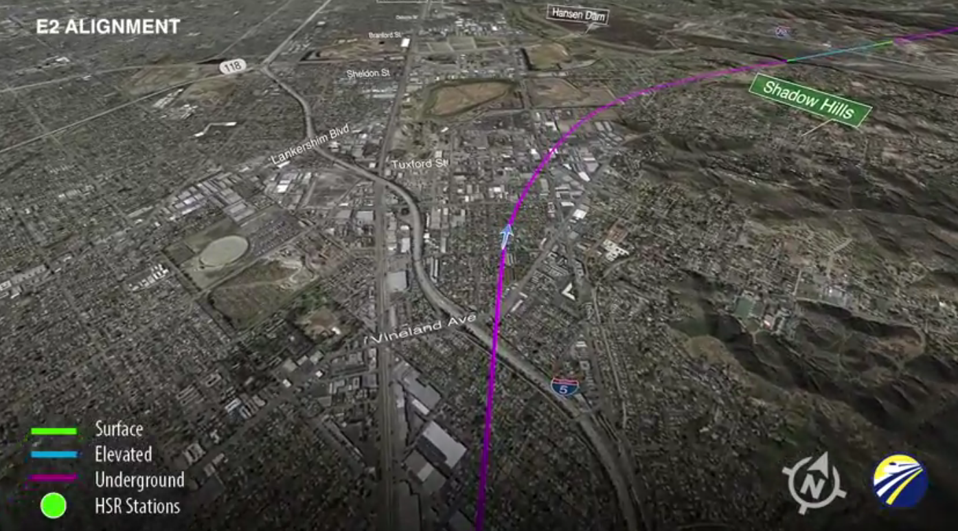
The routes vary slightly in the San Fernando Valley. They all begin in a tunnel, and cut either under Pacoima, emerging to pass around Hansen Dam, or under Shadow Hills, emerging for a moment in the recreation area before dipping back underground to cut through the San Gabriel Mountains. The routes also differ as they approach Palmdale, with the train emerging from the tunnels in a few places and then going back underground before finally emerging just west of Palmdale itself.
All three routes feature extensive tunnels through the San Gabriel Mountains. Estimated costs for the different HSRA segments were released in its 2016 Business Plan, but the cost differences between these three potential routes are buried in a Supplemental Alternatives Analysis. Buried deeply. The short version is that the most expensive of the three is Route E1, the middle route that passes close to the Pacoima Dam and steers mostly clear of Highway 14.
Note that there is a public meeting on the alignments tomorrow night, Thursday, September 22, from 5 to 8 p.m. at the Fernangeles Recreation Center, 8851 Laurel Canyon Boulevard in Sun Valley.

Streetsblog has migrated to a new comment system. New commenters can register directly in the comments section of any article. Returning commenters: your previous comments and display name have been preserved, but you'll need to reclaim your account by clicking "Forgot your password?" on the sign-in form, entering your email, and following the verification link to set a new password — this is required because passwords could not be carried over during the migration. For questions, contact tips@streetsblog.org.