Can Berkeley’s Bike Plan Keep it a Top Bike-Friendly City?
The city of Berkeley just made its most recent draft bicycle plan available for public comment, and Dave Campbell, advocacy director of Bike East Bay, says it could be better.
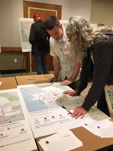
The city did some innovative work to create the plan, including conducting an extensive in-person survey of local residents that produced solid data about local preferences. As Campbell writes in Berkeleyside, it was:
The kind of extensive public outreach Bike East Bay wishes all cities would engage in for their bicycle plan updates. A key finding of Berkeley’s public outreach [showed] that 70 percent of Berkeley residents who currently do not bicycle often or at all are interested in bicycling more if streets were safer. It’s certainly no surprise to hear that a higher quality product creates more demand.
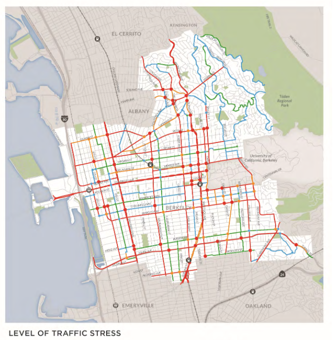
City planners also created a map of “low-stress” and “high-stress” zones, based on traffic volumes and collision rates. By overlaying maps of existing bike routes with maps of high-collision zones, they could clearly see where there was the most need for improvement. For example, although Berkeley already has a pretty solid number of existing low-stress bikeways, every one of those routes runs into trouble somewhere. They cross through high-traffic areas or come to busy intersections that are difficult or dangerous—or both—to cross.
The maps make it clear that the bike boulevards do not constitute a connected, low-stress bike network, which may be deterring riding.
The new bike plan focuses on the spots that interrupt the network. It proposes safer crossings at many hot spots, including new marked crossings, a protected intersection, and crossing lights, depending on traffic volumes.
It also proposes more low-stress bicycle boulevards. These are streets with relatively low traffic volumes where bicycle traffic is prioritized with sharrows and traffic diverters. The new plan also includes removing some stop signs to allow bike riders to maintain momentum along the bike boulevards—in many parts of the city there is a stop sign at every block—and adding speed tables to slow down traffic.
However, Campbell writes:
The main shortcoming of the draft plan is its retreat from an earlier commitment for Berkeley to have a dense network of low-stress, comfortable, family-friendly bikeways throughout the city, including protected bikeways on busy streets residents use every day.
An initial map of [the] draft Berkeley bicycle plan… showed a more dense network of low-stress bikeways, and in fact staff emphasized that a fully connected low-stress network was the direction the plan was taking as a result of public input received. The current draft bicycle map omits many needed low-stress, protected bike facilities.
Campbell points to good things in the plan, like the proposed two-way protected bike lane along Milvia Street through downtown and the proposed protected intersections.
But in other crucial places the plan falls back on the phrase “future studies are needed.” Studies are not necessarily a bad thing, but as Campbell points out, it would be better if calls for future studies were more specific about what exactly needs to be studied. That is, if the plan’s vision includes a network of protected bike lanes, then future studies should focus not on whether to build protected lanes, but on how.
By doing so, Berkeley’s bicycle plan will reflect the vision of the people of Berkeley, expressed over the course of the last two years — a vision of a dense network of modern, comfortable, attractive bikeways for residents of all interests, abilities, [and] comfort levels… that extends throughout the city.
Still, continues Campbell:
Berkeley’s draft bicycle plan… is a good improvement over its current plan, and is better than most bicycle plans currently under development in other East Bay cities such as Concord, Pleasanton, and Moraga. But Bike East Bay members and thousands of people who bicycle in Berkeley every day have higher expectations for the number two city in the U.S. for bike commuting.
The draft plan and more information can be found here.
Written comments are due by September 29. The draft bike plan will be presented to the Transportation Commission on October 20, and from there it will go to the City Council for approval on December 13.

Streetsblog has migrated to a new comment system. New commenters can register directly in the comments section of any article. Returning commenters: your previous comments and display name have been preserved, but you'll need to reclaim your account by clicking "Forgot your password?" on the sign-in form, entering your email, and following the verification link to set a new password — this is required because passwords could not be carried over during the migration. For questions, contact tips@streetsblog.org.