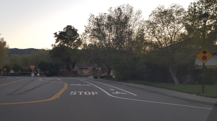
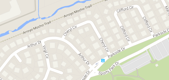
Pleasanton, California may have just created the shortest bike lane in the state. It's one short block long, on Parkside between Cheryl and Arthur roads.
You can see from the map above that the neighborhood is full of loop roads that don't connect to much. In fact, Parkside is really the only way through here, even by bike. Just east of this point there's a path connecting to the trail that can be seen at the top. But this single block is the only section that's marked with a lane.
It's no April Fools joke. Mark Candland of the Pleasanton planning department said that the intersection was recently changed from a two-way to an all-way stop, which made it necessary to restripe the street.
“When we're going to resurface a street,” said Candland, “we look to see if we can add bike lanes. It's short, but a little bit is better than nothing at all.”
The very wide median along Parkside left plenty of space to give bicycles an officially marked approach to the new stop sign. They also narrowed the vehicle lane to eleven feet wide, to signal to cars they needed to slow down as they approached the intersection.
It's officially an example of a “complete streets” approach, wherein when changes are made to any street, the opportunity to accommodate bikes and pedestrians is pounced upon.
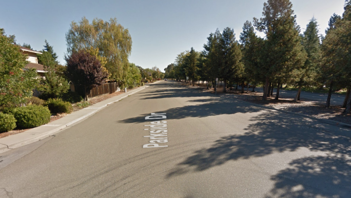
It's also officially a way to create a deeply fragmented bike network that gets bikes exactly nowhere. There's certainly plenty of room along Parkside for bike lanes, as this view looking away from the new lane shows. But that section of road is not due for repaving, so there is no plan to extend the bike lane further.
Currently Pleasanton is in the process of developing a bike master plan, but whether this adorable stub of a lane gets connected to other parts of the city remains to be seen.
Hat tip to Robert Prinz.
