In an effort to help cities and towns throughout the state update their planning documents, the state's Office of Planning and Research (OPR) is updating its General Plan Guidelines.
As part of the process, it is holding a series of workshops throughout the state to discuss the update and gather public feedback. A list of the workshops is included after the jump, below.
All cities and counties are required to adopt a general plan, which lays out a community's vision for future growth and is supposed to reflect a community's values and priorities. In turn, all local land use policies, including zoning regulations, must be consistent with the local general plan. A general plan lays out local goals and describes how they will be achieved. By doing so, it can promote better projects and better use of resources. For example, a general plan could help people understand the connection between land use planning and transportation.
There's no set schedule for updating general plans, but data grows old, growth patterns shift, and state law changes, so updates are generally necessary about every ten to fifteen years. In many California jurisdictions, local general plans are already more than fifteen years old.
But adopting a new general plan is an expensive and time consuming process, especially if it's done well. The proposed state guidelines aim to make the job less onerous. “Part of our goal was to make it easier for communities by providing data and tools all in one place,” said Sahar Shirazi, who is managing the guidelines update for OPR. “That way it takes less time and capacity to do the update.”
The last time the OPR updated its guidelines was in 2003, when a chapter on public participation was added. That new section recommended early, frequent, and broad public participation to educate and engage people using workshops, town hall meetings, focus groups, design charrettes, and the like.
The current update starts with a section on community outreach, because, said Shirazi, setting up a framework to define a community's values is a key first step. “How do you set up a framework to define that? If that part is out of date, it will create planning and logistical problems.”
The update also contains templates, sample sections, and model policy language that can be edited for the local context. There are new sections on equity and environmental justice, infill, renewable energy, agricultural land, healthy communities, economic considerations, and climate change.
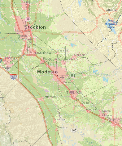
The update also includes a mapping tool containing a range of information from multiple sources so planners can incorporate local, regional, and statewide data without cost. Data in the map include things like city and county boundaries, open space, flood risk, traffic bottlenecks, and life expectancy.
OPR is actively seeking comments on the guidelines, and the workshops are meant to introduce the new tools and gather feedback from participants on what works, what is confusing, and what's missing.
The idea, said Shirazi, is to encourage cities and counties to understand that a general plan update is important, but doesn't have to be overwhelming. The guidelines are a hefty document—over 300 pages—but they break down the process into reasonable tasks, and clarify which tasks are necessary and which are optional.
“We wanted to be clear about what is required by statute, and what are just recommendations,” said Shirazi. “At the same time, we want to encourage places that can to do more than the bare minimum, because we understand how important planning is.”
The text of the draft guidelines are available here [PDF]. A beta version of the mapping tool—beware, data nerds, this could be a time suck-- can be found here.
Note that recently passed legislation like S.B. 379, which requires general plan safety elements to include a discussion of adaptation to climate change, has not yet been added to the draft, but will be added before the update is completed.
There are two series of workshops. OPR is holding extensive workshops throughout the state aimed at planners, and the public is encouraged to attend these. At the OPR workshops (the second list below), some time will be spent discussing the importance of general plans and what's new in these guidelines before going more in depth about specific issues communities have faced and what guidance or tools would help them.
A different set of four workshops are being held in partnership with the California Pan Ethnic Health Network (CPEHN). That series will be more targeted towards educating community members and finding out what's important for them. The CPEHN workshops are not free ($25 for general public, which includes breakfast and lunch) and they'll focus specifically on the new Healthy Communities and Social Equity sections of the guidelines.
To register for CPEHN workshops, click on the links below. They will be held in:
- Fresno: November 10, 9:00 a.m. to 1:30 p.m.First Five Fresno County, 2405 Tulare StreetRegister for the Fresno workshop here.
- Oakland: November 12, 9:00 a.m. to 1:30 p.m.The California Endowment, 1111 Broadway, 7th FloorRegister for the Oakland workshop here.
- Los Angeles: November 17, 9:00 a.m. to 1:30 p.m.The California Endowment, 1000 North Alameda StreetRegister for the Los Angeles workshop here.
- San Diego: November 18, 9:00 a.m. to 1:30 p.m., Sherman Heights Community Center, 2258 Island AvenueRegister for the San Diego workshop here.
Register here to attend one of the OPR workshops listed below. There have already been workshops held in Eureka, Santa Rosa, and Salinas, and the remaining ones are:
- Oroville: November 5, 1:30 to 4:30 p.m.Butte County Board of Supervisors Meeting Chambers. 25 County Center Drive
- Sacramento: November 6, 9:00 a.m. to 1:30 p.m.Sacramento County Board of Supervisors Chambers. 700 H Street
- Bakersfield: November 9, 9:30 a.m. to 1:30 p.m.Kern Council of Governments, 1401 19th Street #300
- Fresno: November 12, 10 a.m. to 2 p.m.2550 Mariposa Mall, Suite 1036
- Stockton: Monday, November 16, 9:30 a.m. to 1:30 p.m.San Joaquin Council of Governments, 555 E. Weber Avenue
- Truckee: November 17, 10:30 a.m. to 2 p.m.Airport Community Room A, 10356 Airport Road
- San Luis Obispo: November 20, 9:30 a.m. to 2 p.m.Library Community Room, 995 Palm Street
- Los Angeles: November 30, 9:30 a.m. to 2 p.m.Southern California Association of Governments, 818 West 7th Street, 12th floor
- San Bernardino: December 1, 9:30 a.m. to 2 p.m.San Bernardino Associated Governments, 1170 W. 3rd Street, 2nd floor
- San Diego: December 2, 9:30 a.m. to 2 p.m.San Diego Metropolitan Transit System, 1255 Imperial Avenue, Suite 1000
- San Francisco: December 4, 9:30 a.m. to 2 p.m.San Francisco Planning Department Conference Room, 1650 Mission Street #400
- Oakland: December 7, 9:30a.m. to 2 p.m.1515 Clay Street, Room 1
- Santa Barbara: December 9, 1:30 to 4:30 p.m.David Gebhard Public Meeting Room, 630 Garden Street

