New Video and Map Reveal L.A. Streetcar Transit History
There are some interesting recent pieces that tell some things about L.A.’s transit history, and how it shaped the city Angelenos move through today.
For your Friday enjoyment, watch City Beautiful’s new YouTube video on the history of L.A.’s once-extensive streetcar systems. Streetsblog USA makes a nice cameo!
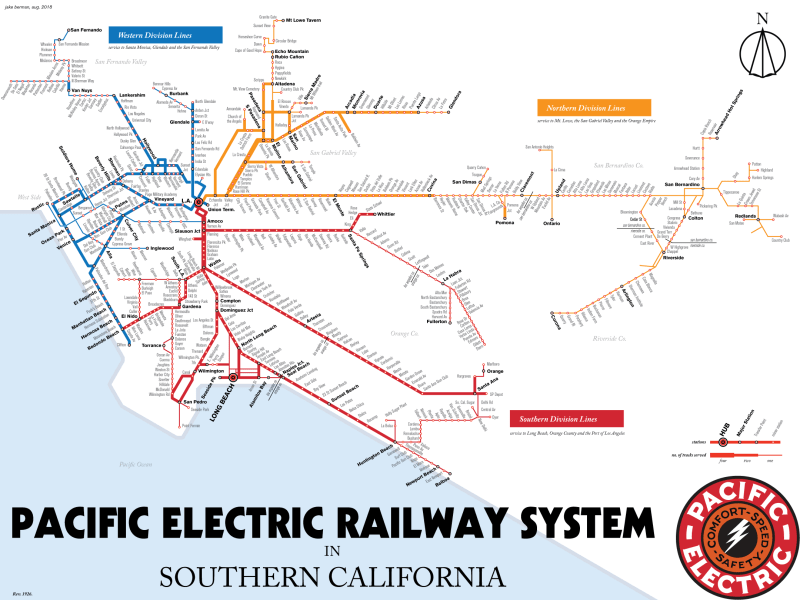
Readers may have spotted this at Reddit, L.A. Taco, and Curbed, but you read it here fourth! Check out Jake Berman’s sleek new map (at top of post) of L.A.’s streetcar lines at their peak. Purchase your own prints via Berman’s Etsy page.

Streetsblog has migrated to a new comment system. New commenters can register directly in the comments section of any article. Returning commenters: your previous comments and display name have been preserved, but you'll need to reclaim your account by clicking "Forgot your password?" on the sign-in form, entering your email, and following the verification link to set a new password — this is required because passwords could not be carried over during the migration. For questions, contact tips@streetsblog.org.