Kern County Holds Walk Audits to Identify Safe Walking Solutions
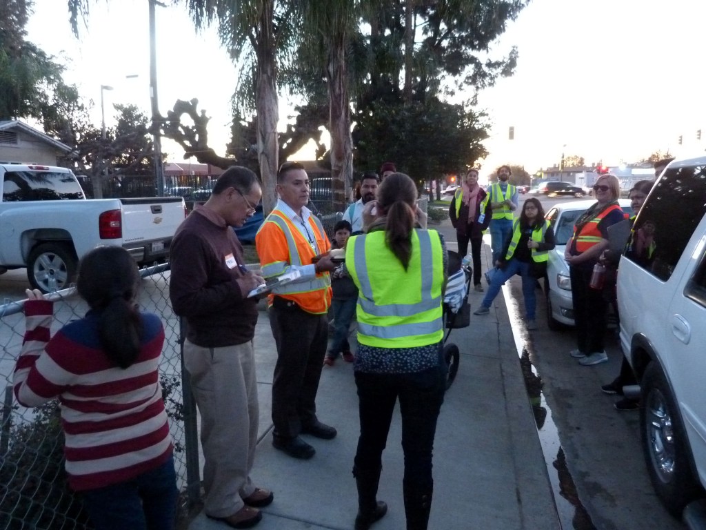
Kern County planners know that it can be difficult being a pedestrian in the Central Valley region, and they are looking for ways to improve infrastructure so that the county can be safer and walkable for everyone.
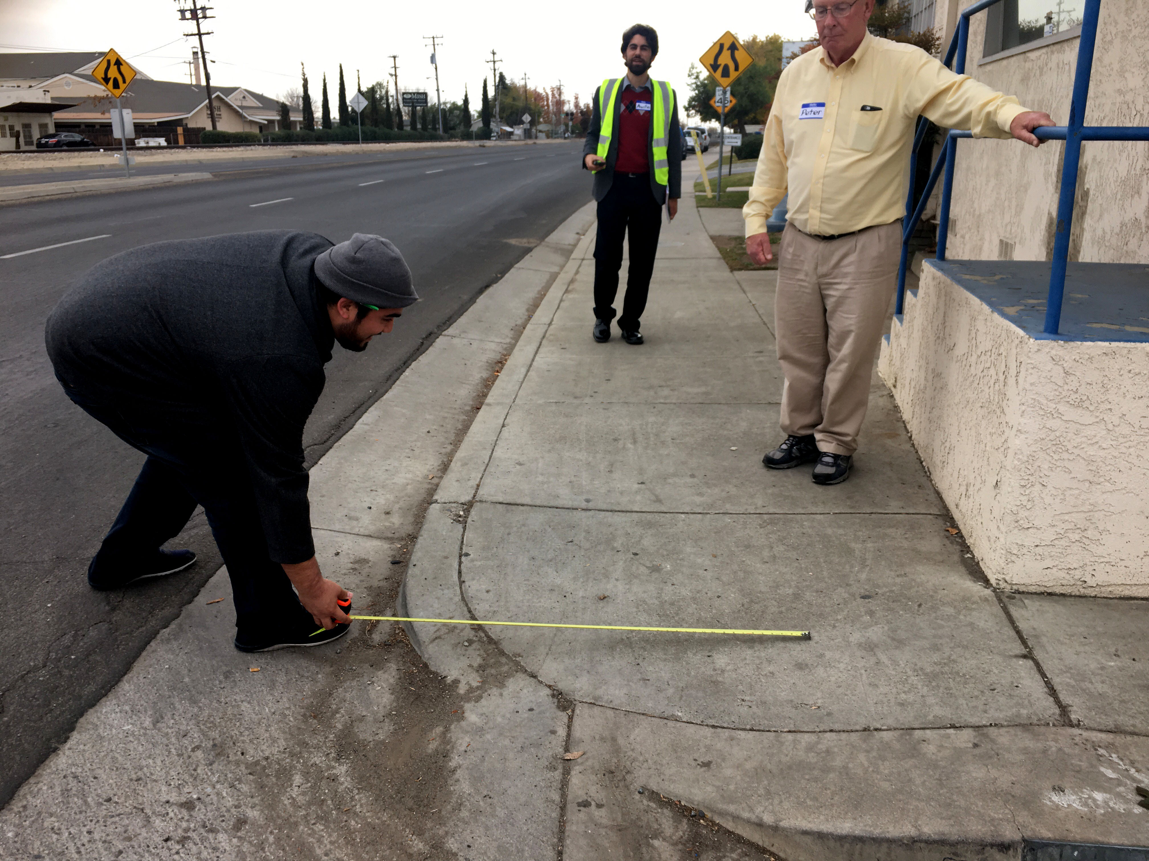
“There is nothing worse than seeing a mother push a stroller down a dirt path by the side of a road,” said Peter Smith, regional planner with the Kern Council of Governments (KernCOG). That is one of the reasons KernCOG is undertaking a series of walking audits throughout the region.
Smith said the data collected will help develop an inventory of existing conditions to inform the region’s Active Transportation Plan, which is expected to be completed in June 2017.
Wendy Alfsen, executive director of California Walks, a nonprofit that advocates for pedestrian safety and is helping facilitate the walk audits, said Kern County already has a fair amount of data on bicycle and pedestrian conditions—compiled as part of other plan plans—but no local pedestrian plan.
“The pedestrian knowledge is missing, scattered, and poor,” she said.
Although there are some good localized walking spaces in the county, a lot of the region is unincorporated, she said, with little biking or walking infrastructure and hardly any data-driven priorities. Alfsen said the walk audits are meant to shed light on questions like: Where do people go? What are places that are highly dangerous?
Outreach is being done in 21 communities via public workshops, but only nine were selected for the walk audits, including downtown Bakersfield, desert communities like Mojave, and environmentally disadvantaged locations like Arvin.
Walk audits provide information on human behavior and current conditions straight from the experts—community residents, said Alfsen. And the audits and subsequent workshops, Smith and Alfsen said, can provide information about issues and ideas for solutions that can be replicated throughout the region, which is as big as the state of Massachusetts.
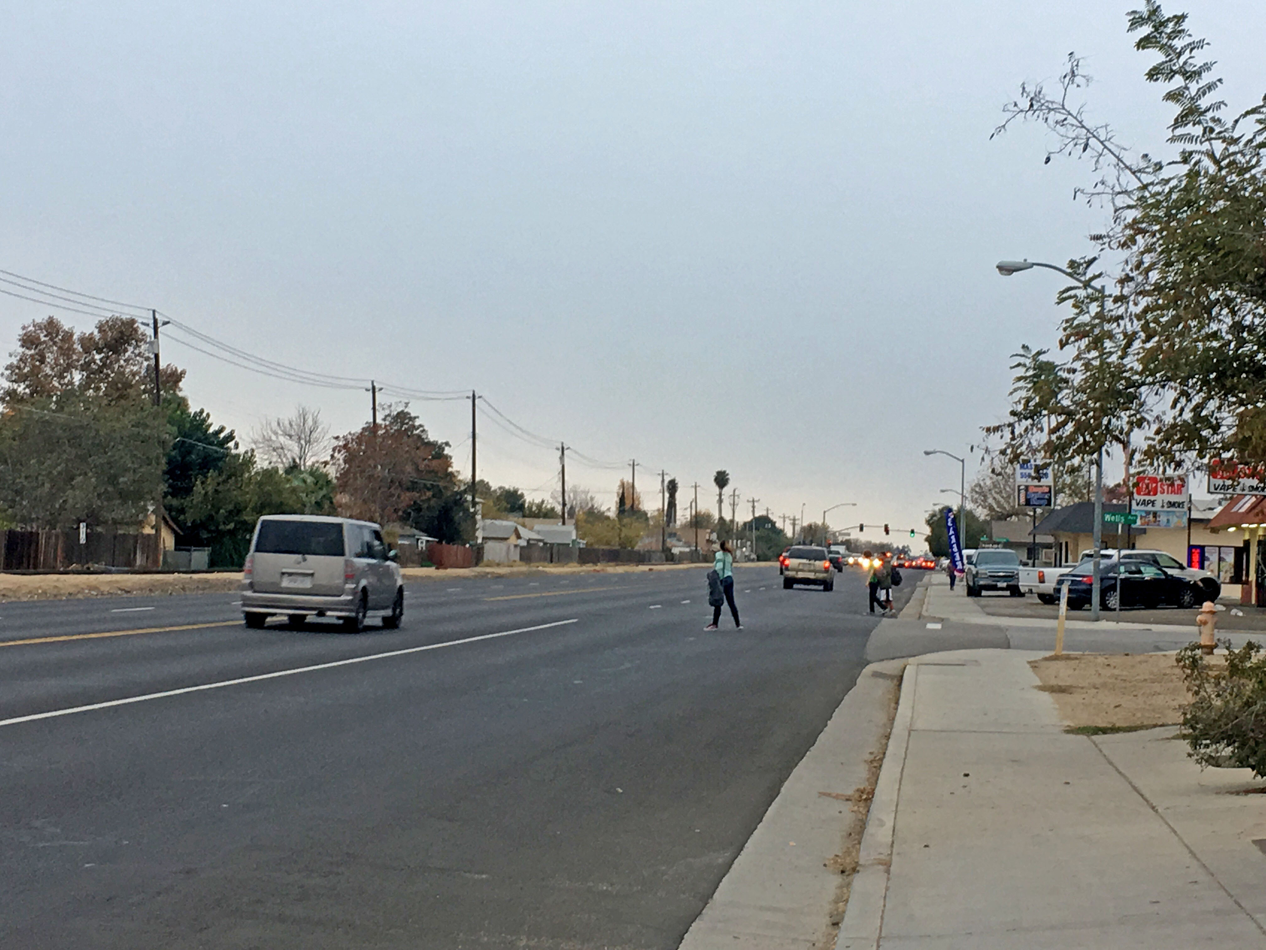
Alfsen said the kick-off audit in downtown Bakersfield provided a perfect example of information they hope to get. “We walked up to 20th Street, and it’s almost storybook—a statewide [best] practice,” she said of the safety islands, bulb outs, benches, and trees in the area.
But as the group conducting the audit neared the transit center, they noticed a corner crossing where riders catch the bus. It’s an uncontrolled intersection between two highways where cars are speeding through, and there isn’t so much as a sign to get the driver’s attention to slow down.
“So here you have a situation that needs a solution, and [you have] a solution that can be used,” she said.
Walk audits like the ones KernCOG is undertaking are rare in active transportation data collection, according to Alfsen, so it’s impressive that the county decided to do several. It’s one of the many good outcomes of the region’s quest to capitalize on the statewide Active Transportation Program grants, which helped fund the creation of the plan as well as the audits.
In the most recent funding cycle of funding, more than $9 million was awarded to projects in the KernCOG region. One is a project in Rexland Acres that will receive $5.6 million to build sidewalks, improve intersections and pedestrian crossings, and add crossing lights. That project was planned after California Walks and UC Berkeley’s SafeTREC conducted pedestrian safety training workshops with community members and identified specific needs in the area.
Smith said that once it’s finished, the regional Active Transportation Plan will arm communities with the data they needed to be able to compete for state and federal grants to make needed improvements. He said that although KernCOG leverages whatever local, state, and federal funding is available, the projects are done incrementally—“a mile of bike path here (and there)”—leaving gaps and difficult intersections, which doesn’t help improve the county’s pedestrian collision rate.
Kern County is ranked one of the worst in the state when it comes to pedestrian fatalities, particularly among children under the age of fifteen, according to the California Office of Traffic Safety. Also, Bakersfield is a Focus City under the U.S. Department of Transportation Federal Highway Administration, part of an initiative aimed at reducing deaths by providing extra resources to the cities and states with the highest pedestrian fatality rates.
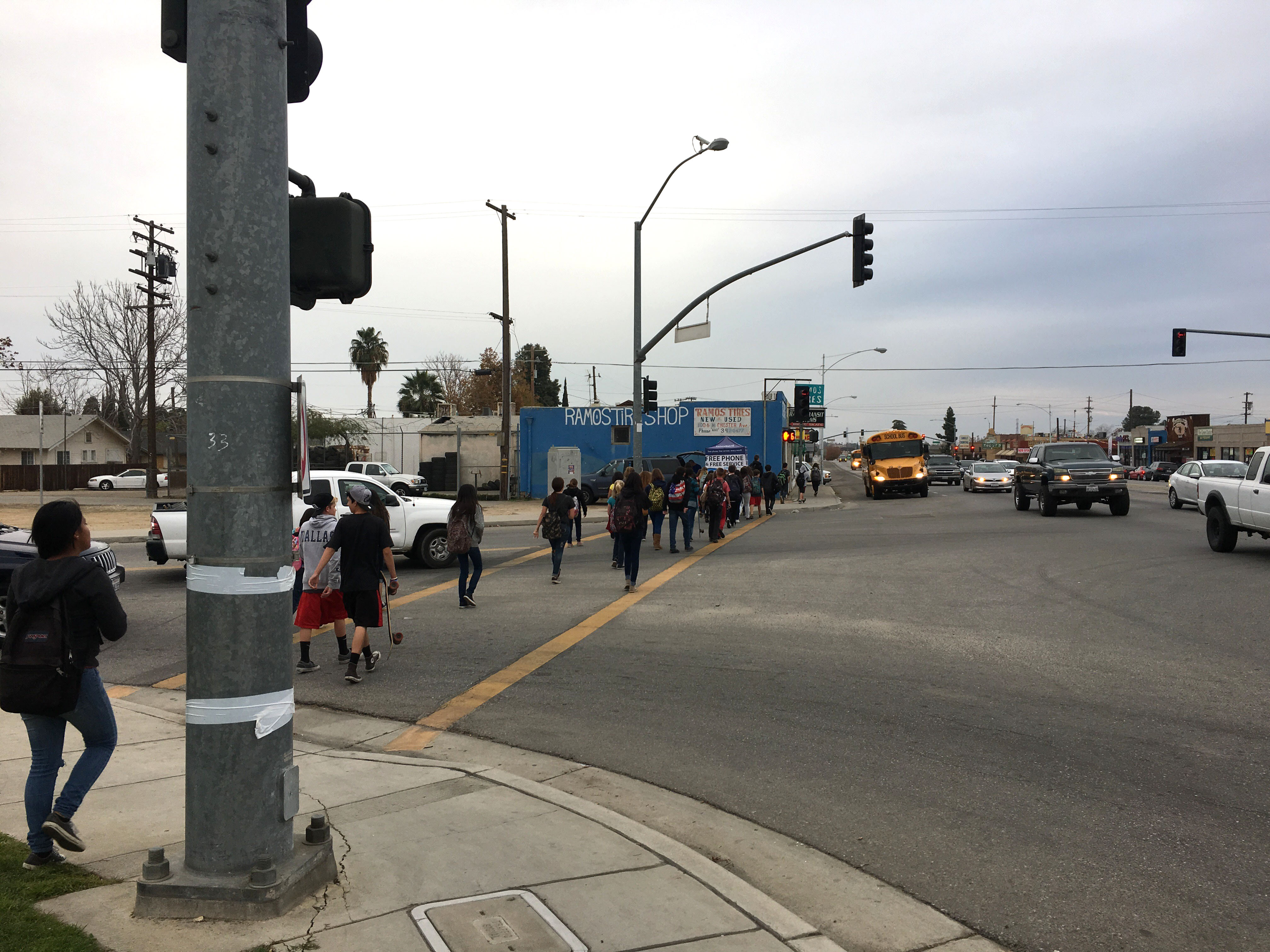
The turnout for the audits—aside from agency representatives—could always be better, Alfsen said, but she is pleased with the breadth of community representation. They’ve had several parents participate in walk audits near elementary schools, and a 90-year-old man joined in on one of the audits. “Now he had a very unique perspective,” she said.
Hearing from the people who use the streets every day can lead to better, more focused improvements, with solutions aimed directly at problems.
For instance, during the Mojave walk audit, facilitators learned of a dangerous crossing where Highways 14 and 58 come together. On one side of the wide street is a motel is frequented by hikers on the Pacific Crest Trail, and on the other side is a restaurant and store where they can stock up on resources before heading back out to the trail.
“It is a busy highway, there’s no signage,” Alfsen said. “We wouldn’t have known about this problem if not for the walk audit.”
The Kern Council of Governments is holding its final walk audits today and tomorrow, in Delano, Shafter, Arvin, and Taft. It is also holding public workshops in McFarland, Bakersfield, Wasco, and Frazier Park. For a list of times and locations, see here.
At the same site there is an interactive map of the county where community members can comment on specific needs, add walking and biking routes and destinations, and highlight areas that need improvements.
Here’s a first-person description from someone who participated in Oildale’s walk audit.

Streetsblog has migrated to a new comment system. New commenters can register directly in the comments section of any article. Returning commenters: your previous comments and display name have been preserved, but you'll need to reclaim your account by clicking "Forgot your password?" on the sign-in form, entering your email, and following the verification link to set a new password — this is required because passwords could not be carried over during the migration. For questions, contact tips@streetsblog.org.