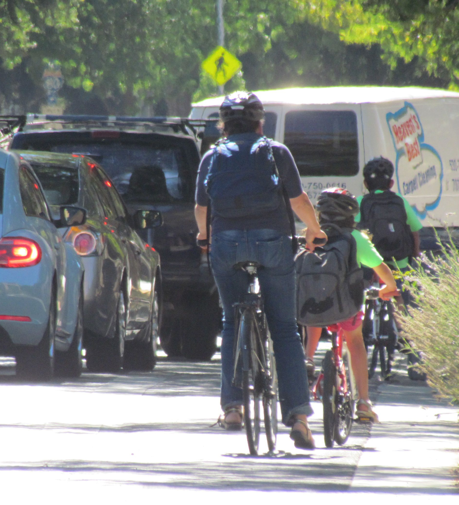
California Launches New Transportation Equity Tool
The Transportation Equity Index calls attention to inequitable distribution of transportation benefits and harms - and creates a new way to map multimodal access
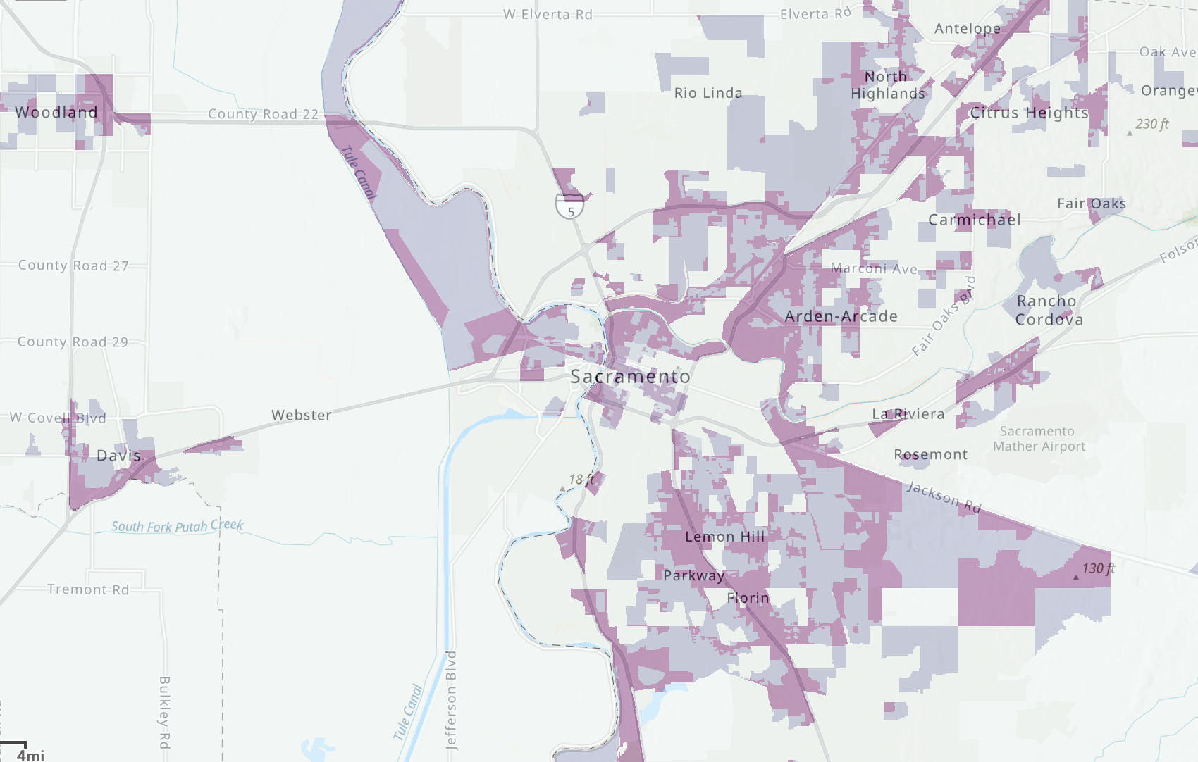
The greater Sacramento area, as mapped in the Transportation Equity Index
Note: GJEL Accident Attorneys regularly sponsors coverage on Streetsblog San Francisco and Streetsblog California. Unless noted in the story, GJEL Accident Attorneys is not consulted for the content or editorial direction of the sponsored content.
The California State Transportation Agency (CalSTA) and Caltrans released a new tool to aid in the state's work towards addressing the inequitable distribution of transportation benefits and burdens. Called the Transportation Equity Index (EQI), the tool is similar to the state's existing CalEnviroScreen, which identifies areas that suffer unduly from economic and pollution burdens.
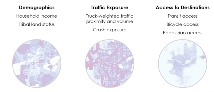
However, unlike CalEnviroScreen, the EQI focuses solely on transportation. Its maps show traffic volumes and traffic proximity to communities - particularly truck traffic - as well as crash rates. It also maps out how easily residents can access destinations via transit, biking, and walking. There is another layer to the maps showing household income and tribal status. These three "screens" combine to show where in the state, in areas as small as census blocks, transportation burdens are highest.
The tool has been in development for several years, as called for by the state's Climate Action Plan for Transportation Investment (CAPTI). In conjunction with other tools in development, specifically the Caltrans System Investment Strategy (CSIS), it is meant to help guide the state towards better and more equitable transportation. It can also help California meet federal funding requirements.
The EQI is now available to the public, who can explore the tool and evaluate the transportation gaps officially identified in their own communities.
Its development also acknowledges that up until now, transportation funding decisions have been made without access to similar data. "To my knowledge, this is a one-of-a-kind tool for a state DOT," said CalSTA Secretary Toks Omishakin. "Transportation is a necessity, but it should not cause harms. The state has been hampered by a lack of data to identify priority areas. The EQI is an attempt to attain more equitable outcomes for people throughout the state."
Not using this kind of data has led to some areas of the state being more exposed to danger from crashes and having poor access to jobs and education. "With the EQI, Caltrans can more easily identify transportation projects that improve access in [burdened] areas to prioritize for state and federal funding programs," says the Caltrans press release.
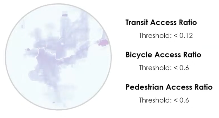
In what seems to be a major innovation, the EQI tool developers came up with a way to visualize multimodal access, using ratios. For transit, they map the ratio of transit access to auto access. So, for example, if residents cannot reach at least twelve percent as many destinations by transit that they can reach by car, the local score is low. (California has to set the bar that low, because so few areas have good transit access.) Note that "destinations" include jobs but also shopping, health care, school - anywhere someone needs to go.
Bicycle access is measured as a ratio between how many destinations can be reached via a low-stress bike network vs. high-stress, dangerous routes. To measure pedestrian access, they looked at the ratio between what a person on foot can reach via the existing pedestrian network vs. what could be reached if they could walk in a straight line. That allows the tool to analyze gaps and barriers that transportation planners could do something about.
In the webinar introducing the tool, developer Henry Mckay pointed out that some places in California - for example, some neighborhoods in San Francisco - have high burdens (low income, high traffic exposure, high crash rates) but relatively good access via transit or walking. Other places have both high burdens and lousy multimodal access, and these areas are the ones the tool seeks to identify.
Like with CalEnviroScreen, which has gone through many iterations and is still being analyzed for unintended consequences, the EQI is likely to undergo changes as data is updated and new tools become available.
While the EQI is limited in scope to focus narrowly transportation issues, it can be used in conjunction with the broader CalEnviroScreen maps to better analyze underlying issues.
How the EQI will be used is still being developed, according to Eric Sundquist, formerly of the State Smart Transportation Initiative and now working as Sustainability Coordinator at Caltrans. It can be used now to help analyze transportation projects to see whether they will improve access where most needed. Caltrans intends to use it as part of the forthcoming CSIS (which should be released mid-2024, according to the presenters). It can also be used to analyze existing programs and projects to judge whether they are being equitably distributed.
But Caltrans doesn't always apply some of its own best analyses. And whether local and regional planners use the information that is newly available to them via EQI to help make funding decisions remains a question. Legislation may be needed to force them to do so.
Today's presentation of the EQI is available to watch online. Also, there will be a technical information session on March 20 from 2-3 p.m. to go into more details about how to use the tool - register here.
Send questions ahead of time to CaltransEQI@dot.ca.gov.
Read More:
Stay in touch
Sign up for our free newsletter
More from Streetsblog California
Metro Board Funds Free Student Transit Pass Program through July 2025
Metro student free passes funded another year - plus other updates from today's Metro board meeting

Commentary: There is Zero Ambiguity to the West Portal Tragedy
What happened in West Portal was entirely predictable and preventable. The city must now close Ulloa to through traffic and make sure it can never happen again
Friday’s Headlines
Inspiration from the Bike Summit; OakDOT proposes standards for temporary safety upgrades; San Diego transforms a fast road in Balboa Park; Stockton transit funding is under threat; More
Active Transportation Program Calls for Volunteer Evaluators
Apply to be a volunteer ATP application evaluator by May 10.