Santa Monica Reduces Speed Limits Throughout City
In its most recent news roundup, the Ocean Park Association noted that the promised speed limit reductions on Neilson Way between Pico Boulevard and Marine Street are now in place. Speed limits dropped 5 miles per hour, from 30 to 25, as part of a series of reductions made after a speed survey on Santa Monica’s streets was completed earlier this year.
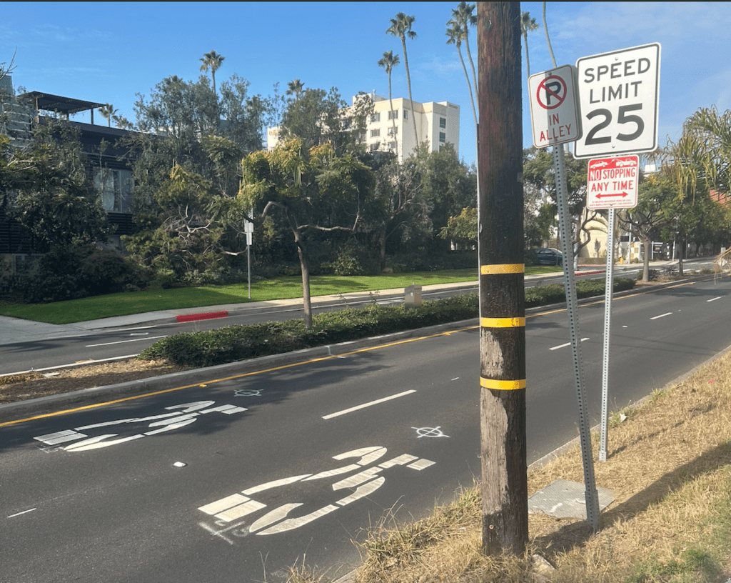
The changes were announced with new signs on the side of the road and “25 mph” markings painted on the road.
Recent state legislation granted cities greater flexibility in how to set speed limits after decades of a rigid state standard that was theoretically intended to prevent cities from artificially reducing speeds to create “speed traps.” In effect, the law prevented cities from setting appropriate speed limits where too many drivers speed. The 2022 law is still based on the “85th percentile rule,” but gives cities the opportunity to lower limits in residential, commercial, school and other areas where other safety concerns exist. For more information, read the state’s guidelines on setting speed limits.
This segment of Neilson Way is one of 30 streets that will see changes in their posted speed limits as a result of the survey. All but one will see lowered limits, and along one street the speed limit will increase. The new limits were set by Santa Monica DOT and approved by the City Council after a speed survey conducted earlier this year; this ensures the new speed limits would survive a legal challenge. The survey, conducted from January 27 through July 29, included measuring vehicular speeds along roadway segments to determine how fast drivers were traveling.
Anecdotally, Neilson has always been a scourge for me, whether biking to the beach or out for an exercise run. The wide lanes and 30mph speed limit has often led to cars traveling at high speeds, and they seem to be more likely to run a red light if they arrive just after a light changes from yellow to red.

A full list of the changes approved earlier this year can be found below.
Reduction from 40 to 35 mph
- Olympic Boulevard between 11th Street and Centinela Avenue
Reduction from 35 to 30 mph
- Lincoln Boulevard between I-10 Freeway and Pico Boulevard
- Ocean Park Boulevard between 23rd Street and Centinela Avenue
- Pico Boulevard between Lincoln Boulevard and Centinela Avenue
Reduction from 30 to 25 mph
- 2nd Street between Wilshire Boulevard and Colorado Avenue
- 4th Street between Colorado Avenue and Pico Boulevard
- 11th Street between San Vicente Boulevard and Marine Street
- 14th Street between San Vicente Boulevard and Ashland Avenue
- 20th Street between Wilshire and Pico boulevards
- 26th Street between San Vicente and Cloverfield boulevards
- Colorado Avenue between Ocean Avenue and 17th Street
- Dewey Street between Robson Avenue and 23rd Street
- Main Street between Colorado Avenue and Pico Boulevard
- Marine Street between Lincoln Boulevard and 17th Street
- Montana Avenue between Ocean Avenue and Stanford Street
- Neilson Way between Pico Boulevard and Marine Street
- Ocean Avenue between the north city limit and Pico Boulevard
- Ocean Park Boulevard between Barnard Way and 23rd Street
- Pico Boulevard between Appian Way and Lincoln Boulevard
- Stewart Street between Colorado Avenue and Pico Boulevard
- Wilshire Boulevard between Ocean Avenue and Lincoln Boulevard
Reduction from 25 to 20 mph
- 6th Street between Pico Boulevard and Pier Avenue
- 20th Street between Pico and Ocean Park boulevards
- Appian Way between Pacific Coast Highway and Bay Street
- Ashland Avenue between Neilson Way and Lincoln Boulevard
- Barnard Way between Hollister Avenue and Neilson Way
- California Avenue between Ocean Avenue and Lincoln Boulevard
- Michigan Avenue between Lincoln Boulevard and 19th Street
- Washington Avenue between Ocean Avenue and Stanford Street
Increase to 30 mph
- California Avenue between Pacific Coast Highway and Ocean Avenue (also known as the California Incline) — from 25 mph
Note: This post was previously published on Santa Monica Next.

Streetsblog has migrated to a new comment system. New commenters can register directly in the comments section of any article. Returning commenters: your previous comments and display name have been preserved, but you'll need to reclaim your account by clicking "Forgot your password?" on the sign-in form, entering your email, and following the verification link to set a new password — this is required because passwords could not be carried over during the migration. For questions, contact tips@streetsblog.org.