Construction Nearing Completion for OC Streetcar, Opening Expected Summer 2025
Tracks and stations appear nearly complete for the 4.1-mile streetcar. Through Santa Ana much of the light rail project is accompanied by curb-protected bike lanes.
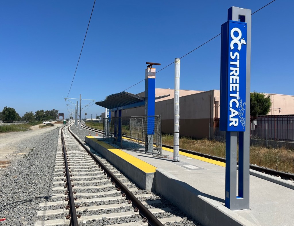
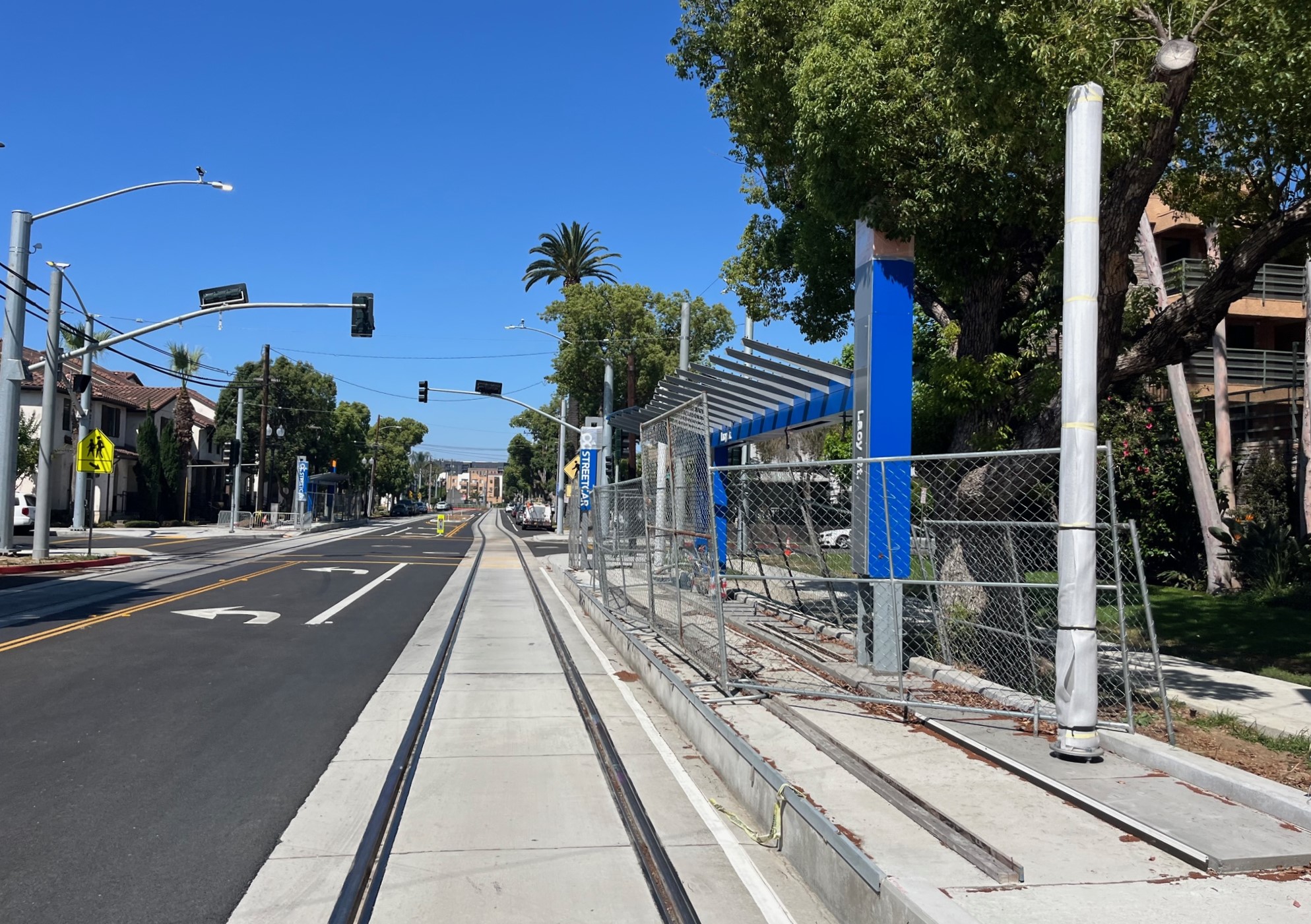
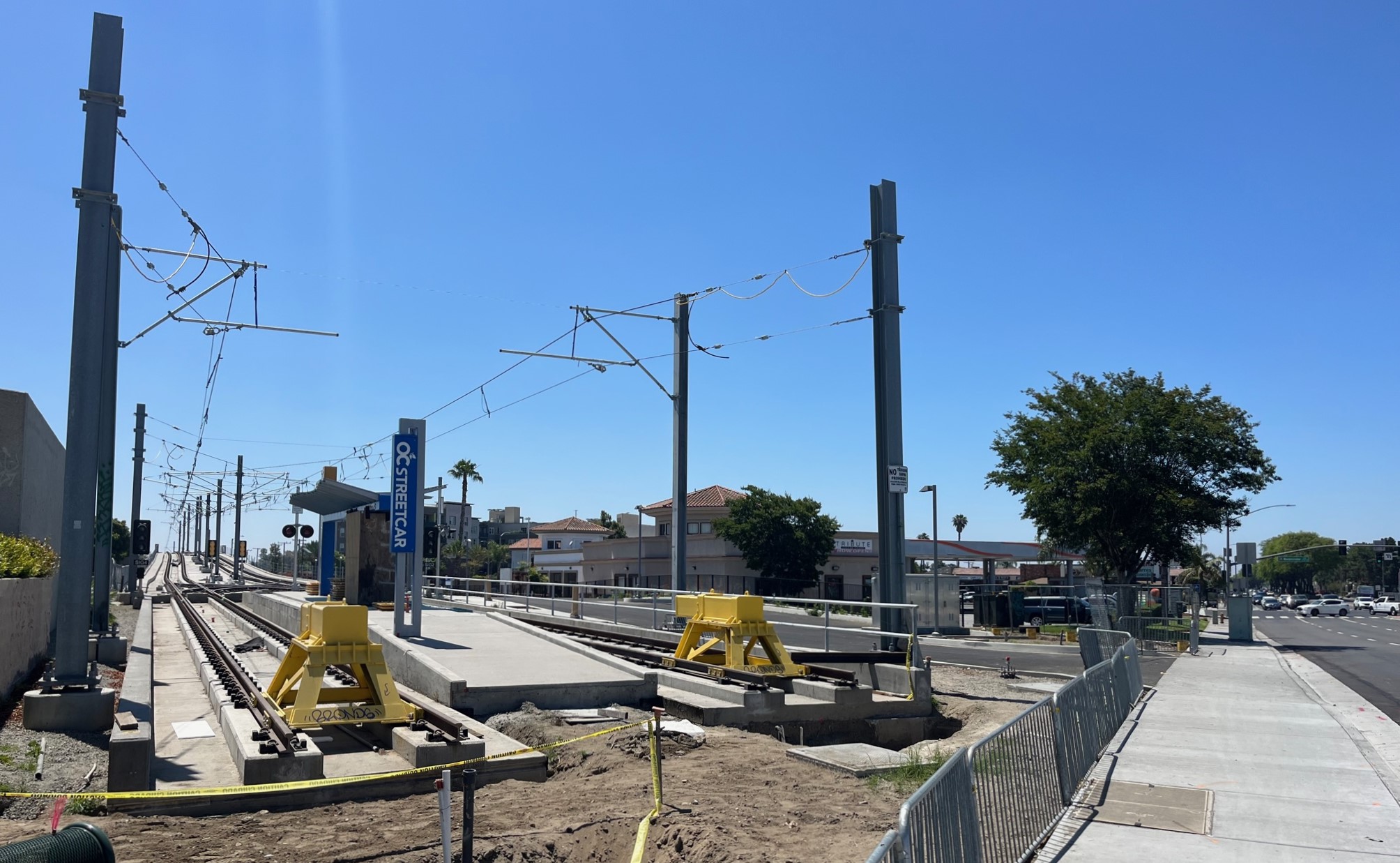
OC Streetcar Fairview Street stop under construction. Photos by Joe Linton/Streetsblog
The Orange County Transportation Authority (OCTA) is nearing completion on the OC Streetcar project, a 4.15-mile long $579 million light rail line located in the Orange County cities of Santa Ana and Garden Grove.
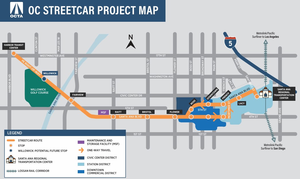
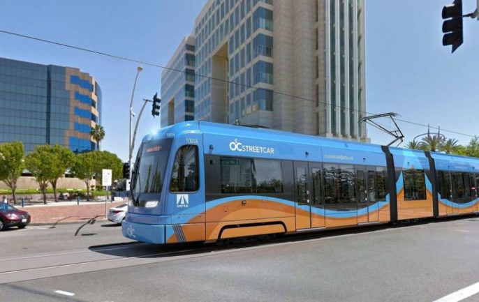
OC Streetcar project map – via project factsheetOC Streetcar rendering via OCTA
OC Streetcar construction got underway in 2018. Its anticipated opening date is just over a year off: August 2025.
The eastern end of the OC Streetcar project will run on-street through central Santa Ana, connecting with its civic center and train station, which serves Amtrak and Metrolink, plus other bus transit connections. The western end of the route will run off-street on a historic rail corridor called the West Santa Ana Branch (where, one county and a dozen miles away, L.A. Metro is also finalizing plans for its Southeast Gateway Line light rail. Though it may be theoretically possible, it is unlikely that the two lines would connect in the foreseeable future.)
Streetsblog toured OC Streetcar construction last weekend. Below are photos showing the current state of the project, from east to west.
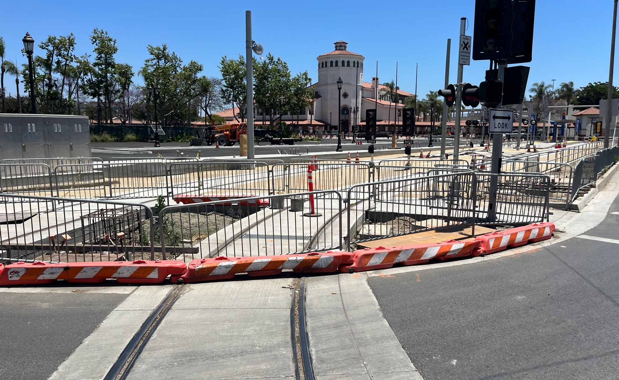
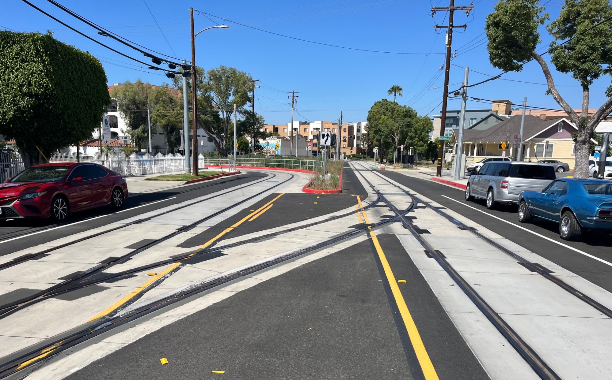
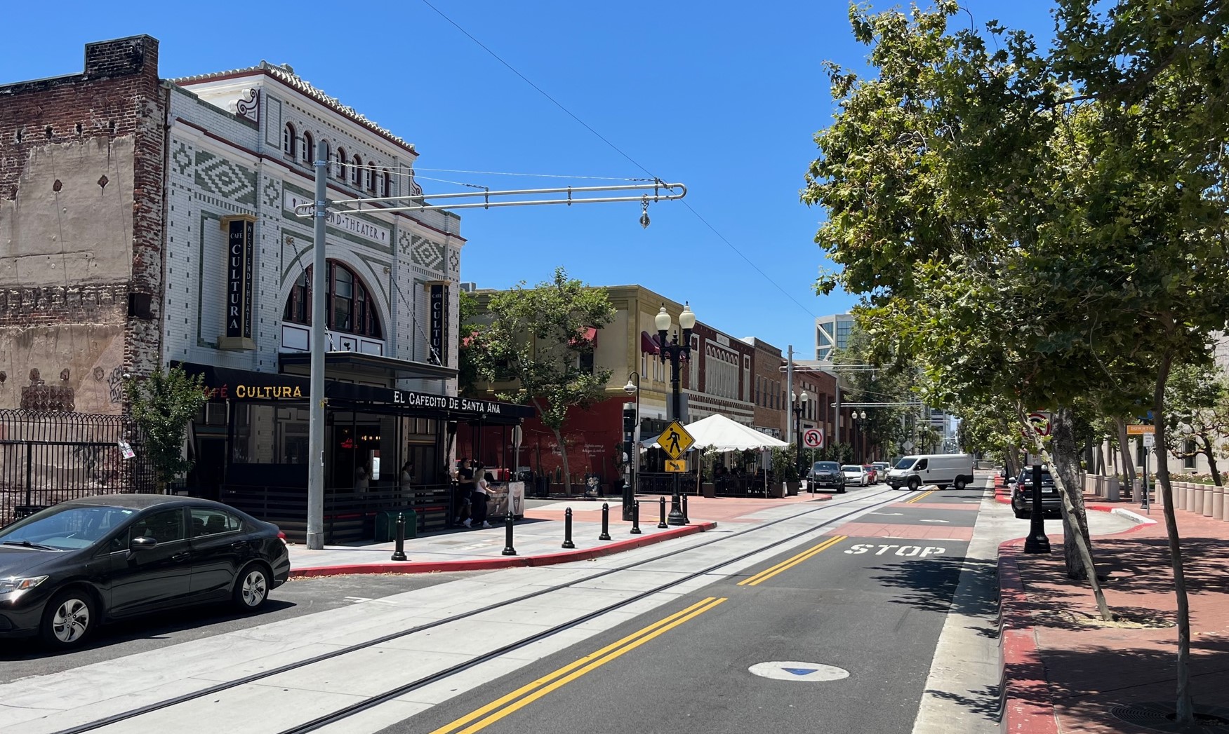
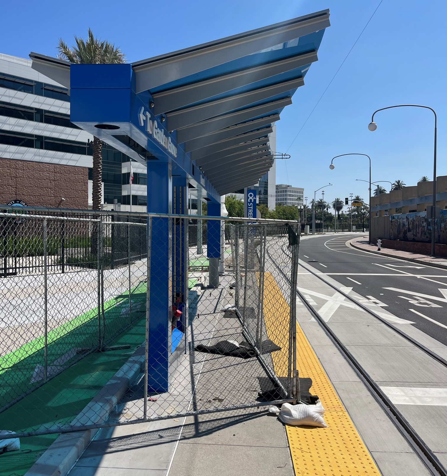
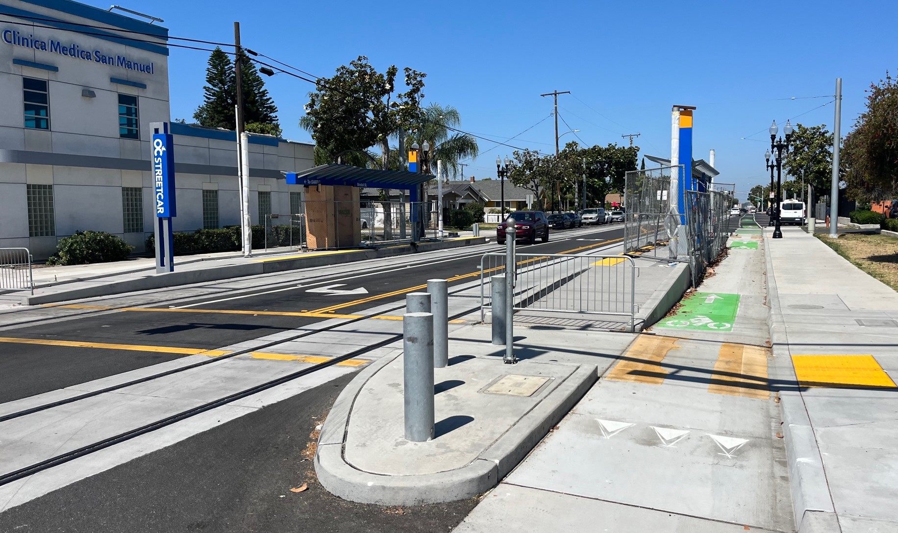
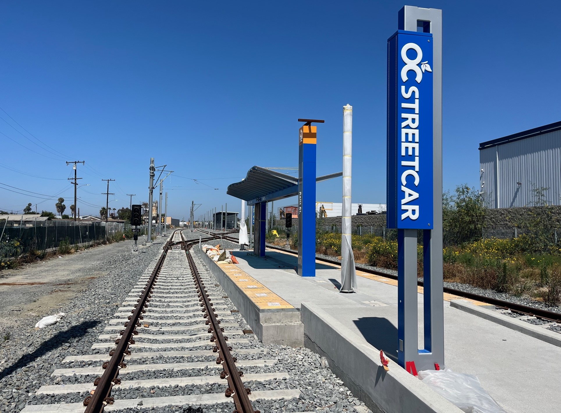
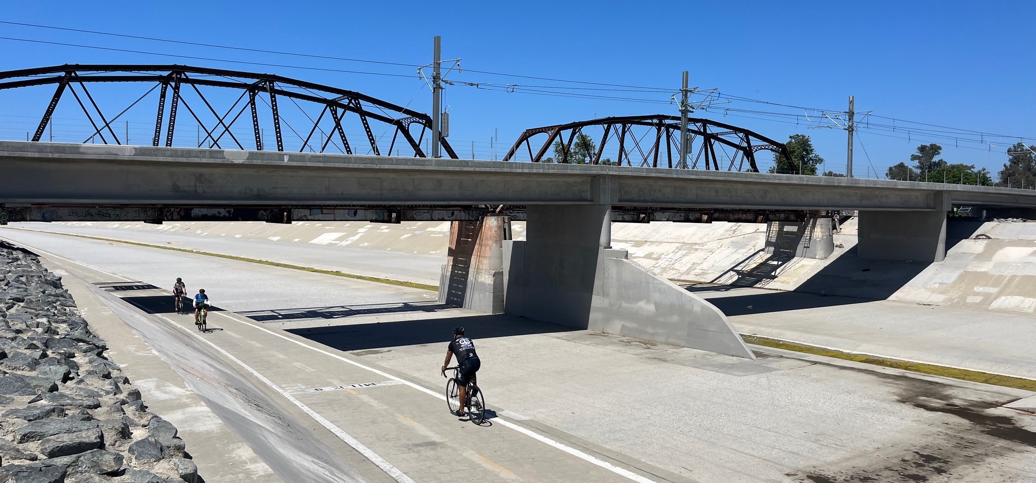
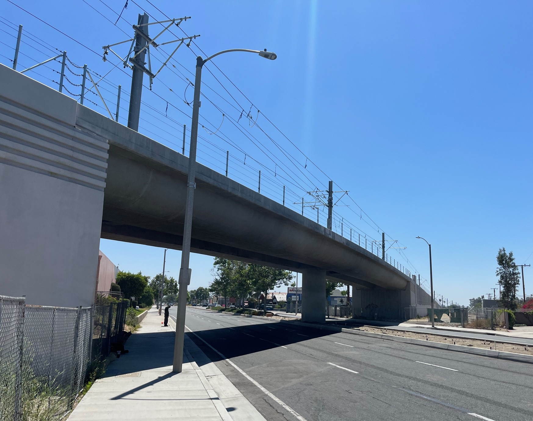
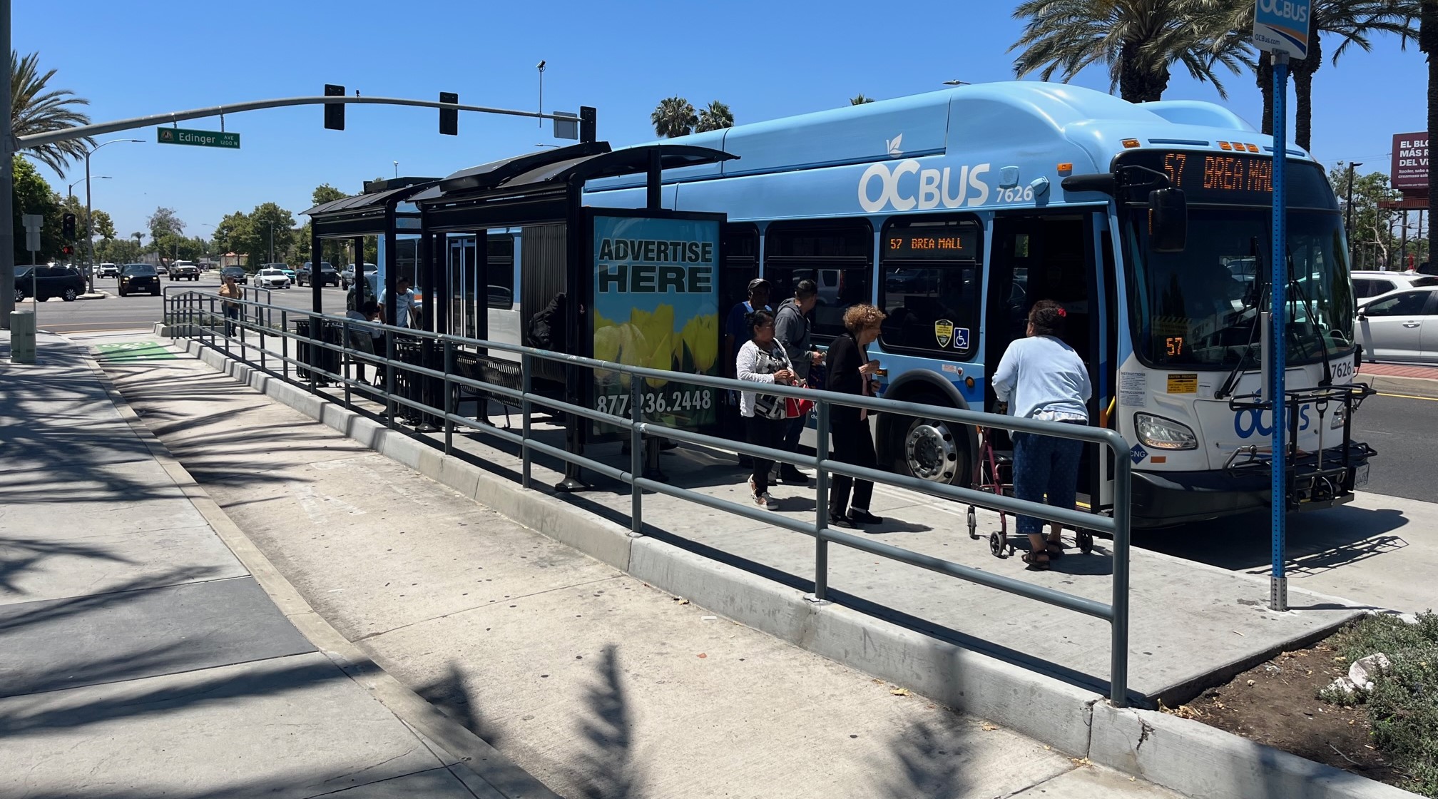
The eastern OC Streetcar terminus is at the Santa Ana train station, officially called the Santa Ana Regional Transportation Center (SARTC). The streetcar stop is located at the northwest corner of the site (just off Santiago Street at Santa Ana Boulevard) replacing part of a former surface parking lot.At the edge of the Santa Ana train station, the OC Streetcar tracks turn onto Santa Ana Boulevard, where the streetcar route runs for about two miles Lacy Street stop under construction in central Santa AnaFor about three-quarters of a mile through downtown, the streetcar tracks split, with westbound trains on Santa Ana Boulevard and eastbound trains on 4th Street (two blocks to the south). Pictured is Santa Ana Boulevard where the tracks split at Mortimer Street.One-way eastbound tracks on 4th Street in downtown Santa Ana. Note that the eastern portion of the route has structures that will hold the catenary wire (note the L-shaped pole on the left), but the actual overhead wire has not been installed yet.The under-construction Ross Street stop, on the westbound tracks on Santa Ana Boulevard in downtown Santa AnaBristol Street Stop, where tracks again run both ways on Santa Ana BoulevardRaitt Street stop, under construction. West of Raitt Street, the streetcar leaves mixed traffic on city streets, and operates on its own rail right-of-way. Visible in the distance (right of the tracks, center of photo) is is the OC Streetcar rail maintenance yard facility.The OC Streetcar travels over the Santa Ana River on a new rail bridge, adjacent to the historic trestle rail bridge (near Fairview Street)New OC Streetcar rail bridge over Westminster AvenueThe OC Streetcar’s western terminus is at Harbor Boulevard, just north of Westminster Avenue. This area is slated to become the Harbor Transit Center, an intermodal transit center serving relatively high-ridership bus lines on adjacent streets.
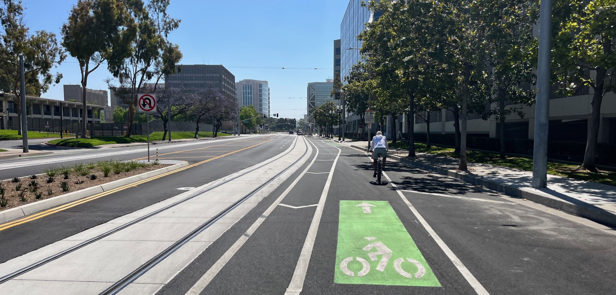
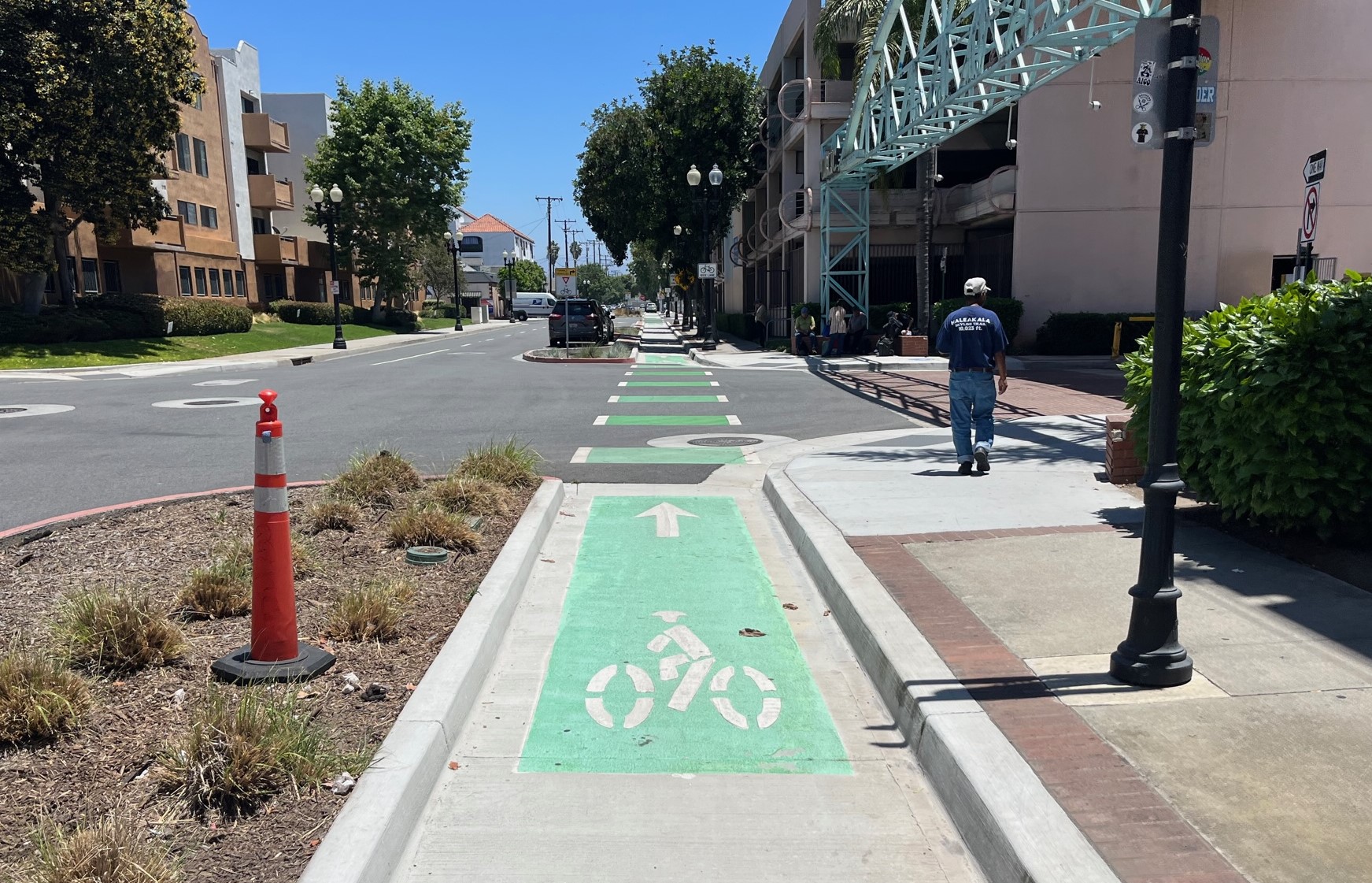
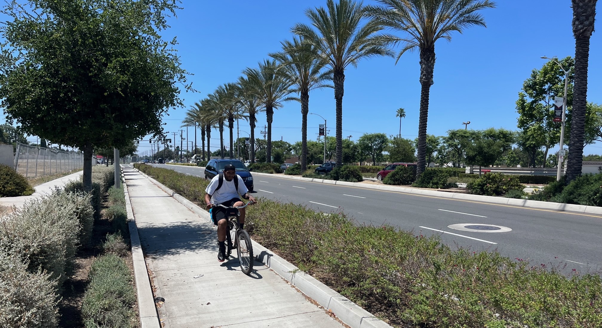
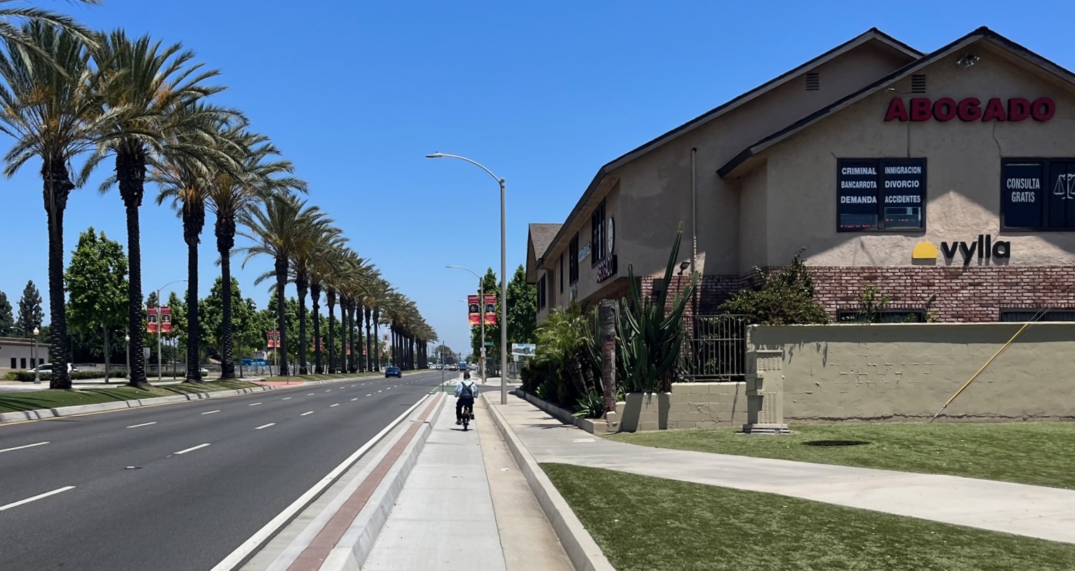
Especially in the city of Santa Ana where the streetcar will run in the street, the project is accompanied by several bikeways, mostly curb-protected. The bikeways are visible in several of the above photos; below are more bike-specific images. Though a few stretches are blocked by construction, the streetcar-parallel bikeways are mostly already open and in use.
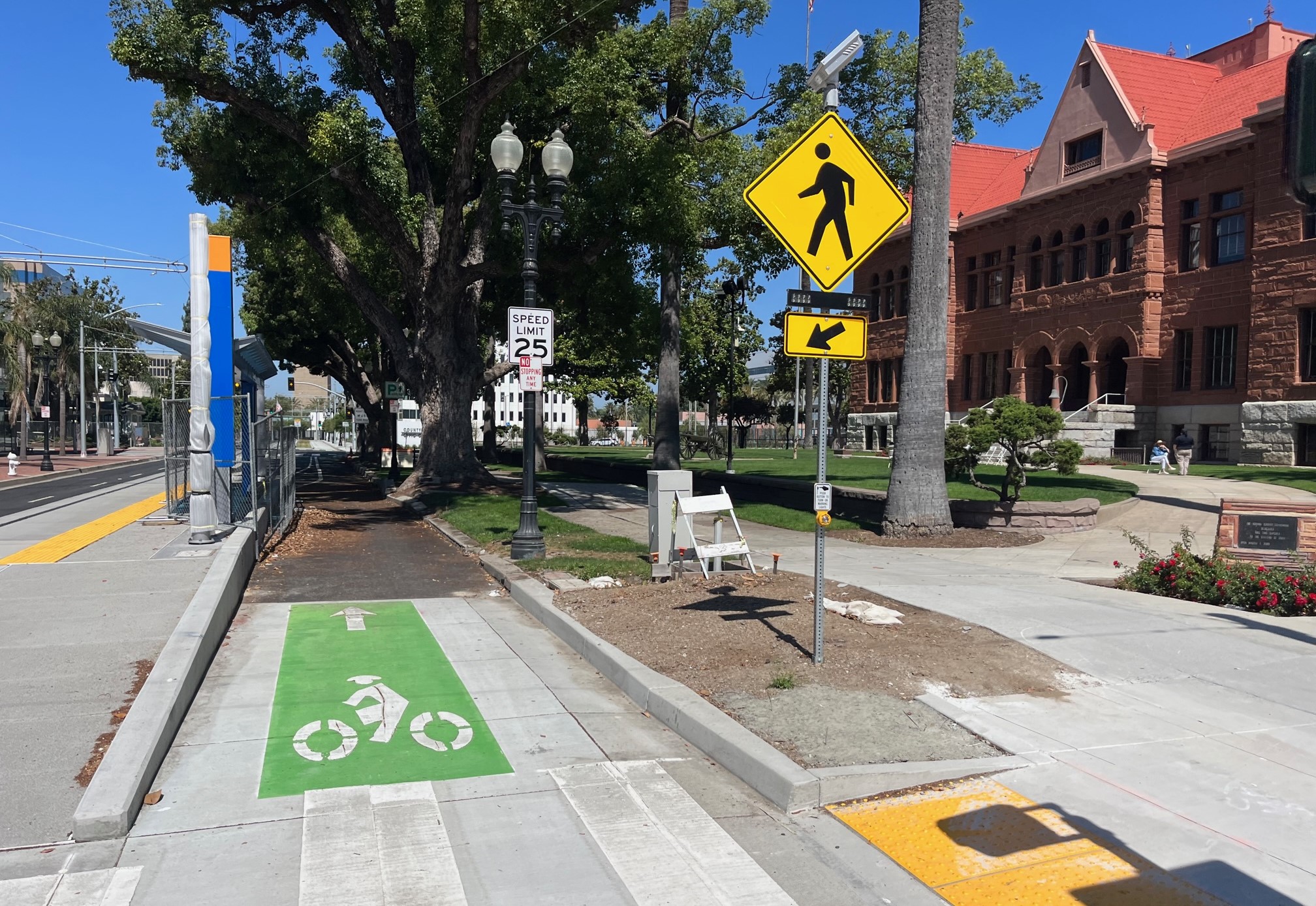
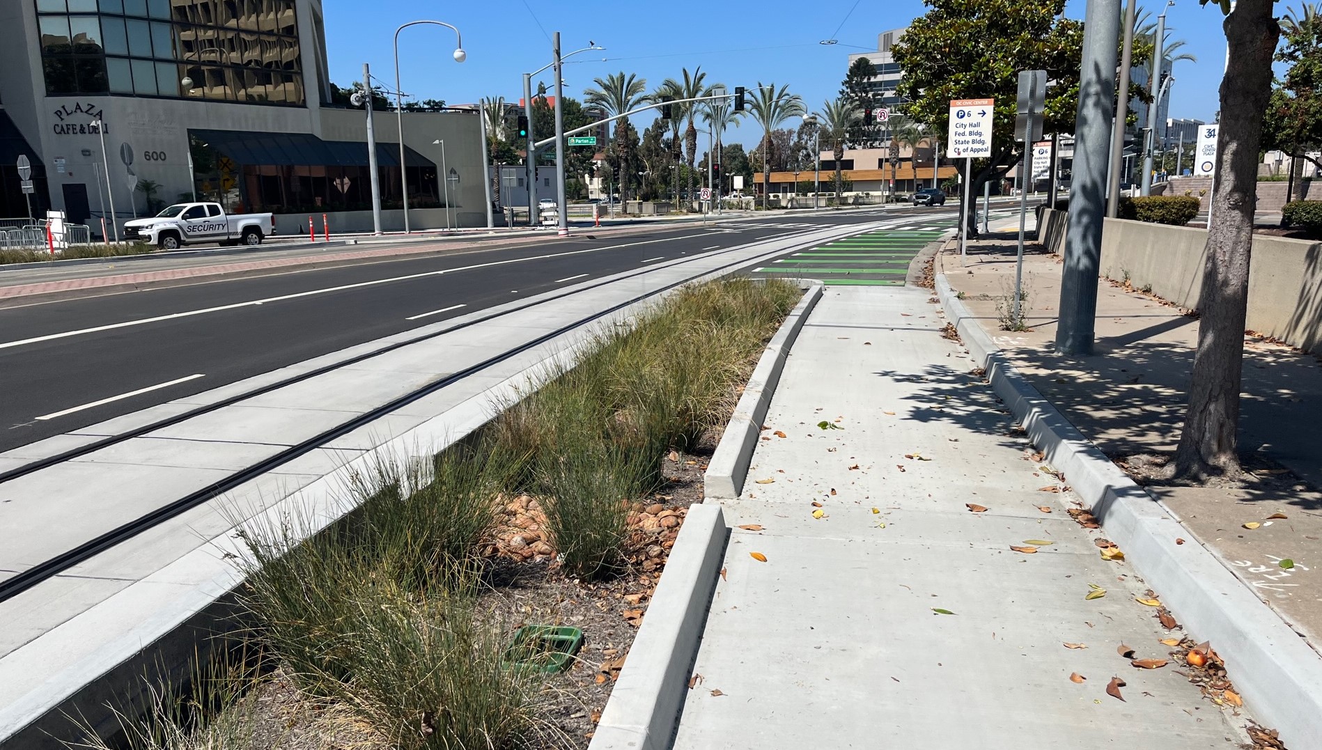
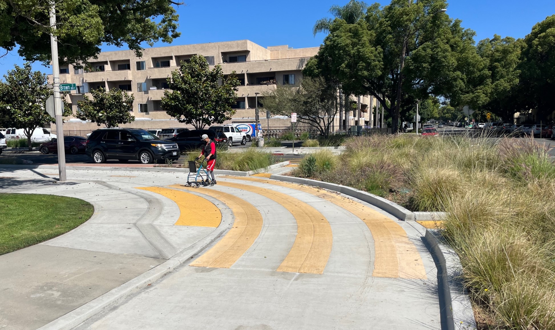
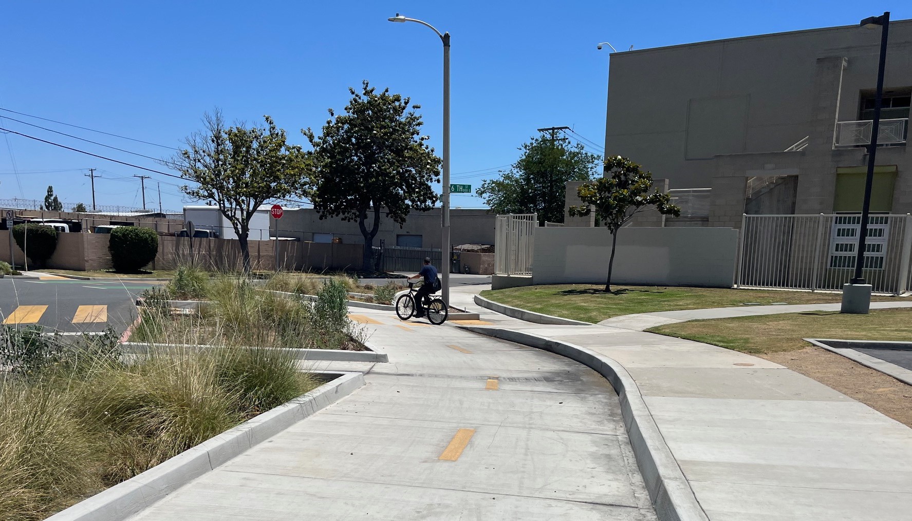
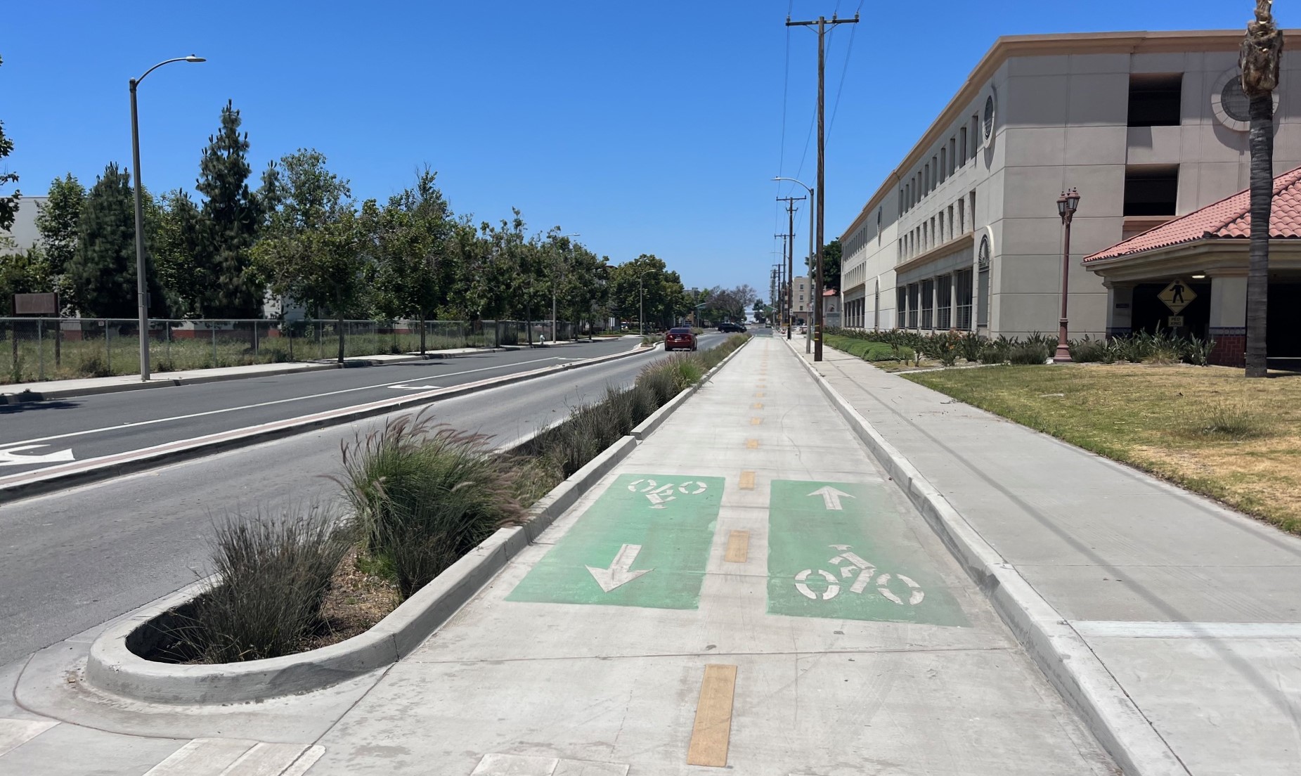
In some places along the streetcar route, there are parallel unprotected bike lanes. Pictured is Santa Ana Boulevard near Flower Street.Along most of the route through downtown Santa Ana, the streetcar route includes curb-protected bike lanes. The westbound bikeway runs on Santa Ana Boulevard next to the streetcar tracks. Pictured is the westbound bikeway running next to the Downtown Santa Ana stop (at the handsome historic Old Orange County Courthouse).Outside of stops, most of the streetcar-parallel bikeway is curb-protected, including several landscaped median planter areas designed to catch and infiltrate rain waterIn the downtown Santa Ana stretch where the streetcar tracks are split two blocks apart, space is fairly tight on 4th Street, so the eastbound bikeway is located on the street in between the two with tracks: 5th Street.East of Mortimer (where streetcar tracks join/split), the protected bikeways come back together into a two-way protected bikeway on Brown, Garfield (pictured), and 6th Streets. The bikeway route is parallel to the streetcar, running a block or two south.Two-way curb-protected bikeway on Garfield Street, turning onto 6th StreetThe parallel bikeway connects to the Santa Ana train station via this two-way protected bikeway on Santiago Street. (The train station parking structure is visible on the right.)
Not directly related to the OC Streetcar, but serving first-last mile connections, the city of Santa Ana has completed about two miles of curb-protected bike lanes on Bristol Street.
Landscaped curb-protected bike lanes on Bristol Street, adjacent to Santa Ana CollegeSanta Ana’s Bristol Street protected bikeway includes bus boarding islands, where the bikeway runs behind the bus shelterSanta Ana’s Bristol Street protected bike lanes
For additional information on the OC Streetcar, see the project website.
Streetsblog has migrated to a new comment system. New commenters can register directly in the comments section of any article. Returning commenters: your previous comments and display name have been preserved, but you'll need to reclaim your account by clicking "Forgot your password?" on the sign-in form, entering your email, and following the verification link to set a new password — this is required because passwords could not be carried over during the migration. For questions, contact tips@streetsblog.org.
Streetsblog is skeptical that AVs will move the needle on car dependence. But our recent coverage has spurred many AV boosters to demand equal time. So today, we present one such piece.
Cities throughout L.A. County rejected Gibbs appointment to the Metro Board. The decision sends the appointment back to the North County and San Fernando Valley subregion.