The last spot in the Final Four of Streetsblog's annual "Sorry Bus Stop" contest is up for grabs today as we pair up two West Coast heavy hitters.
Cincinnati and New Orleans have already moved into the coveted semi-finals. Meanwhile, Suffolk County is still duking it out with Pittsburgh for the third spot (vote now!).
So the final spot will go to a grubby spot in famously tony Beverly Hills or a scary situation on the outskirts of Vancouver. Vote below:
Beverly Hills, Calif.
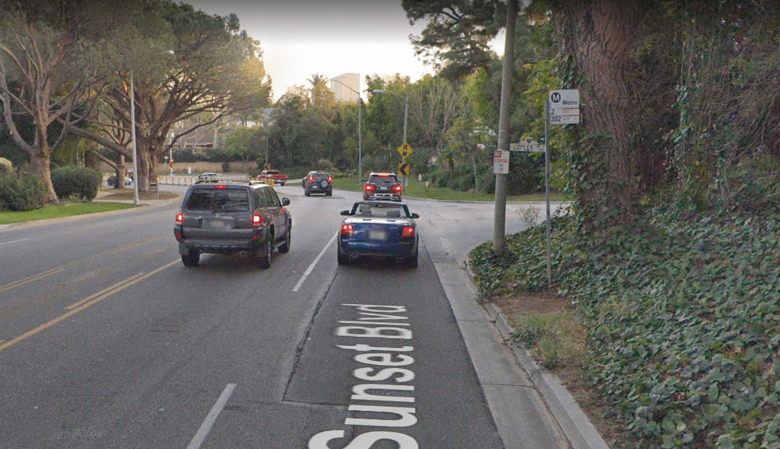
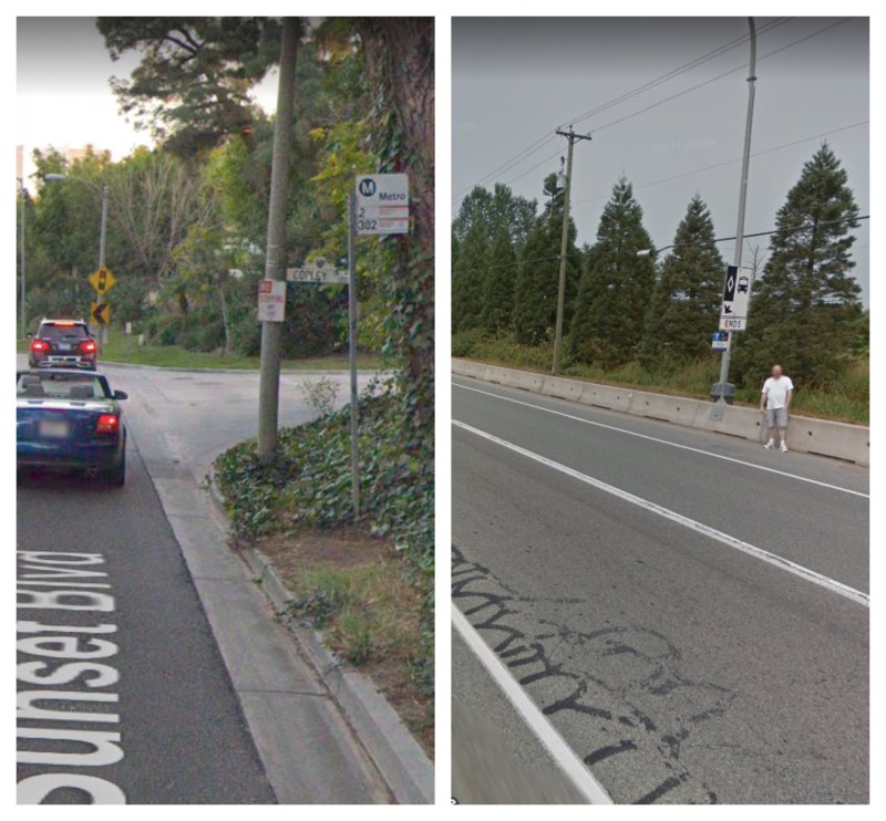
This is the famous Sunset Boulevard in Los Angeles. It's basically a racetrack, naturally. This particular stop serves the Beverly Hills neighborhood. It was submitted by an anonymous reader, who writes:
In the middle of one of the richest cities, Beverly Hills, there is a bus stop carved out of overgrown vines — no sidewalk as far as the eye can see. 700 feet to the nearest marked crossing on one side. 1.2 miles on the other. The domestic workers in these people's homes take the 2 and 302 to get to get to work daily from poorer neighborhoods like Hollywood — and are left on a dirt patch with no safe crossing anywhere, and nowhere safe to wait.
Just for fun, here's the view on the other side of the street.

The lowly status of bus riders could not be clearer.
This stop is served by Los Angeles Metro bus routes 2 and 302. Beverly Hills seems to be to blame for the sad conditions here though.
Suburban Vancouver, B.C.
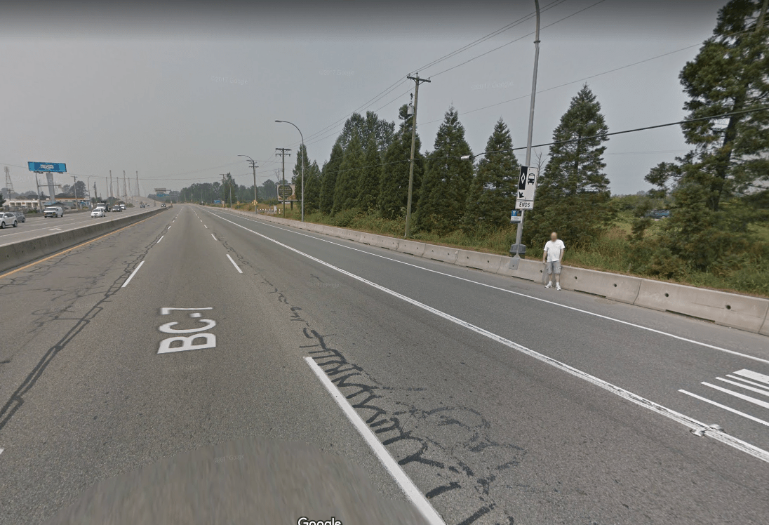
So this bus stop is in Canada, readers have pointed out. But Streetsblog's "Sorry Bus Stop" contest includes all the Americas, especially if there is a really good stop in Canada or a U.S. territory. And this is an absolutely terrible bus stop.
It's located on Lougheed Highway in Pitt Meadows, British Columbia, about 25 miles from Vancouver. Reader Jason Lee sent us this entry, saying:
Lougheed Highway is a major arterial linking Vancouver's exurbs with its inner-ring suburbs. It is also one of the most dangerous in British Columbia — ranking second in the entire province with 33 fatal crashes over the 10-year period between 2004 and 2013. Translink, Vancouver's well-respected transit agency, has been investing a lot of service in suburban areas, with impressive ridership growth. The routes that serves Lougheed Highway — the 701 and express companion, the 791 — together provide service at least every 15 minutes or better, seven days per week, serving over 8,600 trips on an average weekday. Bus stop 61452 [pictured above], located in the westbound direction of Lougheed Highway and Old Dewdney Trunk Road, is a major safety hazard. At that point, Lougheed Highway consists of four lanes in each direction (one of which is a bus lane), with speeds of 50 mph or higher. The bus stop pole is located atop a jersey barrier, which serves as a buffer between speeding cars and the edge of the roadway. Transit riders are forced to either a) wait on the other side of the jersey barrier, and then climb over it when the bus arrives, or b) wait on the highway side of barrier, directly exposed to traffic. Riders in wheelchairs must wait on the highway side of the barrier. The roadway can also be slick; that part of British Columbia's Lower Mainland receives nearly 58 inches of precipitation per year, most of it concentrated during the dark winter months. This bus stop is a disaster waiting to happen. In my three decades of riding transit, I have never seen a bus stop designed like this. During my journey on the 701 less than two weeks ago, I saw a group of people climb over the jersey barrier to get on the bus. They appeared to be non-English speakers who were carrying buckets of berries they had harvested, captive riders who could easily have become the latest victims of speeding cars along Lougheed Highway.
The stop is served by Translink's Line 701, which provides frequent service, and 791. Lougheed Highway, however, is the responsibility of the British Columbia Ministry of Transportation.
