Talking Headways Podcast: Better Data, Better Planning
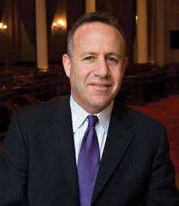
This week we’re joined by Alex Hoffman, assistant director for CID Planning at the City of El Paso. We chat about using data to make planning decisions, the geography of place, and what the future might look like with more information.
For those of you who prefer to read rather than to listen, check out an edited transcript below the audio player. For the unedited full podcast, click here.
Jeff Wood: You use the tool called SafeGraf to look at, like you said, the equity of destinations, what does the inequity look like? What does that lead to in the data? What does that mean in terms of potential solutions? I mean, if you look at this data, what can you figure out about whether people are going to parks or libraries or not?
Alex Hoffman: When we talk about things like walkability as a general goal that we have, we have to keep in mind that just because there are a destination nearby doesn’t mean that they are accessible to people. So like, as an example, I know that Whole Foods gets the rap about being a “whole paycheck.” When we think about food deserts, the places that we you’re saying, “oh, look, there is a grocery store here,” but that doesn’t mean that’s accessible to all people. So I think we really need to be careful when we talk about accessibility, just in general.
When we were looking specifically at the city services, the thing that really stood out to me was….One is just the geography of the way that people consume city services is not equal across all areas of our city. As an example, we know that people who live like on our east side of our city traveled significantly further to get to these different destinations. That provides us some really important insights. Why are these people driving or taking the bus and walking so far just to get to these different services? When we think about the demographic profiles … from that information, we knew their home block group. So we knew that these areas where we have high concentrations of low- to moderate-income populations, as an example, that people’s access to services is very diverse based on the facility time.
As an example, recreation centers are not traditionally used by our low-income residents. What does that mean? What services do we need to be providing, maybe, when we’re thinking of doing this great service of providing parks? Well, people who live in these areas don’t use them. There could be a number of reasons why they don’t use some of them — maybe because of the hours they work, or maybe there just isn’t interest. They would really like to have a senior center, but the senior centers are super far away. So, when we start to look at who the demographic profiles are, who the users are within these different geographies, and try to apply as many different filters to things as possible, it can really help us to answer this question: Who are we serving? Are we doing a good job of it? I just think that that’s not something that cities traditionally do, or if they do it, they don’t do it very well. They don’t think to ask the right questions.

Streetsblog has migrated to a new comment system. New commenters can register directly in the comments section of any article. Returning commenters: your previous comments and display name have been preserved, but you'll need to reclaim your account by clicking "Forgot your password?" on the sign-in form, entering your email, and following the verification link to set a new password — this is required because passwords could not be carried over during the migration. For questions, contact tips@streetsblog.org.