Hey 1999! It looks like L.A. City's Department of Transportation (LADOT), Bureau of Engineering (BOE), and Councilmember Paul Krekorian miss you. It's 2020 and city engineers are still pushing a Magnolia Boulevard widening project based on the city's 1999 Transportation Element, ignoring updated standards in the citys 2015 Mobility Plan.
Back in 1999, the city of Los Angeles adopted the Transportation Element of its General Plan. That plan specified that North Hollywood's Magnolia Boulevard should be a 65-foot wide Secondary Highway. At the time, all L.A. City street standard cross-sections fit onto a single page.
In 2000, Metro opened the Red Line North Hollywood subway station - located half a mile from the stretch of Magnolia Boulevard that the city plans to widen.
In 2015, the city adopted its Mobility Plan 2035, which replaced the 1999 Transportation Element. While the Mobility Plan did not end all road widening, it did rein it in quite a bit. The Plan notes that "wider roads can result in adverse environmental, public health, and fiscal impacts. Wider roads are more expensive to maintain and enable driving at faster speeds..." The Mobility Plan reduced the planned width of many L.A. Streets, including Magnolia Boulevard.
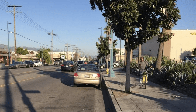
The 2015 Mobility Plan (page 20 map) designates Magnolia Boulevard as an "Avenue II," which the plan states (chart page 19) should be 56 feet wide. The stretch of Magnolia that is targeted for widening - from Cahuenga Boulevard to Vineland Avenue - is already 57 feet wide. One would think that after the Mobility Plan was adopted, the city should narrow it one foot to comply with current standards.
At a project meeting last night, Streetsblog inquired as to why the city was using the 1999 standard over the 2015 standard. LADOT Senior Transportation Engineer Tim Frémaux responded that the Mobility Plan did not apply because the project was essentially too old. Under then-councilmember Tom LaBonge, the city had sought and received federal funds via the 2013 Metro Call for Projects.
The project was not well received at last night's meeting. (It has already been repeatedly opposed by the NoHo Neighborhood Council, which is pushing for density and walkability in the NoHo Arts District.)
Attendees vocally criticized the Magnolia widening project as being "jammed down our throats" and for removing trees, generating construction noise, and adding more car traffic to a walkable neighborhood.
At the meeting, North Hollywood Arts District resident Chika Okafo stated, "We don't need more space for cars in this neighborhood." Ofako told Streetsblog, "I moved to this neighborhood so I wouldn't have to drive everywhere. I can walk to basically everything I need." She walks daily and takes the train, but states, "Every day I walk in this neighborhood I'm dodging cars - and also vehicles on the sidewalk - it's dangerous." She would like see streets in the neighborhood "walking first, biking first, transit first" and further, "There's no need for [NoHo streets] to be freeways in the middle of a major city. It's absurd. Especially in a neighborhood this dense ...that's becoming even denser by the day - they're building hundreds of new apartment units and condo units in this neighborhood."
LADOT and BOE have tried to smear a lot of lipstick on this pig. To their credit, both are trying to offsett deadly road widening by adding some safety features: new flashing-light crosswalks, bulb-outs, painted curb extensions, a new storm drain, and a new left turn signal at Vineland. Additional enhancements LADOT and BOE stated are "pending" include speed humps and pedestrian head-start signals (leading pedestrian intervals - LPIs.)
Also presented as pending were "possible future" bike enhancements elsewhere - along Chandler Boulevard, a quarter mile to the north of the project. Chandler should be made safer for bicycling, but the project at hand is Magnolia. This pernicious off-site alternative seems to presume that a widened Magnolia will become too dangerous for bicycling. And that bicyclists don't need safe access to retail and residential locations on Magnolia. Would drivers be happy with a solution that made them go two quarter-mile legs out of their way to access destinations? No. BOE, LADOT, and Krekorian should not insult cyclists by suggesting they should accept this off-site crap.
All that lipstick is increasing the project cost. The 0.5-mile project's announced $8.4 million cost has ballooned to roughly $10 million with the addition of $1.4 million worth of storm drain features. The city's local contribution increased from $3 million to $5 million.
LADOT and BOE representatives did express the difficulties they saw in trying to somewhat improve such an undesirable project. BOE project manager Winnie Lam stated that "I wish I could change it" and that the city had added all the "bells and whistles" it could "within this box of the requirements I had" in order to "bring [the project] into 2020."
LADOTs Frémaux stated that he would like to see the city complete the Magnolia widening, add more traffic, then later undo the project, adding protected bike lanes to this stretch of Magnolia. This is possible, but would likely require many future steps - like council office approval, modifying the Mobility Plan, finding funding to rip-out or modify bulb-outs. It is a worthwhile vision, but very unlikely to be easy or quick.
(And if the 2015 Mobility Plan somehow wasn't enough, the widening also violates Mayor Eric Garcetti's February 2020 Climate Directive which mandates BOE and LADOT prioritize reducing vehicle miles traveled and greenhouse gas emissions. Maybe Garcetti could issue a directive to BOE and LADOT to let them know that the 2015 Mobility Plan is in effect?)
What is sad is that city engineers often say things like "This street (or bridge) needs to be brought up to the current standard," as seen in this Strong Towns video.
In the case of Magnolia, that "current standard" was updated five years ago. The "current standard" is 56 feet. Magnolia already meets that "current standard." But the city's engineers are reaching into the past century to cite an outdated 1999 standard. When the "current standard" isn't car-centric, the engineers don't give a damn about the current standard any more.
(Also note that the Magnolia widening project's narrowed sidewalks don't meet 1999 standards - so when an engineer says standards, they pretty much always mean car standards, not pedestrian ones. Bikes don't appear in the 1999 L.A. street standards.)
When livability advocates fought hard for the city to adopt the Mobility Plan, it felt like the city might be turning a corner toward embracing multi-modal travel that has always taken place in Los Angeles. But five years later, the city is still moving forward with harmful projects, and saying that the Mobility Plan doesn't apply.
BOE, LADOT, and Councilmember Krekorian should open their eyes. North Hollywood doesn't look like it did in 1999. Since then, there's been a subway, Bus Rapid Transit, dense housing, great walkability, thriving sidewalk cafes, bike lanes, bike paths, bike-share, theaters, galleries, and much more. In two decades NoHo has emerged as the most walkable, most transit-oriented place in the San Fernando Valley, and indeed one of the more walkable neighborhoods in the entire city. Ignoring the current neighborhood opposition and holding steadfastly to outdated plans threatens to cram more cars into the area disrupting what makes it work for the people that live there.
