UCLA Study Shows How Ambiguous Definition of “Major Transit Stop” Creates Wiggle Room for Municipalities
New research and story maps from UCLA’s Institute of Transportation Studies pose an interesting—and potentially useful—hypothetical question: how does California define the area of a transit stop?
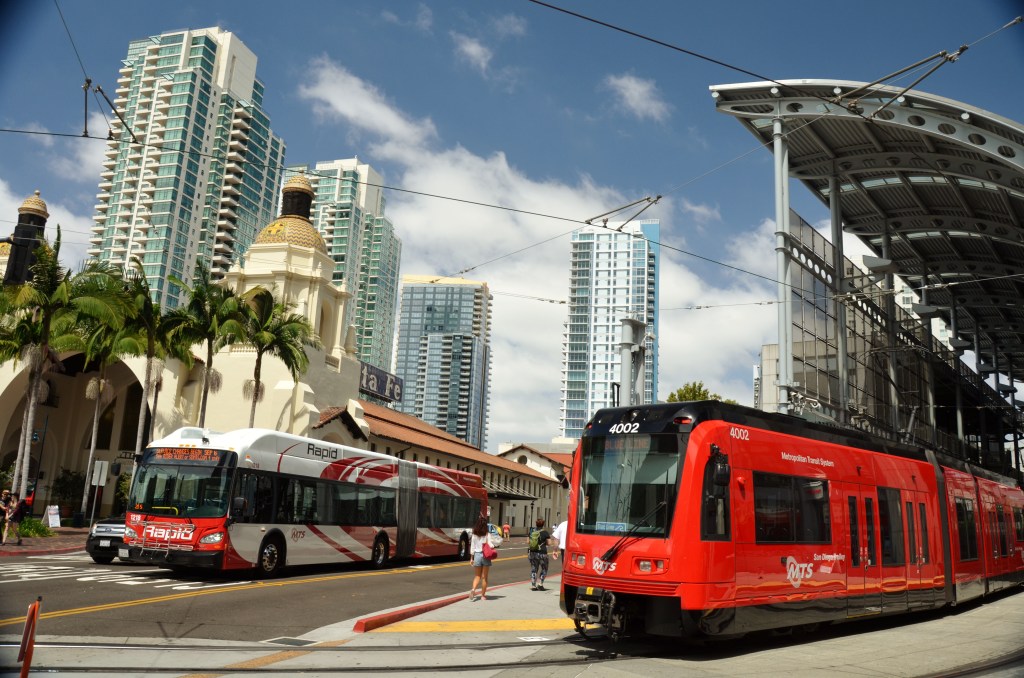
According to the research, every municipality and regional planning organization maps a transit stop only as the small, physical location where one boards or gets off a bus, train, or ferry. Because state law provides development incentives for housing built within a quarter-mile or half-mile of a “major transit stop,” the researchers argue using a broader definition of where the stops themselves begin and end could have major implications. Major transit stops are mostly Bus Rapid Transit, light rail, or heavy rail stops or ferry terminals, but there are a handful of regular bus stops that have enough service to also qualify.
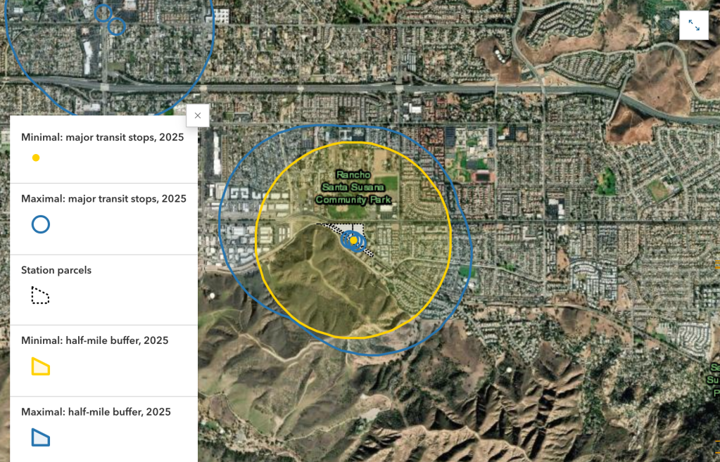
After extensive mapping of the data, the UCLA team claims that if government bodies were to consider the area surrounding boarding location owned by the agency or city that surrounds the boarding location as the transit stop, it could add more than 1.3 million acres of land statewide where housing bonuses would apply, nearly tripling the amount of land currently eligible. UCLA calls this the “maximal approach” to defining a transit stop, major or not.
No transit agency, city council, or government body is currently using that broader definition that the UCLA team could find. However, they also state that nothing in state law explicitly prevents it.
For cities actively looking to maximize housing near transit redefining the transit stop, or seeking clearer guidance from the state, could be a way to unlock additional development opportunities.
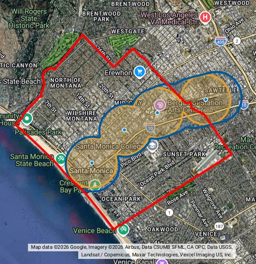
An example of what using the maximal approach could look like in practice, using Metro’s E-Line (nee’ Expo Line), is below. UCLA’s story map tool also allows users to explore how widening the geographic footprint of a transit stop could affect housing capacity in other cities.

Streetsblog has migrated to a new comment system. New commenters can register directly in the comments section of any article. Returning commenters: your previous comments and display name have been preserved, but you'll need to reclaim your account by clicking "Forgot your password?" on the sign-in form, entering your email, and following the verification link to set a new password — this is required because passwords could not be carried over during the migration. For questions, contact tips@streetsblog.org.