
High Speed Rail Update: Animations of Potential Palmdale-Burbank Routes
The California High Speed Rail Authority released three simple animations showing possible routes for the Palmdale to Burbank section. The animations appear on separate maps, so it's hard to compare them side-by-side, but they give a pretty good idea of how very, very long the proposed tunnels are.
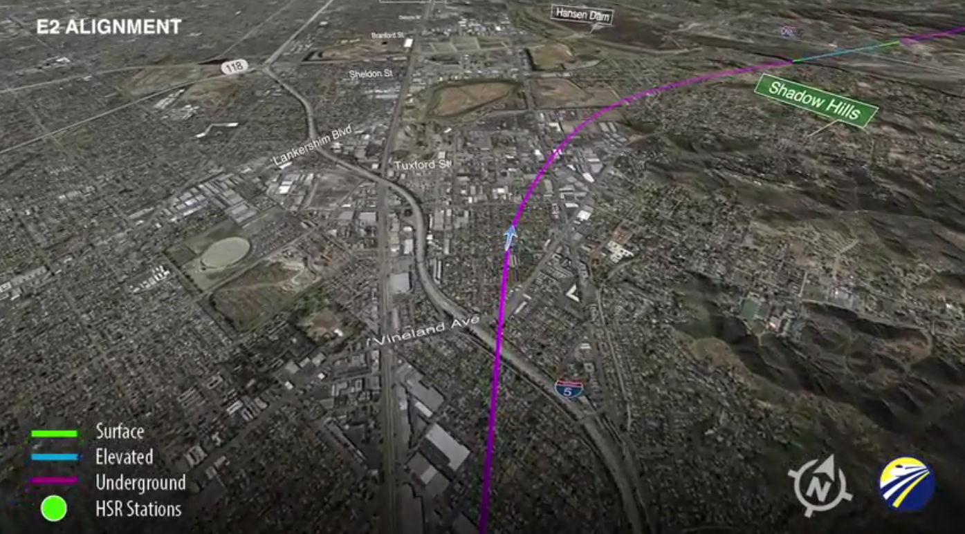
The routes vary slightly in the San Fernando Valley. They all begin in a tunnel, and cut either under Pacoima, emerging to pass around Hansen Dam, or under Shadow Hills, emerging for a moment in the recreation area before dipping back underground to cut through the San Gabriel Mountains. The routes also differ as they approach Palmdale, with the train emerging from the tunnels in a few places and then going back underground before finally emerging just west of Palmdale itself.
All three routes feature extensive tunnels through the San Gabriel Mountains. Estimated costs for the different HSRA segments were released in its 2016 Business Plan, but the cost differences between these three potential routes are buried in a Supplemental Alternatives Analysis. Buried deeply. The short version is that the most expensive of the three is Route E1, the middle route that passes close to the Pacoima Dam and steers mostly clear of Highway 14.
Note that there is a public meeting on the alignments tomorrow night, Thursday, September 22, from 5 to 8 p.m. at the Fernangeles Recreation Center, 8851 Laurel Canyon Boulevard in Sun Valley.
Read More:
Stay in touch
Sign up for our free newsletter
More from Streetsblog California
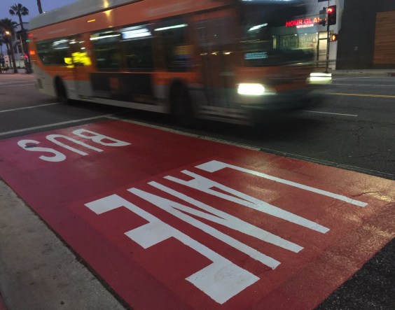
Automated Enforcement Coming Soon to a Bus Lane Near You
Metro is already installing on-bus cameras. Soon comes testing, outreach, then warning tickets.
Friday’s Headlines
SF plans street redesign at crash site; Santa Cruz commission still supports plan to have both trail and rail; State budget includes subsidies for fossil fuel industry; Unhoused camping; More

Thursday’s Headlines
CA youth speak out on climate: How LA Metro plans to spend $ from canceled 710 freeway; Watch out, illegal SF parkers, tickets are coming; More
Legislators Tackle AV, School Zone Safety
Are AVs freight trucks ready to be deployed on California roads with no one in them?
Metro Looks to Approve Torrance C Line Extension Alignment
Selecting the relatively low-cost hybrid alternative should help the oft-delayed South Bay C Line extension move a step closer to reality
